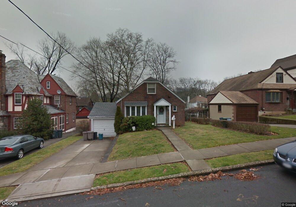
33 Westbury Ave Staten Island, NY 10301
Randall Manor NeighborhoodEstimated Value: $691,420 - $954,000
--
Bed
4
Baths
1,300
Sq Ft
$644/Sq Ft
Est. Value
About This Home
This home is located at 33 Westbury Ave, Staten Island, NY 10301 and is currently estimated at $836,605, approximately $643 per square foot. 33 Westbury Ave is a home located in Richmond County with nearby schools including P.S. 45 John Tyler, Is 61 William A Morris, and Curtis High School.
Ownership History
Date
Name
Owned For
Owner Type
Purchase Details
Closed on
Aug 17, 1994
Sold by
Friend Catherine and Meehan Marie S
Bought by
Reilly Hugh P and Reilly Eileen
Current Estimated Value
Home Financials for this Owner
Home Financials are based on the most recent Mortgage that was taken out on this home.
Original Mortgage
$150,000
Interest Rate
8.55%
Create a Home Valuation Report for This Property
The Home Valuation Report is an in-depth analysis detailing your home's value as well as a comparison with similar homes in the area
Home Values in the Area
Average Home Value in this Area
Purchase History
| Date | Buyer | Sale Price | Title Company |
|---|---|---|---|
| Reilly Hugh P | $180,000 | -- |
Source: Public Records
Mortgage History
| Date | Status | Borrower | Loan Amount |
|---|---|---|---|
| Previous Owner | Reilly Hugh P | $150,000 |
Source: Public Records
Tax History Compared to Growth
Tax History
| Year | Tax Paid | Tax Assessment Tax Assessment Total Assessment is a certain percentage of the fair market value that is determined by local assessors to be the total taxable value of land and additions on the property. | Land | Improvement |
|---|---|---|---|---|
| 2025 | $7,197 | $40,440 | $15,834 | $24,606 |
| 2024 | $7,197 | $38,340 | $15,757 | $22,583 |
| 2023 | $7,161 | $35,260 | $13,371 | $21,889 |
| 2022 | $6,641 | $44,880 | $16,860 | $28,020 |
| 2021 | $7,000 | $37,860 | $16,860 | $21,000 |
| 2020 | $6,699 | $32,640 | $16,860 | $15,780 |
| 2019 | $6,246 | $33,300 | $16,860 | $16,440 |
| 2018 | $5,990 | $29,383 | $13,947 | $15,436 |
| 2017 | $5,651 | $27,720 | $12,325 | $15,395 |
| 2016 | $5,541 | $27,720 | $12,960 | $14,760 |
| 2015 | $4,775 | $26,374 | $14,062 | $12,312 |
| 2014 | $4,775 | $24,883 | $11,824 | $13,059 |
Source: Public Records
Map
Nearby Homes
- 44 Westbury Ave
- 4 Brentwood Ave
- 585 Castleton Ave Unit 1c
- 20 Linden St
- 11 Curtis Ct
- 26 Valencia Ave
- 354 Hoyt Ave
- 160 Bard Ave Unit 6A
- 152 Clinton Ave
- 148 Clinton Ave
- 525 Castleton Ave Unit 1C
- 144 Bard Ave Unit 25b
- 154 Bard Ave Unit 14A
- 165 Davis Ave
- 188 Davis Ave
- 125 Tysen St
- 112 Delafield Ave
- 154 Pelton Ave
- 126 Cassidy Place Unit H2
- 310 Brighton Ave
- 27 Westbury Ave
- 39 Westbury Ave
- 34 Brentwood Ave
- 25 Westbury Ave
- 38 Brentwood Ave
- 43 Westbury Ave
- 28 Brentwood Ave
- 24 Brentwood Ave
- 30 Westbury Ave
- 36 Westbury Ave
- 47 Westbury Ave
- 40 Westbury Ave
- 26 Westbury Ave
- 50 Brentwood Ave
- 20 Brentwood Ave
- 16 Westbury Ave
- 48 Westbury Ave
- 10 Westbury Ave
- 47 Springhill Ave
- 43 Springhill Ave