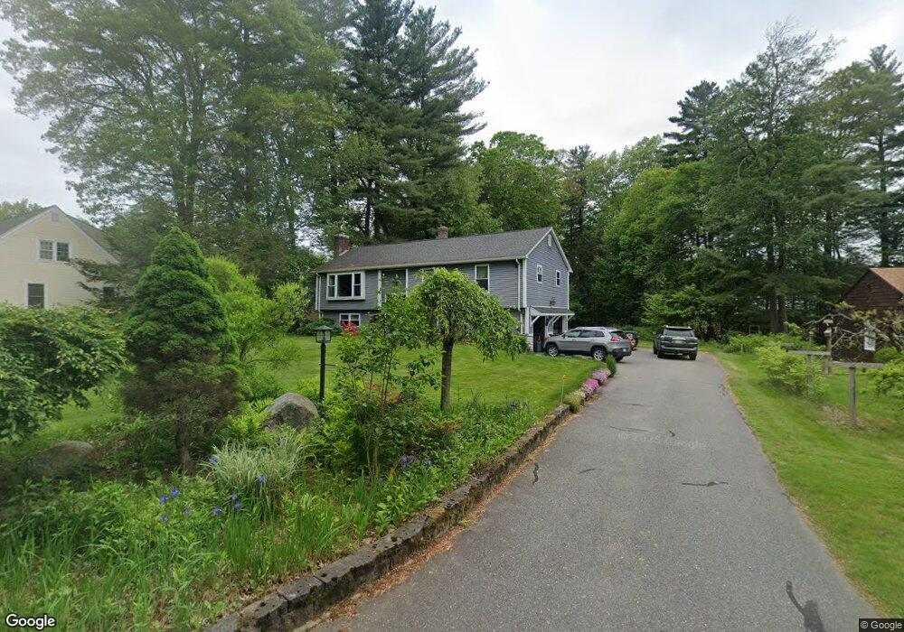
33 Yankee Cir Westfield, MA 01085
Estimated Value: $376,000 - $435,098
3
Beds
3
Baths
1,800
Sq Ft
$227/Sq Ft
Est. Value
About This Home
This home is located at 33 Yankee Cir, Westfield, MA 01085 and is currently estimated at $408,025, approximately $226 per square foot. 33 Yankee Cir is a home located in Hampden County with nearby schools including Westfield High School and Saint Mary High School.
Ownership History
Date
Name
Owned For
Owner Type
Purchase Details
Closed on
Jan 10, 2023
Sold by
Wood Lisa A
Bought by
Peregrin Kristina
Current Estimated Value
Purchase Details
Closed on
Nov 10, 2004
Sold by
Pellegrino Antonio P and Pellegrino Linda
Bought by
Wood Lisa A
Home Financials for this Owner
Home Financials are based on the most recent Mortgage that was taken out on this home.
Original Mortgage
$129,000
Interest Rate
5.75%
Mortgage Type
Purchase Money Mortgage
Purchase Details
Closed on
Dec 23, 1994
Sold by
Fnma
Bought by
Pellegrino Antonio P and Pellegrino Linda
Purchase Details
Closed on
Oct 11, 1994
Sold by
Lynch Joseph D and Bradley Linda L
Bought by
Federal National Mortgage Association
Purchase Details
Closed on
May 16, 1988
Sold by
Trant William T
Bought by
Lynch Joseph D
Create a Home Valuation Report for This Property
The Home Valuation Report is an in-depth analysis detailing your home's value as well as a comparison with similar homes in the area
Home Values in the Area
Average Home Value in this Area
Purchase History
| Date | Buyer | Sale Price | Title Company |
|---|---|---|---|
| Peregrin Kristina | -- | None Available | |
| Wood Lisa A | $229,000 | -- | |
| Pellegrino Antonio P | $124,500 | -- | |
| Federal National Mortgage Association | $132,500 | -- | |
| Lynch Joseph D | $162,500 | -- |
Source: Public Records
Mortgage History
| Date | Status | Borrower | Loan Amount |
|---|---|---|---|
| Previous Owner | Lynch Joseph D | $75,000 | |
| Previous Owner | Wood Lisa A | $129,000 | |
| Previous Owner | Lynch Joseph D | $6,000 | |
| Previous Owner | Lynch Joseph D | $98,000 |
Source: Public Records
Tax History Compared to Growth
Tax History
| Year | Tax Paid | Tax Assessment Tax Assessment Total Assessment is a certain percentage of the fair market value that is determined by local assessors to be the total taxable value of land and additions on the property. | Land | Improvement |
|---|---|---|---|---|
| 2025 | $5,084 | $334,900 | $130,500 | $204,400 |
| 2024 | $5,080 | $318,100 | $119,100 | $199,000 |
| 2023 | $4,895 | $288,300 | $113,400 | $174,900 |
| 2022 | $4,732 | $255,900 | $101,000 | $154,900 |
| 2021 | $2,233 | $243,000 | $95,300 | $147,700 |
| 2020 | $4,466 | $232,000 | $95,300 | $136,700 |
| 2019 | $4,371 | $222,200 | $90,900 | $131,300 |
| 2018 | $4,302 | $222,200 | $90,900 | $131,300 |
| 2017 | $4,234 | $218,000 | $92,200 | $125,800 |
| 2016 | $4,238 | $218,000 | $92,200 | $125,800 |
| 2015 | $4,175 | $225,200 | $92,200 | $133,000 |
| 2014 | $3,123 | $225,200 | $92,200 | $133,000 |
Source: Public Records
Map
Nearby Homes
- 53 Yankee Cir
- 0 Fox Hill Dr
- 508 Granville Rd
- 197 Loomis Rg
- 40 Heritage Ln
- 11 Highland Cir
- 78 Granville Rd Unit 11
- 324 Russell Rd Unit 204
- 128 Crane Ave
- 444 Loomis St
- 555 Russell Rd Unit D18
- 549 Russell Rd Unit 6B
- 172 Valley View Dr
- 205 Russell Rd
- 781 Western Ave
- 386 Hillside Rd
- 82 S Maple St Unit 43
- 82 S Maple St Unit 11
- 69 Beveridge Blvd
- 156 Honey Pot Rd