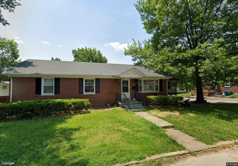
330 Bacon Ct Harrodsburg, KY 40330
Estimated Value: $160,000 - $223,000
3
Beds
2
Baths
1,692
Sq Ft
$110/Sq Ft
Est. Value
About This Home
This home is located at 330 Bacon Ct, Harrodsburg, KY 40330 and is currently estimated at $186,870, approximately $110 per square foot. 330 Bacon Ct is a home located in Mercer County with nearby schools including Mercer County Elementary School, Mercer County Intermediate School, and King Middle School.
Ownership History
Date
Name
Owned For
Owner Type
Purchase Details
Closed on
Feb 8, 2024
Sold by
Mccoy Renee
Bought by
Peach John
Current Estimated Value
Purchase Details
Closed on
Feb 21, 2012
Sold by
Dedman Paul and Dedman Trust Paul
Bought by
Peach John M
Home Financials for this Owner
Home Financials are based on the most recent Mortgage that was taken out on this home.
Original Mortgage
$92,193
Interest Rate
3.89%
Create a Home Valuation Report for This Property
The Home Valuation Report is an in-depth analysis detailing your home's value as well as a comparison with similar homes in the area
Home Values in the Area
Average Home Value in this Area
Purchase History
| Date | Buyer | Sale Price | Title Company |
|---|---|---|---|
| Peach John | $112,000 | None Listed On Document | |
| Peach John | $112,000 | None Listed On Document | |
| Peach John M | $85,000 | Title Suppliers |
Source: Public Records
Mortgage History
| Date | Status | Borrower | Loan Amount |
|---|---|---|---|
| Previous Owner | Peach John M | $92,193 |
Source: Public Records
Tax History Compared to Growth
Tax History
| Year | Tax Paid | Tax Assessment Tax Assessment Total Assessment is a certain percentage of the fair market value that is determined by local assessors to be the total taxable value of land and additions on the property. | Land | Improvement |
|---|---|---|---|---|
| 2024 | $836 | $75,000 | $5,000 | $70,000 |
| 2023 | $1,387 | $123,191 | $0 | $0 |
| 2022 | $1,369 | $123,191 | $0 | $0 |
| 2021 | $1,385 | $123,191 | $0 | $0 |
| 2020 | $1,385 | $112,500 | $10,000 | $102,500 |
| 2019 | $1,285 | $112,500 | $10,000 | $102,500 |
| 2018 | $1,254 | $112,500 | $0 | $0 |
| 2017 | $1,209 | $112,500 | $0 | $0 |
| 2016 | $1,186 | $112,500 | $0 | $0 |
| 2015 | $870 | $112,500 | $10,000 | $102,500 |
| 2014 | $870 | $85,000 | $0 | $0 |
| 2010 | -- | $105,095 | $10,000 | $95,095 |
Source: Public Records
Map
Nearby Homes
- 424 Price Ave
- 302 Pheasant Dr
- 411 College Manor
- 479 N Main St
- 342 N Main St
- 349 N Greenville St
- 228 Fort St
- 218 Fort St
- 214 E Factory St
- 130 N Main St Unit 130/132/134
- 123 Forsythe St
- 905 N College St
- 324 Woodsland Dr
- 120 S Main St
- 202 S College St
- 141 Cummins Dr
- 400 Bellaire Dr
- 366 E Lexington St
- 913 Milward Dr
- 146 Marimon Ave
- 454 N College St
- 334 Bacon Ct
- 321 Bacon Ct
- 460 N College St
- 446 N College St
- 325 Bacon Ct
- 470 N College St
- 335 Bacon Ct
- 476 N College St
- 340 Bacon Ct
- 440 N College St
- 343 Bacon Ct
- 349 Shawnee Dr
- 432 N College St
- 316 Cornishville St
- 316 Cornishville St
- 345 Shawnee Dr
- 330 Cornishville St
- 352 Bacon Ct
- 484 N College St