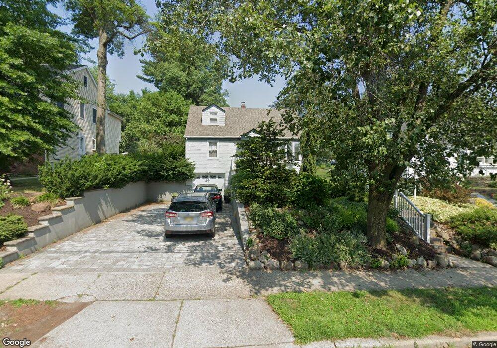
330 Boulevard Glen Rock, NJ 07452
Estimated Value: $827,874 - $921,000
--
Bed
--
Bath
1,610
Sq Ft
$540/Sq Ft
Est. Value
About This Home
This home is located at 330 Boulevard, Glen Rock, NJ 07452 and is currently estimated at $869,469, approximately $540 per square foot. 330 Boulevard is a home located in Bergen County with nearby schools including Glen Rock Middle School, Glen Rock High School, and St Anthony School.
Ownership History
Date
Name
Owned For
Owner Type
Purchase Details
Closed on
Jul 14, 2000
Sold by
Nowicki Edward and Nowicki Sylvia Kay
Bought by
Diament Jacob and Diament Debra
Current Estimated Value
Home Financials for this Owner
Home Financials are based on the most recent Mortgage that was taken out on this home.
Original Mortgage
$245,250
Outstanding Balance
$87,448
Interest Rate
8.18%
Estimated Equity
$782,021
Create a Home Valuation Report for This Property
The Home Valuation Report is an in-depth analysis detailing your home's value as well as a comparison with similar homes in the area
Home Values in the Area
Average Home Value in this Area
Purchase History
| Date | Buyer | Sale Price | Title Company |
|---|---|---|---|
| Diament Jacob | $272,500 | -- |
Source: Public Records
Mortgage History
| Date | Status | Borrower | Loan Amount |
|---|---|---|---|
| Open | Diament Jacob | $245,250 |
Source: Public Records
Tax History Compared to Growth
Tax History
| Year | Tax Paid | Tax Assessment Tax Assessment Total Assessment is a certain percentage of the fair market value that is determined by local assessors to be the total taxable value of land and additions on the property. | Land | Improvement |
|---|---|---|---|---|
| 2025 | $14,612 | $444,400 | $255,600 | $188,800 |
| 2024 | $14,043 | $444,400 | $255,600 | $188,800 |
| 2023 | $13,692 | $444,400 | $255,600 | $188,800 |
| 2022 | $13,692 | $444,400 | $255,600 | $188,800 |
| 2021 | $13,523 | $444,400 | $255,600 | $188,800 |
| 2020 | $13,550 | $444,400 | $255,600 | $188,800 |
| 2019 | $13,194 | $444,400 | $255,600 | $188,800 |
| 2018 | $12,830 | $444,400 | $255,600 | $188,800 |
| 2017 | $12,581 | $444,400 | $255,600 | $188,800 |
| 2016 | $12,399 | $444,400 | $255,600 | $188,800 |
| 2015 | $12,203 | $444,400 | $255,600 | $188,800 |
| 2014 | $12,043 | $444,400 | $255,600 | $188,800 |
Source: Public Records
Map
Nearby Homes
- 110 Mawhinney Ave
- 251 Boulevard
- 406 Dixie Ave
- 116 Post Ave
- 47 Heathcote Rd
- 111 Thornbury Ave
- 61 10th Ave
- 14 Heights Ave Unit 1X
- 155 Main St
- 19 Iris Cir
- 327 Harristown Rd
- 126 Hawthorne Ave
- 40 Pomona Ave
- 71 9th Ave
- 155 Washington Ave
- 51 Pomona Ave
- 61 Pomona Ave Unit 1X
- 8-24 Fern St Unit 1X
- 59 Lincoln Ave
- 84 Washington Ave
- 326 Boulevard
- 336 Boulevard
- 36 Mortlock Place
- 320 Boulevard
- 27 Cornelia Place
- 30 Mortlock Place
- 348 Boulevard
- 331 Boulevard
- 337 Boulevard
- 325 Boulevard
- 25 Cornelia Place
- 24 Mortlock Place
- 343 Boulevard
- 319 Boulevard
- 352 Boulevard
- 310 Boulevard
- 41 Mortlock Place
- 315 Boulevard
- 18 Mortlock Place
- 33 Mortlock Place