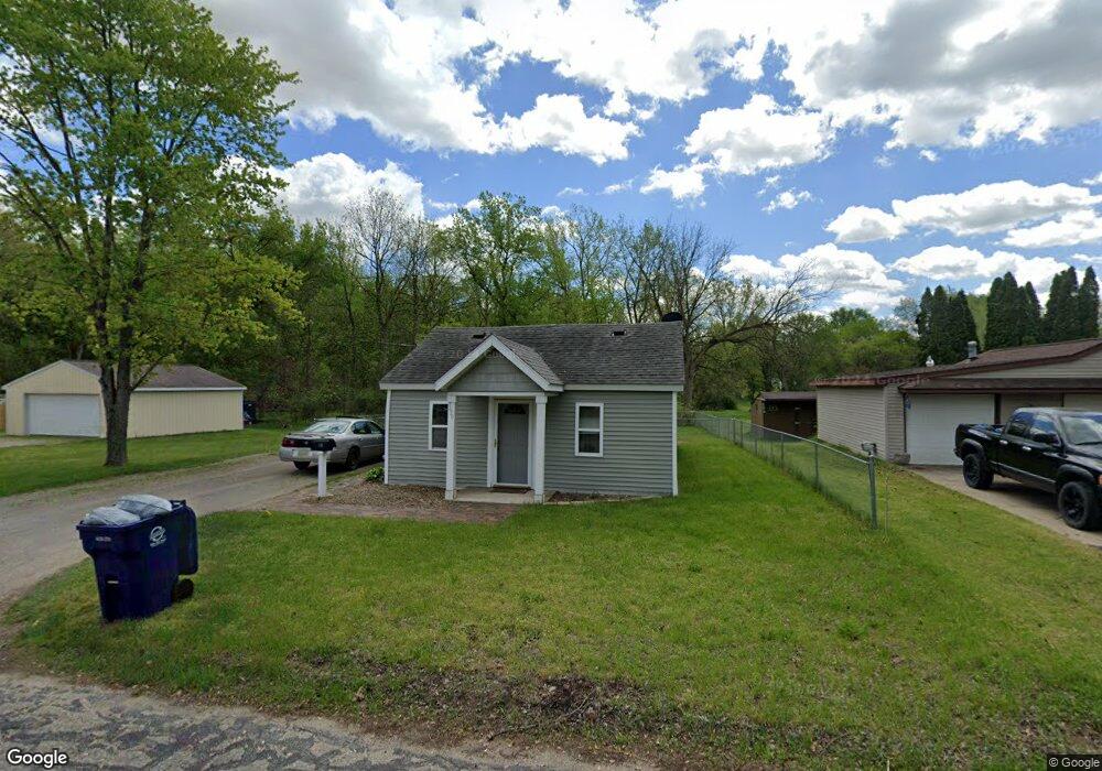
330 Coal St Saint Charles, MI 48655
Estimated Value: $79,000 - $107,360
2
Beds
1
Bath
888
Sq Ft
$106/Sq Ft
Est. Value
About This Home
This home is located at 330 Coal St, Saint Charles, MI 48655 and is currently estimated at $93,840, approximately $105 per square foot. 330 Coal St is a home located in Saginaw County with nearby schools including St. Charles Elementary School and St. Charles Community Middle/High School.
Ownership History
Date
Name
Owned For
Owner Type
Purchase Details
Closed on
Apr 1, 2021
Sold by
Dna Rentals Llc
Bought by
Horton Michael
Current Estimated Value
Purchase Details
Closed on
Apr 5, 2019
Sold by
Wimberg Andrea L and Farmer Sara K
Bought by
Dna Rentals Llc
Purchase Details
Closed on
Jun 24, 2014
Sold by
Farmer Andrea L and Winberg Andrea L
Bought by
Farmer James
Purchase Details
Closed on
Jul 18, 2008
Sold by
Federal Nat'L Mtge 1701483530
Bought by
Farmer Andrea L and Farmer Lori K
Purchase Details
Closed on
Aug 20, 2007
Sold by
Mers Inc 1701483530
Bought by
Federal Nat'L Mtge 1701483530
Purchase Details
Closed on
Jun 8, 2007
Sold by
Saginaw County Deputy Sheriff
Bought by
Mers Inc 1701483530
Purchase Details
Closed on
Jun 14, 2006
Bought by
Griffus Jacob C and Buell Shawna
Purchase Details
Closed on
Apr 29, 2004
Sold by
Moore Angela L
Bought by
Key Bank Usa Na
Purchase Details
Closed on
Aug 14, 2001
Sold by
Theile Richard Lee and Theile Lois Ann
Bought by
Moore Angela L
Home Financials for this Owner
Home Financials are based on the most recent Mortgage that was taken out on this home.
Original Mortgage
$24,750
Interest Rate
7.03%
Mortgage Type
Balloon
Create a Home Valuation Report for This Property
The Home Valuation Report is an in-depth analysis detailing your home's value as well as a comparison with similar homes in the area
Home Values in the Area
Average Home Value in this Area
Purchase History
| Date | Buyer | Sale Price | Title Company |
|---|---|---|---|
| Horton Michael | -- | Zolton Law Offices | |
| Dna Rentals Llc | $28,000 | None Available | |
| Farmer James | $30,000 | -- | |
| Farmer Andrea L | $34,000 | -- | |
| Federal Nat'L Mtge 1701483530 | -- | -- | |
| Mers Inc 1701483530 | $71,700 | -- | |
| Griffus Jacob C | $68,500 | -- | |
| Key Bank Usa Na | $23,297 | -- | |
| Moore Angela L | $27,500 | -- |
Source: Public Records
Mortgage History
| Date | Status | Borrower | Loan Amount |
|---|---|---|---|
| Previous Owner | Moore Angela L | $24,750 |
Source: Public Records
Tax History Compared to Growth
Tax History
| Year | Tax Paid | Tax Assessment Tax Assessment Total Assessment is a certain percentage of the fair market value that is determined by local assessors to be the total taxable value of land and additions on the property. | Land | Improvement |
|---|---|---|---|---|
| 2025 | $1,815 | $35,900 | $0 | $0 |
| 2024 | $965 | $35,900 | $0 | $0 |
| 2023 | $928 | $31,800 | $0 | $0 |
| 2022 | $1,447 | $27,100 | $0 | $0 |
| 2021 | $1,222 | $25,100 | $0 | $0 |
| 2020 | $1,620 | $23,000 | $0 | $0 |
| 2019 | $1,009 | $21,500 | $0 | $0 |
| 2018 | $769 | $23,300 | $0 | $0 |
| 2017 | $953 | $19,400 | $0 | $0 |
| 2016 | $940 | $18,800 | $0 | $0 |
| 2014 | -- | $18,400 | $0 | $15,400 |
| 2013 | -- | $18,000 | $0 | $0 |
Source: Public Records
Map
Nearby Homes
- 710 Chesaning St
- 120 S Miami St
- 123 E Maple St
- vl E Maple St
- 135 W Walnut St
- 213 E Oak St
- 0 W Walnut St Unit 50159593
- 7899 Beaver Rd
- 12000 W Townline Rd
- 12385 Baumgartner Rd
- 13869 Hanchett Rd
- 6215 S Graham Rd
- 12034 Carr Rd
- 11145 S Fordney Rd
- 4755 S Graham Rd
- 8700 S Hemlock Rd
- 10505 S Hemlock Rd
- 12100 Raucholz Rd
- 15852 W Brant Rd
- 10854 S Hemlock Rd