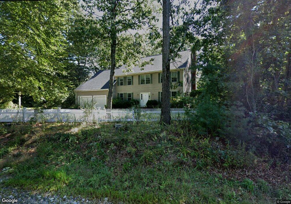
330 Creek St Wrentham, MA 02093
Estimated Value: $774,000 - $1,028,000
4
Beds
3
Baths
2,876
Sq Ft
$324/Sq Ft
Est. Value
About This Home
This home is located at 330 Creek St, Wrentham, MA 02093 and is currently estimated at $932,049, approximately $324 per square foot. 330 Creek St is a home located in Norfolk County with nearby schools including Delaney Elementary School and Charles E Roderick.
Ownership History
Date
Name
Owned For
Owner Type
Purchase Details
Closed on
Jul 26, 2005
Sold by
Gallacher Lillian F
Bought by
Pyne Christina and Pyne John F
Current Estimated Value
Home Financials for this Owner
Home Financials are based on the most recent Mortgage that was taken out on this home.
Original Mortgage
$569,145
Outstanding Balance
$297,633
Interest Rate
5.59%
Mortgage Type
Purchase Money Mortgage
Estimated Equity
$634,416
Purchase Details
Closed on
Apr 16, 1999
Sold by
Council Oaks Assoc Inc
Bought by
Gallacher Lillian F
Home Financials for this Owner
Home Financials are based on the most recent Mortgage that was taken out on this home.
Original Mortgage
$239,900
Interest Rate
7.04%
Mortgage Type
Purchase Money Mortgage
Create a Home Valuation Report for This Property
The Home Valuation Report is an in-depth analysis detailing your home's value as well as a comparison with similar homes in the area
Home Values in the Area
Average Home Value in this Area
Purchase History
| Date | Buyer | Sale Price | Title Company |
|---|---|---|---|
| Pyne Christina | $582,500 | -- | |
| Gallacher Lillian F | $328,000 | -- |
Source: Public Records
Mortgage History
| Date | Status | Borrower | Loan Amount |
|---|---|---|---|
| Open | Pyne Christina | $569,145 | |
| Previous Owner | Gallacher Lillian F | $239,900 | |
| Closed | Gallacher Lillian F | $7,500 |
Source: Public Records
Tax History Compared to Growth
Tax History
| Year | Tax Paid | Tax Assessment Tax Assessment Total Assessment is a certain percentage of the fair market value that is determined by local assessors to be the total taxable value of land and additions on the property. | Land | Improvement |
|---|---|---|---|---|
| 2025 | $9,627 | $830,600 | $311,800 | $518,800 |
| 2024 | $9,205 | $767,100 | $311,800 | $455,300 |
| 2023 | $8,848 | $701,100 | $283,500 | $417,600 |
| 2022 | $7,793 | $570,100 | $218,300 | $351,800 |
| 2021 | $7,772 | $552,400 | $228,700 | $323,700 |
| 2020 | $8,222 | $577,000 | $206,300 | $370,700 |
| 2019 | $7,687 | $544,400 | $190,500 | $353,900 |
| 2018 | $7,534 | $529,100 | $190,600 | $338,500 |
| 2017 | $7,382 | $518,000 | $186,900 | $331,100 |
| 2016 | $7,014 | $491,200 | $166,400 | $324,800 |
| 2015 | $6,820 | $455,300 | $145,400 | $309,900 |
| 2014 | $6,710 | $438,300 | $139,900 | $298,400 |
Source: Public Records
Map
Nearby Homes
- 570 Franklin St
- 131 Creek St Unit 7
- 11 Earle Stewart Ln
- Lot 3 - 14 Earle Stewart Ln
- Lot 1 - Blueberry 2 Car Plan at King Philip Estates
- Lot 8 - Blueberry 2 Car Plan at King Philip Estates
- Lot 5 - Hughes 2 car Plan at King Philip Estates
- Lot 6 - Blueberry 3 Car Plan at King Philip Estates
- Lot 2 - Camden 2 Car Plan at King Philip Estates
- Lot 7 - Cedar Plan at King Philip Estates
- Lot 4 - Hemingway 2 Car Plan at King Philip Estates
- Lot 3 - Blueberry 2 Car Plan at King Philip Estates
- 10 Nature View Dr
- 15 Nature View Dr
- 50 Reed Fulton Ave Unit Lot 61
- 319 Taunton St
- 270 Dedham St
- 1 Lorraine Metcalf Dr
- 45 Joshua Rd
- 246 Forest Grove Ave