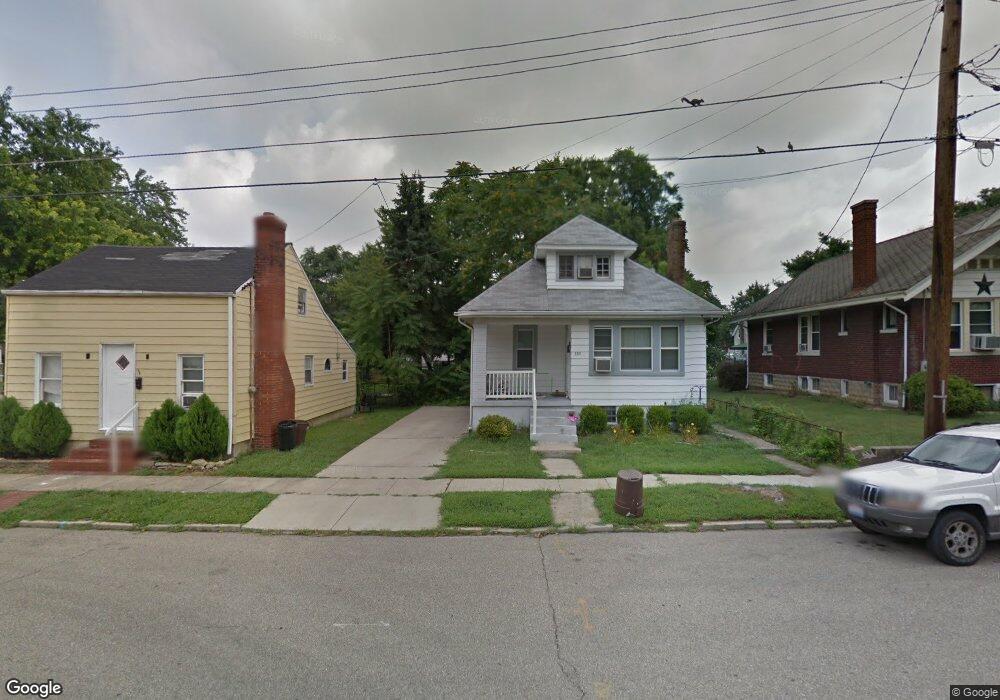
330 Elm St Lockland, OH 45215
Estimated Value: $162,677 - $206,000
3
Beds
2
Baths
1,441
Sq Ft
$126/Sq Ft
Est. Value
About This Home
This home is located at 330 Elm St, Lockland, OH 45215 and is currently estimated at $182,169, approximately $126 per square foot. 330 Elm St is a home located in Hamilton County with nearby schools including Reading Community High School, Saints Peter and Paul Academy, and Mount Notre Dame High School.
Ownership History
Date
Name
Owned For
Owner Type
Purchase Details
Closed on
May 2, 2003
Sold by
Locke Catherine E Tr
Bought by
Vonrohr Andrew C
Current Estimated Value
Purchase Details
Closed on
May 24, 2000
Sold by
Locke Richard C and Locke Catherine E
Bought by
Locke Catherine E and Catherine E Locke Revocable Trust
Purchase Details
Closed on
Jan 28, 1997
Sold by
Kastens Jean
Bought by
Locke Richard C and Locke Catherine E
Purchase Details
Closed on
Jan 24, 1997
Sold by
Meyer Gene W and Meyer Karen L
Bought by
Kastens Jean and Kastens Jeanne
Create a Home Valuation Report for This Property
The Home Valuation Report is an in-depth analysis detailing your home's value as well as a comparison with similar homes in the area
Home Values in the Area
Average Home Value in this Area
Purchase History
| Date | Buyer | Sale Price | Title Company |
|---|---|---|---|
| Vonrohr Andrew C | $77,500 | -- | |
| Locke Catherine E | -- | -- | |
| Locke Richard C | $38,500 | -- | |
| Kastens Jean | -- | -- |
Source: Public Records
Tax History
| Year | Tax Paid | Tax Assessment Tax Assessment Total Assessment is a certain percentage of the fair market value that is determined by local assessors to be the total taxable value of land and additions on the property. | Land | Improvement |
|---|---|---|---|---|
| 2025 | $1,660 | $31,315 | $6,769 | $24,546 |
| 2024 | $1,621 | $31,315 | $6,769 | $24,546 |
| 2023 | $1,646 | $31,315 | $6,769 | $24,546 |
| 2022 | $1,253 | $18,488 | $5,443 | $13,045 |
| 2021 | $1,046 | $18,488 | $5,443 | $13,045 |
| 2020 | $1,057 | $18,488 | $5,443 | $13,045 |
| 2019 | $1,025 | $16,359 | $4,816 | $11,543 |
| 2018 | $1,026 | $16,359 | $4,816 | $11,543 |
| 2017 | $967 | $16,359 | $4,816 | $11,543 |
| 2016 | $1,189 | $20,185 | $5,103 | $15,082 |
| 2015 | $1,200 | $20,185 | $5,103 | $15,082 |
| 2014 | $1,050 | $20,185 | $5,103 | $15,082 |
| 2013 | $1,064 | $20,598 | $5,208 | $15,390 |
Source: Public Records
Map
Nearby Homes
- 321 Southern Ave
- 311 Southern Ave
- 129 Pike St
- 435 Pearl St
- 306 Pearl St
- 415 Arlington Ave
- 329 Walnut St
- 654 3rd St
- 1401 Jefferson Ave
- 20 Clark Rd
- 1421 Jefferson Ave
- 310 E Vine St
- 0 Hill St Unit 1616370
- 217 W Wyoming Ave
- 529 Elliott Ave
- 1521 Hunt Rd
- 68 Gorman Ln
- 2281 E Galbraith Rd
- 454 Hillside Ave
- 59 Gorman Ln
Your Personal Tour Guide
Ask me questions while you tour the home.