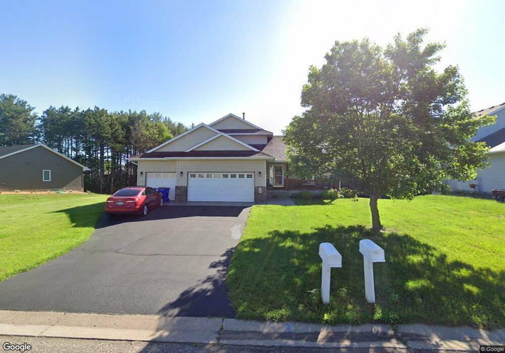
330 Evergreen Dr Somerset, WI 54025
Estimated Value: $380,000 - $474,000
4
Beds
3
Baths
864
Sq Ft
$489/Sq Ft
Est. Value
About This Home
This home is located at 330 Evergreen Dr, Somerset, WI 54025 and is currently estimated at $422,380, approximately $488 per square foot. 330 Evergreen Dr is a home located in St. Croix County with nearby schools including Somerset Elementary School, Somerset Middle School, and Somerset High School.
Ownership History
Date
Name
Owned For
Owner Type
Purchase Details
Closed on
May 16, 2007
Sold by
Lasalle Bank Na
Bought by
Buchannan Guy and Buchannan Betsy
Current Estimated Value
Home Financials for this Owner
Home Financials are based on the most recent Mortgage that was taken out on this home.
Original Mortgage
$237,500
Outstanding Balance
$144,779
Interest Rate
6.21%
Mortgage Type
New Conventional
Estimated Equity
$277,601
Purchase Details
Closed on
Jun 28, 2006
Sold by
Morgan Patricia
Bought by
Lasalle Bank Na
Create a Home Valuation Report for This Property
The Home Valuation Report is an in-depth analysis detailing your home's value as well as a comparison with similar homes in the area
Home Values in the Area
Average Home Value in this Area
Purchase History
| Date | Buyer | Sale Price | Title Company |
|---|---|---|---|
| Buchannan Guy | $237,500 | None Available | |
| Lasalle Bank Na | -- | None Available |
Source: Public Records
Mortgage History
| Date | Status | Borrower | Loan Amount |
|---|---|---|---|
| Open | Buchannan Guy | $237,500 |
Source: Public Records
Tax History Compared to Growth
Tax History
| Year | Tax Paid | Tax Assessment Tax Assessment Total Assessment is a certain percentage of the fair market value that is determined by local assessors to be the total taxable value of land and additions on the property. | Land | Improvement |
|---|---|---|---|---|
| 2024 | $59 | $327,500 | $33,500 | $294,000 |
| 2023 | $5,530 | $327,500 | $33,500 | $294,000 |
| 2022 | $5,396 | $327,500 | $33,500 | $294,000 |
| 2021 | $5,419 | $327,500 | $33,500 | $294,000 |
| 2020 | $5,658 | $327,500 | $33,500 | $294,000 |
| 2019 | $5,959 | $233,400 | $24,500 | $208,900 |
| 2018 | $5,559 | $233,400 | $24,500 | $208,900 |
| 2017 | $5,454 | $233,400 | $24,500 | $208,900 |
| 2016 | $5,454 | $233,400 | $24,500 | $208,900 |
| 2015 | $5,399 | $233,400 | $24,500 | $208,900 |
| 2014 | $5,293 | $233,400 | $24,500 | $208,900 |
| 2013 | $5,320 | $233,400 | $24,500 | $208,900 |
Source: Public Records
Map
Nearby Homes
- 316 Evergreen Dr
- 206 Red Pine Dr
- 441 White Pine Ln
- 481 Martin Way
- 315 Harriman St
- 357 Harriman St
- 441 Charles Ln
- 1932 64th St
- 325 Church Hill Rd
- The Rockport Plan at Pine Vale
- The Newport Plan at Pine Vale
- The Brook View Plan at Pine Vale
- The Cheyenne Plan at Pine Vale
- The Ashton Plan at Pine Vale
- The Waverly Plan at Pine Vale
- The Mulbery Plan at Pine Vale
- The Primrose Plan at Pine Vale
- The Water Stone Plan at Pine Vale
- 270 Main St
- 302 Main St
- 334 Evergreen Dr
- 326 Evergreen Dr
- 322 Evergreen Dr
- 336 Evergreen Dr
- 333 Evergreen Dr
- 329 Evergreen Dr
- 308 Evergreen Dr
- 327 Evergreen Dr
- 340 Evergreen Dr
- 337 Evergreen Dr
- 304 Evergreen Dr
- 205 Balsam Dr
- 343 Evergreen Dr
- 221 Balsam Dr
- 300 Evergreen Dr
- 328 Blue Spruce Ln
- 344 Evergreen Dr
- 227 Balsam Dr
- 218 Red Pine Dr
- 208 Balsam Dr