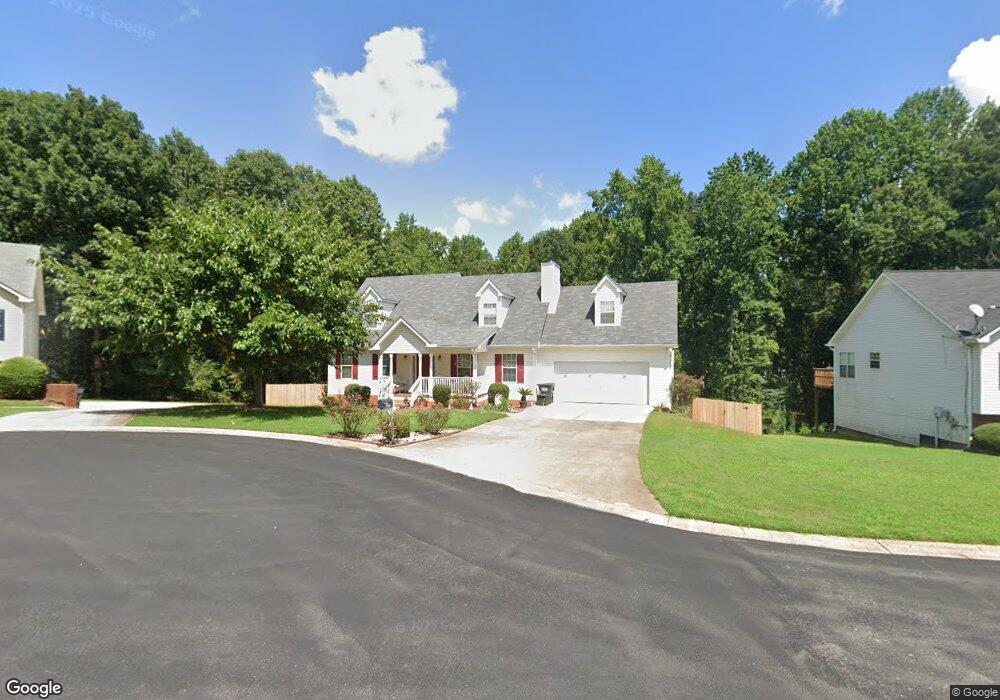
330 Forest Brook Dr Unit 3 Covington, GA 30016
Estimated Value: $297,248 - $320,000
Studio
2
Baths
1,961
Sq Ft
$157/Sq Ft
Est. Value
About This Home
This home is located at 330 Forest Brook Dr Unit 3, Covington, GA 30016 and is currently estimated at $308,312, approximately $157 per square foot. 330 Forest Brook Dr Unit 3 is a home located in Newton County with nearby schools including Live Oak Elementary School, Veterans Memorial Middle School, and Newton High School.
Ownership History
Date
Name
Owned For
Owner Type
Purchase Details
Closed on
Jun 30, 2023
Sold by
Delvalle Maria
Bought by
Delvalle Christina and Delvalle Maria
Current Estimated Value
Purchase Details
Closed on
Oct 14, 2005
Sold by
Noles Larry R and Noles Mabel
Bought by
Delvalle Maria
Home Financials for this Owner
Home Financials are based on the most recent Mortgage that was taken out on this home.
Original Mortgage
$100,400
Interest Rate
5.66%
Mortgage Type
New Conventional
Create a Home Valuation Report for This Property
The Home Valuation Report is an in-depth analysis detailing your home's value as well as a comparison with similar homes in the area
Home Values in the Area
Average Home Value in this Area
Purchase History
| Date | Buyer | Sale Price | Title Company |
|---|---|---|---|
| Delvalle Christina | -- | -- | |
| Delvalle Maria | $157,000 | -- |
Source: Public Records
Mortgage History
| Date | Status | Borrower | Loan Amount |
|---|---|---|---|
| Previous Owner | Delvalle Maria | $100,400 |
Source: Public Records
Tax History
| Year | Tax Paid | Tax Assessment Tax Assessment Total Assessment is a certain percentage of the fair market value that is determined by local assessors to be the total taxable value of land and additions on the property. | Land | Improvement |
|---|---|---|---|---|
| 2025 | $2,026 | $123,040 | $16,800 | $106,240 |
| 2024 | $1,942 | $115,960 | $16,800 | $99,160 |
| 2023 | $2,335 | $112,960 | $7,200 | $105,760 |
| 2022 | $1,981 | $99,920 | $7,200 | $92,720 |
| 2021 | $1,597 | $79,880 | $7,200 | $72,680 |
| 2020 | $1,562 | $74,120 | $7,200 | $66,920 |
| 2019 | $1,516 | $72,120 | $7,200 | $64,920 |
| 2018 | $1,872 | $64,680 | $7,200 | $57,480 |
| 2017 | $1,780 | $54,200 | $7,200 | $47,000 |
| 2016 | $1,512 | $46,400 | $5,200 | $41,200 |
| 2015 | $1,330 | $41,120 | $5,200 | $35,920 |
| 2014 | $1,011 | $31,880 | $0 | $0 |
Source: Public Records
Map
Nearby Homes
- 230 Forest Brook Dr
- 230 Overlook Dr Unit 2
- 160 Julia Ann Ln
- 385 Hinton Chase Pkwy
- 1025 Lakeside Cir
- 170 Heather Woods Ct
- 3315 Salem Cove Trail SE
- 3380 Salem Cove Way SE
- 45 Chandler Field Dr
- 360 Crestfield Cir
- 95 Heather Woods Ct
- 280 Mackenzie Ct
- 30 Crestfield Cir
- 230 Mackenzie Ct
- 2692 Fairview Rd
- 30 Pinewood Dr
- 257 Pinewood Dr
- 408 Pinewood Dr
- 2895 Fairview Rd
- 3409 Salem Rd
- 320 Forest Brook Dr
- 340 Forest Brook Dr Unit 3
- 335 Forest Brook Dr
- 310 Forest Brook Dr
- 325 Forest Brook Dr
- 315 Forest Brook Dr Unit 3
- 265 Lakeside Point
- 255 Lakeside Point
- 305 Forest Brook Dr
- 265 Lakeside Point
- 275 Lakeside Point
- 255 Lakeside Point
- 285 Lakeside Point
- 300 Forest Brook Dr
- 245 Lakeside Point
- 295 Lakeside Point
- 245 Lakeside Point
- 235 Lakeside Point Unit 235
- 235 Lakeside Point
- 305 Lakeside Point
Your Personal Tour Guide
Ask me questions while you tour the home.