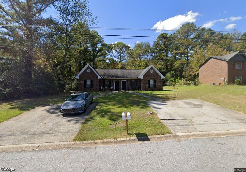
330 Freeport Dr Unit 2 Lawrenceville, GA 30046
Estimated Value: $351,255 - $412,000
4
Beds
4
Baths
2,202
Sq Ft
$177/Sq Ft
Est. Value
About This Home
This home is located at 330 Freeport Dr Unit 2, Lawrenceville, GA 30046 and is currently estimated at $389,814, approximately $177 per square foot. 330 Freeport Dr Unit 2 is a home located in Gwinnett County with nearby schools including Benefield Elementary School, Richards Middle School, and Discovery High School.
Ownership History
Date
Name
Owned For
Owner Type
Purchase Details
Closed on
Mar 28, 2012
Sold by
The Bank Of New York Mello
Bought by
Bridges Todd
Current Estimated Value
Purchase Details
Closed on
Jul 30, 2003
Sold by
Oltean Ioan and Oltean Elena
Bought by
Feria Jose
Home Financials for this Owner
Home Financials are based on the most recent Mortgage that was taken out on this home.
Original Mortgage
$145,200
Interest Rate
5.94%
Mortgage Type
New Conventional
Create a Home Valuation Report for This Property
The Home Valuation Report is an in-depth analysis detailing your home's value as well as a comparison with similar homes in the area
Home Values in the Area
Average Home Value in this Area
Purchase History
| Date | Buyer | Sale Price | Title Company |
|---|---|---|---|
| Bridges Todd | $49,000 | -- | |
| Feria Jose | $152,900 | -- |
Source: Public Records
Mortgage History
| Date | Status | Borrower | Loan Amount |
|---|---|---|---|
| Previous Owner | Feria Jose | $145,200 |
Source: Public Records
Tax History Compared to Growth
Tax History
| Year | Tax Paid | Tax Assessment Tax Assessment Total Assessment is a certain percentage of the fair market value that is determined by local assessors to be the total taxable value of land and additions on the property. | Land | Improvement |
|---|---|---|---|---|
| 2024 | $4,621 | $110,960 | $20,000 | $90,960 |
| 2023 | $4,621 | $110,960 | $20,000 | $90,960 |
| 2022 | $4,533 | $115,160 | $20,000 | $95,160 |
| 2021 | $3,051 | $68,800 | $11,080 | $57,720 |
| 2020 | $3,063 | $68,800 | $11,080 | $57,720 |
| 2019 | $2,958 | $72,720 | $11,080 | $61,640 |
| 2018 | $2,131 | $45,560 | $9,600 | $35,960 |
| 2016 | $1,615 | $29,720 | $6,800 | $22,920 |
| 2015 | $1,628 | $29,720 | $6,800 | $22,920 |
| 2014 | $1,633 | $29,720 | $6,800 | $22,920 |
Source: Public Records
Map
Nearby Homes
- 209 Towler Rd
- 1231 Providence Way
- 1430 Eugenia Terrace
- 142 Towler Rd
- 749 Dogwood Dr
- 384 Mephisto Cir
- 284 Regal Dr
- 1115 Chris Lake Dr
- 265 Regal Dr
- 771 James Cir
- 25 Darcee Ct
- 829 Bev Ct Unit 1
- 495 Buttercup Trail
- 1405 Chris Lake Dr
- 281 Craig Dr
- 1384 Sunrise Way
- 1469 Bridgestone Dr
- 811 Leonard Ct Unit 1
- 328 Freeport Dr
- 318 Freeport Dr
- 320 Freeport Dr
- 340 Freeport Dr
- 345 Lexington Dr
- 298 Freeport Dr Unit 300
- 335 Lexington Dr Unit 1
- 1040 Arlington Way
- 310 Freeport Dr
- 331 Freeport Dr
- 982 Arlington Way
- 321 Freeport Dr
- 1031 Arlington Way
- 341 Freeport Dr
- 323 Lexington Dr
- 325 Lexington Dr
- 352 Lexington Dr
- 332 Lexington Dr
- 304 Lexington Dr
- 311 Freeport Dr