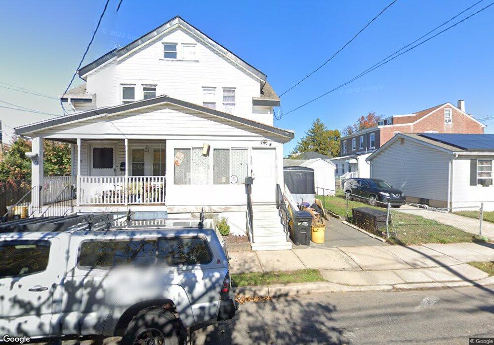
330 Hobart Ave Trenton, NJ 08629
Estimated Value: $263,000 - $355,000
--
Bed
--
Bath
1,512
Sq Ft
$213/Sq Ft
Est. Value
About This Home
This home is located at 330 Hobart Ave, Trenton, NJ 08629 and is currently estimated at $321,454, approximately $212 per square foot. 330 Hobart Ave is a home located in Mercer County with nearby schools including Kuser Elementary School, Emily C. Reynolds Middle School, and Steinert - Hamilton High East.
Ownership History
Date
Name
Owned For
Owner Type
Purchase Details
Closed on
Oct 21, 2005
Sold by
Foley Richard
Bought by
Mora Marvin
Current Estimated Value
Home Financials for this Owner
Home Financials are based on the most recent Mortgage that was taken out on this home.
Original Mortgage
$137,200
Outstanding Balance
$73,852
Interest Rate
5.85%
Mortgage Type
Purchase Money Mortgage
Estimated Equity
$247,602
Create a Home Valuation Report for This Property
The Home Valuation Report is an in-depth analysis detailing your home's value as well as a comparison with similar homes in the area
Home Values in the Area
Average Home Value in this Area
Purchase History
| Date | Buyer | Sale Price | Title Company |
|---|---|---|---|
| Mora Marvin | $171,600 | -- |
Source: Public Records
Mortgage History
| Date | Status | Borrower | Loan Amount |
|---|---|---|---|
| Open | Mora Marvin | $137,200 |
Source: Public Records
Tax History Compared to Growth
Tax History
| Year | Tax Paid | Tax Assessment Tax Assessment Total Assessment is a certain percentage of the fair market value that is determined by local assessors to be the total taxable value of land and additions on the property. | Land | Improvement |
|---|---|---|---|---|
| 2025 | $3,954 | $112,200 | $21,400 | $90,800 |
| 2024 | $3,706 | $112,200 | $21,400 | $90,800 |
| 2023 | $3,706 | $112,200 | $21,400 | $90,800 |
| 2022 | $3,648 | $112,200 | $21,400 | $90,800 |
| 2021 | $4,188 | $112,200 | $21,400 | $90,800 |
| 2020 | $3,785 | $112,200 | $21,400 | $90,800 |
| 2019 | $3,686 | $112,200 | $21,400 | $90,800 |
| 2018 | $3,644 | $112,200 | $21,400 | $90,800 |
| 2017 | $3,458 | $112,200 | $21,400 | $90,800 |
| 2016 | $3,115 | $115,200 | $24,400 | $90,800 |
| 2015 | $4,247 | $87,400 | $18,100 | $69,300 |
| 2014 | $4,179 | $87,400 | $18,100 | $69,300 |
Source: Public Records
Map
Nearby Homes
- 618 Atlantic Ave
- 235 Darcy Ave
- 1524 Elizabeth Ave
- 1427 Hamilton Ave
- 11 Klein Ave
- 20 Charlotte Ave
- 448 Lynwood Ave
- 365 Cleveland Ave
- 631 S Olden Ave
- 657 S Olden Ave
- 144 Beal St
- 19 Scammel Ave
- 1122 Hamilton Ave
- 224 Garfield Ave
- 816 S Olden Ave
- 1110 Hamilton Ave
- 254 S Olden Ave
- 121 Dickinson Ave
- 541 Emmett Ave
- 151 S Logan Ave
- 328 Hobart Ave
- 717 Atlantic Ave
- 340 Hobart Ave
- 715 Atlantic Ave
- 135 Darcy Ave
- 705 Atlantic Ave
- 133 Darcy Ave
- 333 Hobart Ave
- 337 Hobart Ave
- Hobart Hobart Ave
- 319 Hobart Ave
- 319 Hobart Ave Unit 1
- 341 Hobart Ave
- 807 Atlantic Ave
- 317 Hobart Ave
- 315 Hobart Ave
- 313 Hobart Ave
- 311 Hobart Ave
- 809 Atlantic Ave
- 714 Atlantic Ave