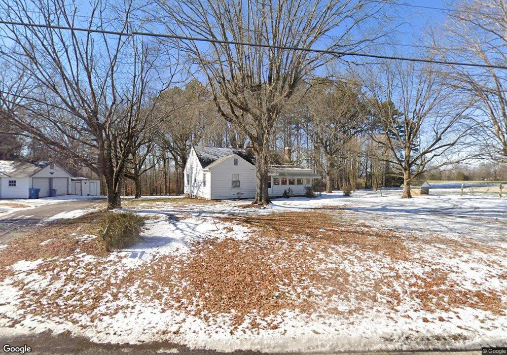
330 Joe Rd Mocksville, NC 27028
Estimated Value: $291,360 - $326,000
2
Beds
1
Bath
1,430
Sq Ft
$212/Sq Ft
Est. Value
About This Home
This home is located at 330 Joe Rd, Mocksville, NC 27028 and is currently estimated at $302,590, approximately $211 per square foot. 330 Joe Rd is a home with nearby schools including Cornatzer Elementary School, William Ellis Middle School, and Davie County High School.
Ownership History
Date
Name
Owned For
Owner Type
Purchase Details
Closed on
Oct 4, 2024
Sold by
Allen Regina S and Darlene Swicegood Allen Regina
Bought by
Duggins Wayne O
Current Estimated Value
Home Financials for this Owner
Home Financials are based on the most recent Mortgage that was taken out on this home.
Original Mortgage
$240,000
Outstanding Balance
$237,529
Interest Rate
6.46%
Mortgage Type
New Conventional
Estimated Equity
$65,061
Purchase Details
Closed on
Nov 3, 2022
Sold by
Swicegood Mona Ruth Fleming and Swicegood Joe
Bought by
Foster Wesley Alan and Foster Heather H
Purchase Details
Closed on
Dec 1, 1993
Purchase Details
Closed on
Sep 1, 1945
Create a Home Valuation Report for This Property
The Home Valuation Report is an in-depth analysis detailing your home's value as well as a comparison with similar homes in the area
Home Values in the Area
Average Home Value in this Area
Purchase History
| Date | Buyer | Sale Price | Title Company |
|---|---|---|---|
| Duggins Wayne O | $273,000 | None Listed On Document | |
| Duggins Wayne O | $273,000 | None Listed On Document | |
| Foster Wesley Alan | $30,000 | -- | |
| Foster Wesley Alan | $30,000 | None Listed On Document | |
| -- | -- | -- | |
| -- | -- | -- |
Source: Public Records
Mortgage History
| Date | Status | Borrower | Loan Amount |
|---|---|---|---|
| Open | Duggins Wayne O | $240,000 | |
| Closed | Duggins Wayne O | $240,000 |
Source: Public Records
Tax History Compared to Growth
Tax History
| Year | Tax Paid | Tax Assessment Tax Assessment Total Assessment is a certain percentage of the fair market value that is determined by local assessors to be the total taxable value of land and additions on the property. | Land | Improvement |
|---|---|---|---|---|
| 2025 | $1,887 | $274,050 | $72,600 | $201,450 |
| 2024 | $733 | $141,540 | $58,940 | $82,600 |
| 2023 | $1,094 | $141,540 | $58,940 | $82,600 |
| 2022 | $1,312 | $168,640 | $86,040 | $82,600 |
| 2021 | $1,304 | $168,640 | $86,040 | $82,600 |
| 2020 | $1,270 | $163,190 | $86,040 | $77,150 |
| 2019 | $1,270 | $163,190 | $86,040 | $77,150 |
| 2018 | $1,270 | $163,190 | $86,040 | $77,150 |
| 2017 | $1,253 | $163,190 | $0 | $0 |
| 2016 | $1,278 | $166,470 | $0 | $0 |
| 2015 | $1,278 | $166,470 | $0 | $0 |
| 2014 | $1,099 | $166,470 | $0 | $0 |
| 2013 | -- | $166,470 | $0 | $0 |
Source: Public Records
Map
Nearby Homes
- 00 Everhart Rd
- 128 Meadowview Rd
- 143 Reserve Dr
- 118 Hickory Tree Rd
- 387 Merrells Lake Rd
- 150 N Lake Louise Dr
- 129 N Lake Louise Dr
- 171 Lakeview Rd
- 174 Eric Rd
- 174 Eric Rd Unit 12
- 599 Cornatzer Rd
- 916 Deadmon Rd
- 906 Deadmon Rd
- 731 Cornatzer Rd
- 898 Deadmon Rd
- 890 Deadmon Rd
- 882 Deadmon Rd
- 876 Deadmon Rd
- 109 Marbrook Dr
- 718 Deadmon Rd