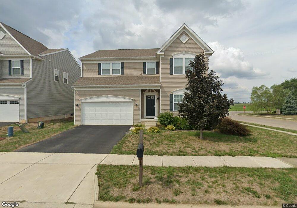
330 Karst Cir Ashville, OH 43103
Estimated Value: $363,000 - $412,000
3
Beds
3
Baths
2,672
Sq Ft
$146/Sq Ft
Est. Value
About This Home
This home is located at 330 Karst Cir, Ashville, OH 43103 and is currently estimated at $389,609, approximately $145 per square foot. 330 Karst Cir is a home.
Ownership History
Date
Name
Owned For
Owner Type
Purchase Details
Closed on
Oct 25, 2017
Sold by
Maronda Homes Inc Of Ohio
Bought by
American Mortgage Service Company
Current Estimated Value
Home Financials for this Owner
Home Financials are based on the most recent Mortgage that was taken out on this home.
Original Mortgage
$201,540
Outstanding Balance
$168,792
Interest Rate
3.83%
Mortgage Type
Future Advance Clause Open End Mortgage
Estimated Equity
$220,817
Create a Home Valuation Report for This Property
The Home Valuation Report is an in-depth analysis detailing your home's value as well as a comparison with similar homes in the area
Home Values in the Area
Average Home Value in this Area
Purchase History
| Date | Buyer | Sale Price | Title Company |
|---|---|---|---|
| American Mortgage Service Company | $212,200 | Attorney |
Source: Public Records
Mortgage History
| Date | Status | Borrower | Loan Amount |
|---|---|---|---|
| Open | American Mortgage Service Company | $201,540 |
Source: Public Records
Tax History Compared to Growth
Tax History
| Year | Tax Paid | Tax Assessment Tax Assessment Total Assessment is a certain percentage of the fair market value that is determined by local assessors to be the total taxable value of land and additions on the property. | Land | Improvement |
|---|---|---|---|---|
| 2024 | -- | $110,070 | $7,180 | $102,890 |
| 2023 | $4,327 | $110,070 | $7,180 | $102,890 |
| 2022 | $3,602 | $84,500 | $6,030 | $78,470 |
| 2021 | $3,420 | $84,500 | $6,030 | $78,470 |
| 2020 | $3,428 | $84,500 | $6,030 | $78,470 |
| 2019 | $1,620 | $72,770 | $6,030 | $66,740 |
| 2018 | $2,964 | $70,020 | $6,030 | $63,990 |
| 2017 | $209 | $4,820 | $4,820 | $0 |
| 2016 | $209 | $4,800 | $4,800 | $0 |
| 2015 | $210 | $4,800 | $4,800 | $0 |
| 2014 | $210 | $4,800 | $4,800 | $0 |
| 2013 | $217 | $4,800 | $4,800 | $0 |
Source: Public Records
Map
Nearby Homes
- 5332 Karst Cir
- Longwood Plan at Walker Pointe
- Birmingham Plan at Walker Pointe
- Sanibel Plan at Walker Pointe
- Carlisle Plan at Walker Pointe
- Somerset Plan at Walker Pointe
- Chattanooga Plan at Walker Pointe
- Rockford Plan at Walker Pointe
- Hoover Plan at Walker Pointe
- Sedona Plan at Walker Pointe
- Truman Plan at Walker Pointe
- Miramar Plan at Walker Pointe
- 52 River Bend Dr
- 5004 Yenko Ct
- 127 Boutot St
- The Daffodil Plan at Riverbend at Scioto Landing
- The Daisy Plan at Riverbend at Scioto Landing
- The Avalon Plan at Riverbend at Scioto Landing
- The Aster Plan at Riverbend at Scioto Landing
- 51 Henderson Ln
- 340 Karst Cir
- 342 Karst Cir
- 337 Karst Cir
- 336 Karst Cir
- 335 Karst Cir
- 16070 North St
- 2293 North St
- 339 Karst Cir
- 341 Karst Cir
- 344 Karst Cir
- 334 Karst Cir
- 343 Karst Cir
- 333 Karst Cir
- 91 Henderson Ln
- 346 Karst Cir
- 5331 Karst Cir
- 88 Henderson Ln
- 89 Henderson Ln
- 5330 Karst Cir
- 487 Walker Pointe Dr Unit 36456524