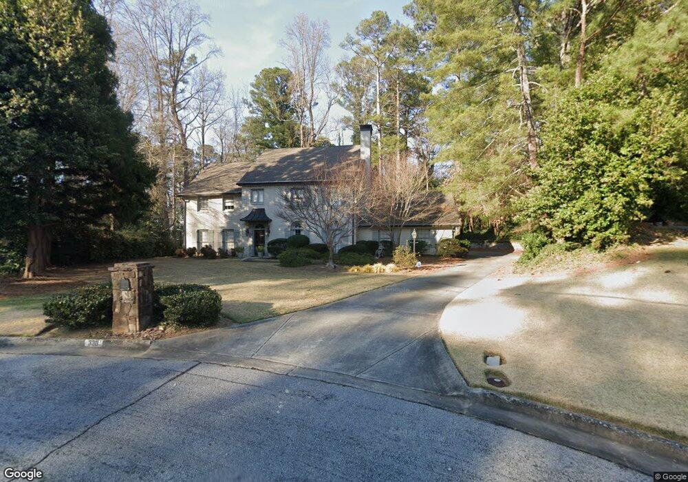
330 Lighthouse Point NW Atlanta, GA 30328
Estimated Value: $896,547 - $1,061,000
4
Beds
3
Baths
2,965
Sq Ft
$325/Sq Ft
Est. Value
About This Home
This home is located at 330 Lighthouse Point NW, Atlanta, GA 30328 and is currently estimated at $964,887, approximately $325 per square foot. 330 Lighthouse Point NW is a home located in Fulton County with nearby schools including Heards Ferry Elementary School, Ridgeview Charter School, and Riverwood International Charter School.
Ownership History
Date
Name
Owned For
Owner Type
Purchase Details
Closed on
Mar 30, 2000
Sold by
Baltz Raymond E and Baltz Pamela G
Bought by
Bressler Alan J and Bressler Diane S
Current Estimated Value
Home Financials for this Owner
Home Financials are based on the most recent Mortgage that was taken out on this home.
Original Mortgage
$287,200
Outstanding Balance
$93,221
Interest Rate
7.5%
Mortgage Type
New Conventional
Estimated Equity
$871,666
Purchase Details
Closed on
May 26, 1995
Sold by
Schwartz William P Anne R
Bought by
Baltz Raymond E Pamela
Create a Home Valuation Report for This Property
The Home Valuation Report is an in-depth analysis detailing your home's value as well as a comparison with similar homes in the area
Home Values in the Area
Average Home Value in this Area
Purchase History
| Date | Buyer | Sale Price | Title Company |
|---|---|---|---|
| Bressler Alan J | $359,000 | -- | |
| Baltz Raymond E Pamela | $245,000 | -- |
Source: Public Records
Mortgage History
| Date | Status | Borrower | Loan Amount |
|---|---|---|---|
| Open | Bressler Alan J | $287,200 | |
| Closed | Baltz Raymond E Pamela | $0 |
Source: Public Records
Tax History Compared to Growth
Tax History
| Year | Tax Paid | Tax Assessment Tax Assessment Total Assessment is a certain percentage of the fair market value that is determined by local assessors to be the total taxable value of land and additions on the property. | Land | Improvement |
|---|---|---|---|---|
| 2025 | $5,011 | $272,240 | $116,680 | $155,560 |
| 2023 | $6,498 | $230,200 | $61,400 | $168,800 |
| 2022 | $4,733 | $259,960 | $103,400 | $156,560 |
| 2021 | $4,808 | $202,800 | $70,080 | $132,720 |
| 2020 | $4,658 | $174,120 | $41,360 | $132,760 |
| 2019 | $4,632 | $174,120 | $41,360 | $132,760 |
| 2018 | $3,940 | $174,120 | $41,360 | $132,760 |
| 2017 | $4,059 | $132,080 | $30,200 | $101,880 |
| 2016 | $4,058 | $132,080 | $30,200 | $101,880 |
| 2015 | $4,080 | $132,320 | $30,200 | $102,120 |
| 2014 | $4,220 | $132,320 | $30,200 | $102,120 |
Source: Public Records
Map
Nearby Homes
- 570 Old Harbor Dr NW Unit 3
- 255 Black Water Cove NW
- 502 Old Harbor Dr NW
- 6715 Laurian Wood Dr NW
- 715 Amberidge Trail NW
- 435 Johnson Ferry Rd NW
- 415 River Valley Rd NW
- 100 Barnard Place NW
- 500 Tanacrest Cir NW Unit 4
- 585 Amberidge Trail NW
- 265 Marchand Ct NW
- Lot 6 N Riverside Cir
- 505 River Valley Rd NW
- 4755 Columns Dr SE
- 276 Colewood Way NW
- 340 River Knoll Dr NW
- 200 River Valley Ct
- 320 Lighthouse Point NW
- 440 N Harbor Dr
- 450 N Harbor Dr Unit 1
- 340 Lighthouse Point NW Unit 3
- 430 N Harbor Dr NW
- 460 N Harbor Dr NW
- 310 Lighthouse Point NW
- 350 Lighthouse Point NW Unit 3
- 360 Lighthouse Point NW
- 1100 N Harbor Ct
- 370 Lighthouse Point NW
- 0 N Harbor Dr NW
- 470 N Harbor Dr NW
- 300 Lighthouse Point NW
- 445 N Harbor Dr NW
- 540 Old Harbor Dr NW
- 435 N Harbor Dr NW Unit 1
- 550 Old Harbor Dr NW
- 6695 Chesapeake Point NW
- 6290 Blackwater Trail NW