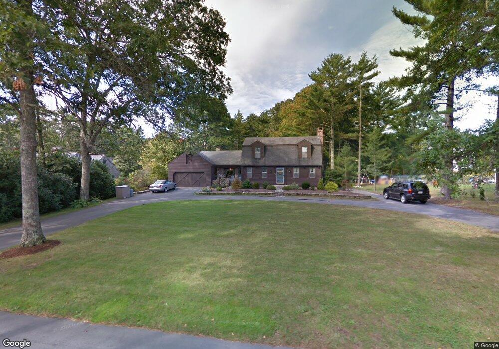
330 Mendall Rd Acushnet, MA 02743
Estimated Value: $546,000 - $624,000
3
Beds
2
Baths
1,857
Sq Ft
$317/Sq Ft
Est. Value
About This Home
This home is located at 330 Mendall Rd, Acushnet, MA 02743 and is currently estimated at $589,572, approximately $317 per square foot. 330 Mendall Rd is a home located in Bristol County with nearby schools including Acushnet Elementary School, Albert F Ford Middle School, and Alma Del Mar Charter School.
Ownership History
Date
Name
Owned For
Owner Type
Purchase Details
Closed on
Apr 9, 2021
Sold by
Pine Grove 4 Rt and Salvail
Bought by
Salvail Donald R and Salvail Dawn-Ann
Current Estimated Value
Purchase Details
Closed on
Jul 11, 2011
Sold by
Salvail Donald R and Salvail Daen-Ann
Bought by
Pine Grove 4 Rt and Salvail
Purchase Details
Closed on
Aug 15, 1988
Sold by
Paulino Joan F
Bought by
Salvaie Donald R
Create a Home Valuation Report for This Property
The Home Valuation Report is an in-depth analysis detailing your home's value as well as a comparison with similar homes in the area
Purchase History
| Date | Buyer | Sale Price | Title Company |
|---|---|---|---|
| Salvail Donald R | -- | None Available | |
| Pine Grove 4 Rt | -- | -- | |
| Salvaie Donald R | $195,000 | -- |
Source: Public Records
Mortgage History
| Date | Status | Borrower | Loan Amount |
|---|---|---|---|
| Previous Owner | Salvaie Donald R | $206,000 | |
| Previous Owner | Salvaie Donald R | $60,000 |
Source: Public Records
Tax History
| Year | Tax Paid | Tax Assessment Tax Assessment Total Assessment is a certain percentage of the fair market value that is determined by local assessors to be the total taxable value of land and additions on the property. | Land | Improvement |
|---|---|---|---|---|
| 2025 | $50 | $463,200 | $140,800 | $322,400 |
| 2024 | $4,691 | $411,100 | $133,400 | $277,700 |
| 2023 | $4,637 | $386,400 | $121,100 | $265,300 |
| 2022 | $4,363 | $328,800 | $113,700 | $215,100 |
| 2021 | $4,309 | $311,600 | $113,700 | $197,900 |
| 2020 | $4,239 | $304,100 | $106,200 | $197,900 |
| 2019 | $4,102 | $289,300 | $101,300 | $188,000 |
| 2018 | $3,978 | $275,900 | $101,300 | $174,600 |
| 2017 | $3,868 | $267,900 | $101,300 | $166,600 |
| 2016 | $3,650 | $251,200 | $101,300 | $149,900 |
| 2015 | $3,587 | $251,200 | $101,300 | $149,900 |
Source: Public Records
Map
Nearby Homes
- 332 Mendall Rd
- 328 Mendall Rd
- 324 Mendall Rd
- 331 Mendall Rd
- 336 Mendall Rd
- 329 Mendall Rd
- 4 Holly Ave
- 320 Mendall Rd
- 338 Mendall Rd
- 11 Mattapoisett Rd
- 7 Holly Ave
- 325 Mendall Rd
- 4 Mattapoisett Rd
- 0 Mattapoisett Rd
- 1 Mattapoisett Rd
- 6 Holly Ave
- 9 Mattapoisett Rd
- 15 Mattapoisett Rd
- 311 Hathaway Rd
- 9 Holly Ave
Your Personal Tour Guide
Ask me questions while you tour the home.