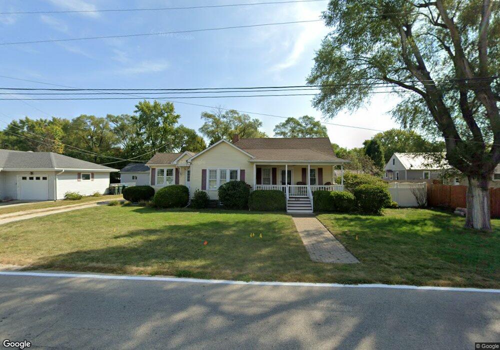
330 N Broadway St Coal City, IL 60416
Estimated Value: $183,568 - $283,000
--
Bed
--
Bath
1,038
Sq Ft
$221/Sq Ft
Est. Value
About This Home
This home is located at 330 N Broadway St, Coal City, IL 60416 and is currently estimated at $229,892, approximately $221 per square foot. 330 N Broadway St is a home with nearby schools including Coal City Elementary School, Coal City Intermediate School, and Coal City Middle School.
Ownership History
Date
Name
Owned For
Owner Type
Purchase Details
Closed on
Oct 9, 2018
Sold by
Wharrie Patricia L
Bought by
Tapley Ronald L
Current Estimated Value
Purchase Details
Closed on
Jun 28, 2018
Sold by
Dupaw Cynthia A
Bought by
Rouse Katie
Home Financials for this Owner
Home Financials are based on the most recent Mortgage that was taken out on this home.
Original Mortgage
$155,138
Interest Rate
4.62%
Mortgage Type
FHA
Purchase Details
Closed on
Feb 6, 2012
Sold by
Dupaw Amanda Delores and Byers Stephen William
Bought by
Dupaw Cynthia A
Create a Home Valuation Report for This Property
The Home Valuation Report is an in-depth analysis detailing your home's value as well as a comparison with similar homes in the area
Home Values in the Area
Average Home Value in this Area
Purchase History
| Date | Buyer | Sale Price | Title Company |
|---|---|---|---|
| Tapley Ronald L | $213,500 | Fidelity National Title | |
| Rouse Katie | $158,000 | Chicago Title | |
| Dupaw Cynthia A | -- | Chicago Title |
Source: Public Records
Mortgage History
| Date | Status | Borrower | Loan Amount |
|---|---|---|---|
| Previous Owner | Rouse Katie | $155,138 |
Source: Public Records
Tax History Compared to Growth
Tax History
| Year | Tax Paid | Tax Assessment Tax Assessment Total Assessment is a certain percentage of the fair market value that is determined by local assessors to be the total taxable value of land and additions on the property. | Land | Improvement |
|---|---|---|---|---|
| 2024 | $4,586 | $62,487 | $10,750 | $51,737 |
| 2023 | $4,291 | $58,459 | $10,057 | $48,402 |
| 2022 | $3,605 | $54,762 | $9,421 | $45,341 |
| 2021 | $3,426 | $51,760 | $8,905 | $42,855 |
| 2020 | $3,345 | $50,720 | $8,726 | $41,994 |
| 2019 | $3,098 | $47,849 | $8,232 | $39,617 |
| 2018 | $3,061 | $47,939 | $8,247 | $39,692 |
| 2017 | $2,862 | $46,206 | $7,949 | $38,257 |
| 2016 | $2,817 | $45,871 | $7,891 | $37,980 |
| 2015 | $875 | $44,354 | $7,630 | $36,724 |
| 2014 | $843 | $43,647 | $7,508 | $36,139 |
| 2013 | $1,699 | $44,470 | $7,650 | $36,820 |
Source: Public Records
Map
Nearby Homes
- 395 N Kankakee St
- 105 N Kankakee St
- Lot 6 Mcardle Rd
- Lot 5 Mcardle Rd
- Lot 4 Mcardle Rd
- Lot 3 Mcardle Rd
- Lot 2 Mcardle Rd
- Lot 1 Mcardle Rd
- 295 N Lincoln St
- 540 N 1st Ave
- 385 S Kankakee St
- 595 W Rathburn St
- 573-585 S Mazon St
- 485 Trotter Dr
- 495 Trotter Dr
- 170 E Walnut St
- 120 E Elm St
- 1060 Regent Ct
- 0 E Division St Unit MRD12083414
- 20 N Carbon Hill Rd
- 30 E 3rd St
- 335 N Broadway St
- 20 E 3rd St
- 40 E 3rd St
- 365 N Broadway St
- 60 E 3rd St
- 360 N Kankakee St
- 90 E 3rd St
- 370 N Kankakee St
- 380 N Kankakee St
- 65 E 3rd St
- 290 N Kankakee St
- 415 N Broadway St
- 40 E 4th St
- 250 N Kankakee St
- 110 E 3rd St
- 425 N Broadway St
- 42 E 4th St
- 355 N Kankakee St
- 355 N Kankakee St