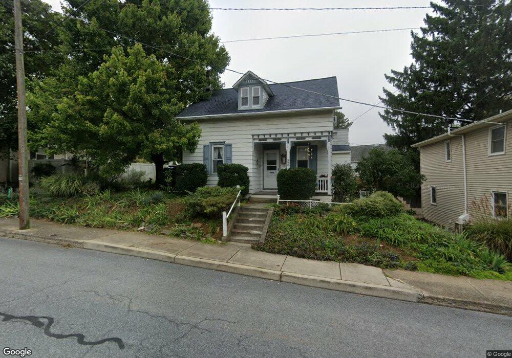
330 N Cedar St Lititz, PA 17543
Estimated Value: $292,322 - $333,000
4
Beds
3
Baths
1,220
Sq Ft
$253/Sq Ft
Est. Value
About This Home
This home is located at 330 N Cedar St, Lititz, PA 17543 and is currently estimated at $309,081, approximately $253 per square foot. 330 N Cedar St is a home located in Lancaster County with nearby schools including Warwick Senior High School, Lititz Christian School, and Linden Hall.
Ownership History
Date
Name
Owned For
Owner Type
Purchase Details
Closed on
Sep 15, 2010
Sold by
Heurich Helen R
Bought by
King Dana G and King Kathleen M
Current Estimated Value
Home Financials for this Owner
Home Financials are based on the most recent Mortgage that was taken out on this home.
Original Mortgage
$124,000
Outstanding Balance
$82,172
Interest Rate
4.51%
Mortgage Type
New Conventional
Estimated Equity
$226,909
Create a Home Valuation Report for This Property
The Home Valuation Report is an in-depth analysis detailing your home's value as well as a comparison with similar homes in the area
Home Values in the Area
Average Home Value in this Area
Purchase History
| Date | Buyer | Sale Price | Title Company |
|---|---|---|---|
| King Dana G | $155,000 | None Available |
Source: Public Records
Mortgage History
| Date | Status | Borrower | Loan Amount |
|---|---|---|---|
| Open | King Dana G | $124,000 |
Source: Public Records
Tax History
| Year | Tax Paid | Tax Assessment Tax Assessment Total Assessment is a certain percentage of the fair market value that is determined by local assessors to be the total taxable value of land and additions on the property. | Land | Improvement |
|---|---|---|---|---|
| 2025 | $3,316 | $146,600 | $48,700 | $97,900 |
| 2024 | $3,316 | $146,600 | $48,700 | $97,900 |
| 2023 | $3,303 | $146,600 | $48,700 | $97,900 |
| 2022 | $3,120 | $146,600 | $48,700 | $97,900 |
| 2021 | $3,120 | $146,600 | $48,700 | $97,900 |
| 2020 | $3,120 | $146,600 | $48,700 | $97,900 |
| 2019 | $3,120 | $146,600 | $48,700 | $97,900 |
| 2018 | $2,286 | $146,600 | $48,700 | $97,900 |
| 2017 | $2,475 | $91,400 | $33,000 | $58,400 |
| 2016 | $2,475 | $91,400 | $33,000 | $58,400 |
| 2015 | $579 | $91,400 | $33,000 | $58,400 |
| 2014 | $1,687 | $91,400 | $33,000 | $58,400 |
Source: Public Records
Map
Nearby Homes
- 146 N Cedar St
- 320 N New St
- 16 E Market St
- 213 N Locust St
- 117 Laurie Ln
- 1500 Furnace Hills Pike
- LOT 14 Thaton Rd
- LOT 12 Thaton Rd
- 3 Amberly Way
- 112 Chukar Ct
- 24 E Orange St
- 601 E Main St
- 44 Duffield Dr
- 133 S Spruce St
- 147 S Spruce St
- 146 S Oak St
- 119 Saybrooke Dr
- 50 E 2nd Ave
- 113 Cameron Ln
- 138 Moorland Ct
- 234 E Lincoln Ave
- 226 E Lincoln Ave
- 326 N Cedar St
- 326 N Cedar St
- 334 N Cedar St
- 220 E Lincoln Ave
- 220 E Lincoln Ave
- 225 E Lincoln Ave
- 309 N Cedar St
- 342 N Cedar St
- 319 N Cedar St
- 223 E Lincoln Ave
- 305 N Cedar St
- 333 N Cedar St
- 229 E Lincoln Ave
- 216 E Lincoln Ave
- 231 E Lincoln Ave
- 301 N Cedar St
- 100 Noble St
- 237 E Lincoln Ave
Your Personal Tour Guide
Ask me questions while you tour the home.