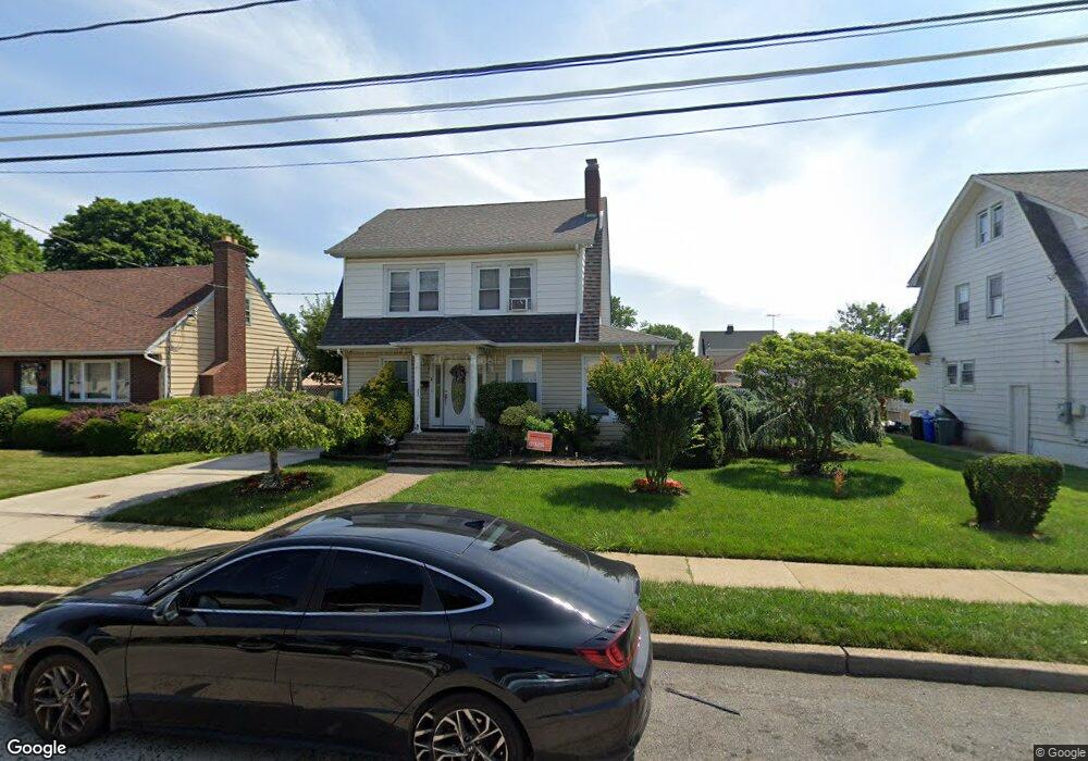
330 N Columbus Ave Freeport, NY 11520
Estimated Value: $603,850 - $797,000
Studio
1
Bath
1,562
Sq Ft
$448/Sq Ft
Est. Value
About This Home
This home is located at 330 N Columbus Ave, Freeport, NY 11520 and is currently estimated at $700,425, approximately $448 per square foot. 330 N Columbus Ave is a home located in Nassau County with nearby schools including Columbus Avenue School, Caroline G. Atkinson Intermediate School, and John W Dodd Middle School.
Ownership History
Date
Name
Owned For
Owner Type
Purchase Details
Closed on
Oct 24, 2005
Sold by
Jiminez Antonio
Current Estimated Value
Purchase Details
Closed on
Jan 2, 1996
Sold by
Johnson Phillip Est
Bought by
Jiminez Antonio and Jiminez Nayvette
Home Financials for this Owner
Home Financials are based on the most recent Mortgage that was taken out on this home.
Original Mortgage
$120,910
Outstanding Balance
$3,212
Interest Rate
7.13%
Estimated Equity
$697,213
Create a Home Valuation Report for This Property
The Home Valuation Report is an in-depth analysis detailing your home's value as well as a comparison with similar homes in the area
Home Values in the Area
Average Home Value in this Area
Purchase History
| Date | Buyer | Sale Price | Title Company |
|---|---|---|---|
| -- | -- | -- | |
| Jiminez Antonio | $120,000 | -- |
Source: Public Records
Mortgage History
| Date | Status | Borrower | Loan Amount |
|---|---|---|---|
| Open | Jiminez Antonio | $120,910 |
Source: Public Records
Tax History
| Year | Tax Paid | Tax Assessment Tax Assessment Total Assessment is a certain percentage of the fair market value that is determined by local assessors to be the total taxable value of land and additions on the property. | Land | Improvement |
|---|---|---|---|---|
| 2025 | $8,840 | $410 | $152 | $258 |
| 2024 | $928 | $410 | $152 | $258 |
| 2023 | $9,243 | $410 | $152 | $258 |
| 2022 | $9,243 | $410 | $152 | $258 |
| 2021 | $14,050 | $393 | $146 | $247 |
| 2020 | $10,117 | $674 | $383 | $291 |
| 2019 | $9,919 | $674 | $383 | $291 |
| 2018 | $9,759 | $674 | $0 | $0 |
| 2017 | $8,111 | $674 | $383 | $291 |
| 2016 | $9,123 | $674 | $383 | $291 |
| 2015 | $974 | $674 | $383 | $291 |
| 2014 | $974 | $674 | $383 | $291 |
| 2013 | $920 | $674 | $383 | $291 |
Source: Public Records
Map
Nearby Homes
- 398 Babylon Turnpike
- 188 Woodside Ave
- 85 Bedford Ave
- 247 N Columbus Ave
- 173 E Seaman Ave
- 400 N Columbus Ave
- 110 Woodside Ave
- 101 Harris Ave
- 76 Cumberland Ave
- 63 E Seaman Ave
- 67 E Dean St
- 49 Elizabeth St
- 48 Pleasant Ave
- 49 Prospect St
- 25 Bainbridge St
- 98 N Columbus Ave
- 96 N Columbus Ave
- 35 W Seaman Ave
- 33 Willow Ave
- 32 Dawes Ave
- 324 N Columbus Ave
- 332 N Columbus Ave
- 187 Independence Ave
- 309 Rutland Rd
- 344 N Columbus Ave
- 311 Rutland Rd
- 307 Rutland Rd
- 325 N Columbus Ave
- 184 Independence Ave
- 169 Independence Ave
- 327 N Columbus Ave
- 313 Rutland Rd
- 346 N Columbus Ave
- 329 N Columbus Ave
- 188 Independence Ave
- 202 Independence Ave
- 314 N Columbus Ave
- 331 N Columbus Ave
- 325 Rutland Rd
- 161 Independence Ave
Your Personal Tour Guide
Ask me questions while you tour the home.