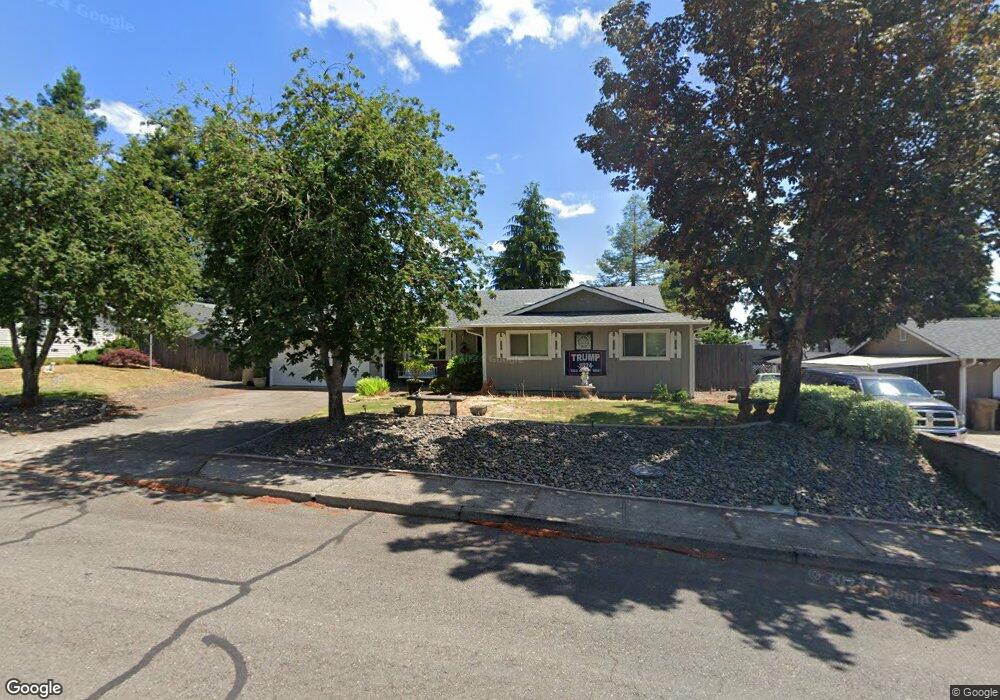
330 NW Robert St Dallas, OR 97338
Estimated Value: $434,000 - $467,000
4
Beds
2
Baths
1,604
Sq Ft
$279/Sq Ft
Est. Value
About This Home
This home is located at 330 NW Robert St, Dallas, OR 97338 and is currently estimated at $447,605, approximately $279 per square foot. 330 NW Robert St is a home located in Polk County with nearby schools including Lyle Elementary School, Whitworth Elementary School, and LaCreole Middle School.
Ownership History
Date
Name
Owned For
Owner Type
Purchase Details
Closed on
May 14, 2010
Sold by
Mulkey Melinda and Mulkey Reed
Bought by
Loerts Janet A and Loerts Michael
Current Estimated Value
Purchase Details
Closed on
Jul 7, 2004
Sold by
Smith Jeffrey Paul and Smith Amy L
Bought by
Loerts Michael A and Loerts Janet A
Home Financials for this Owner
Home Financials are based on the most recent Mortgage that was taken out on this home.
Original Mortgage
$80,000
Interest Rate
6.31%
Mortgage Type
Purchase Money Mortgage
Create a Home Valuation Report for This Property
The Home Valuation Report is an in-depth analysis detailing your home's value as well as a comparison with similar homes in the area
Home Values in the Area
Average Home Value in this Area
Purchase History
| Date | Buyer | Sale Price | Title Company |
|---|---|---|---|
| Loerts Janet A | $87,500 | None Available | |
| Loerts Michael A | $149,900 | Ticor Title |
Source: Public Records
Mortgage History
| Date | Status | Borrower | Loan Amount |
|---|---|---|---|
| Previous Owner | Loerts Michael A | $80,000 |
Source: Public Records
Tax History Compared to Growth
Tax History
| Year | Tax Paid | Tax Assessment Tax Assessment Total Assessment is a certain percentage of the fair market value that is determined by local assessors to be the total taxable value of land and additions on the property. | Land | Improvement |
|---|---|---|---|---|
| 2025 | $2,745 | $226,740 | $58,260 | $168,480 |
| 2024 | $2,745 | $220,140 | $56,560 | $163,580 |
| 2023 | $2,640 | $213,730 | $54,920 | $158,810 |
| 2022 | $2,571 | $207,510 | $53,320 | $154,190 |
| 2021 | $2,500 | $201,470 | $51,770 | $149,700 |
| 2020 | $2,428 | $195,610 | $50,270 | $145,340 |
| 2019 | $2,359 | $189,920 | $48,800 | $141,120 |
| 2018 | $2,352 | $184,390 | $47,380 | $137,010 |
| 2017 | $2,260 | $179,020 | $46,000 | $133,020 |
| 2016 | $2,274 | $173,810 | $44,660 | $129,150 |
| 2015 | $2,242 | $168,750 | $43,360 | $125,390 |
| 2014 | $2,162 | $163,840 | $42,090 | $121,750 |
Source: Public Records
Map
Nearby Homes
- 595 NW Denton Ave
- 467 NW Denton Ave
- 257 NW Douglas (-259) St
- 253/ 255 NW Douglas St
- 147 NW Douglas St
- 466 NW Denton Ave
- 540 NW Hillcrest Dr
- 610 NW Hillcrest Dr
- 607 NW Heath St
- 553 NW Douglas St
- 338 NW Foxglove St
- 373 SW Church St
- 221 SW Rainbow Ave
- 229 SW Newton Dr
- Lot F Cascade Mountain Dr
- Lot G NW Cascade Mountain Dr
- Lot E NW Crater Lake Dr
- Lot D NW Crater Lake Dr
- Lot C NW Crater Lake Dr
- Lot A NW Crater Lake Dr
- TL1506 Robert St
- 498 NW Broadmore Ct
- 340 NW Robert St
- 320 NW Robert St
- 319 NW Robert St
- 482 NW Broadmore Ct
- 350 NW Robert St
- 339 NW Robert St
- 377 NW Hillcrest Ln
- 580 NW Brentwood Ave
- 483 NW Broadmore Ct
- 373 NW Hillcrest Ln
- 550 NW Brentwood Ave
- 309 NW Robert St
- 623 NW Bryant Ct
- 464 NW Broadmore Ct
- 520 NW Brentwood Ave
- 349 NW Robert St
- 368 NW Robert St
- 467 NW Broadmore Ct