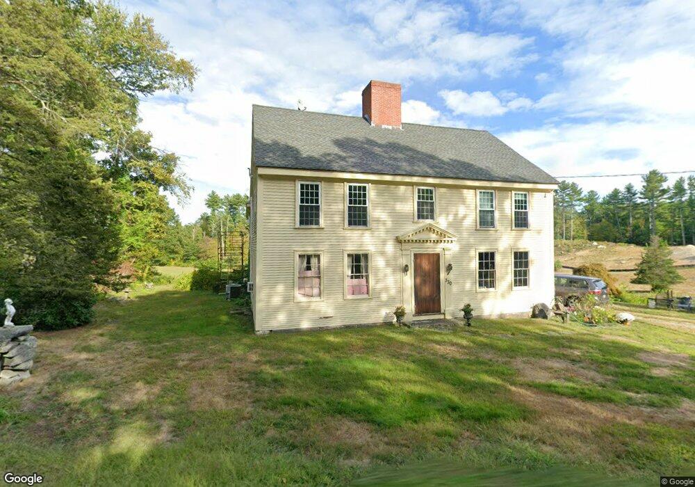
330 Old Dunstable Rd Groton, MA 01450
Estimated Value: $854,335 - $1,121,000
4
Beds
3
Baths
3,376
Sq Ft
$286/Sq Ft
Est. Value
About This Home
This home is located at 330 Old Dunstable Rd, Groton, MA 01450 and is currently estimated at $965,334, approximately $285 per square foot. 330 Old Dunstable Rd is a home located in Middlesex County with nearby schools including Groton Dunstable Regional High School.
Ownership History
Date
Name
Owned For
Owner Type
Purchase Details
Closed on
Feb 26, 2007
Sold by
Knight Patricia L and Lewis Patricia L
Bought by
Lewis Richard W
Current Estimated Value
Home Financials for this Owner
Home Financials are based on the most recent Mortgage that was taken out on this home.
Original Mortgage
$478,642
Outstanding Balance
$286,353
Interest Rate
6.23%
Mortgage Type
Purchase Money Mortgage
Estimated Equity
$678,981
Create a Home Valuation Report for This Property
The Home Valuation Report is an in-depth analysis detailing your home's value as well as a comparison with similar homes in the area
Home Values in the Area
Average Home Value in this Area
Purchase History
| Date | Buyer | Sale Price | Title Company |
|---|---|---|---|
| Lewis Richard W | -- | -- | |
| Lewis Richard W | -- | -- | |
| Lewis Richard W | -- | -- |
Source: Public Records
Mortgage History
| Date | Status | Borrower | Loan Amount |
|---|---|---|---|
| Open | Lewis Richard W | $478,642 | |
| Closed | Lewis Richard W | $478,642 |
Source: Public Records
Tax History Compared to Growth
Tax History
| Year | Tax Paid | Tax Assessment Tax Assessment Total Assessment is a certain percentage of the fair market value that is determined by local assessors to be the total taxable value of land and additions on the property. | Land | Improvement |
|---|---|---|---|---|
| 2025 | $11,573 | $758,900 | $245,100 | $513,800 |
| 2024 | $10,875 | $720,700 | $245,100 | $475,600 |
| 2023 | $10,327 | $660,300 | $245,100 | $415,200 |
| 2022 | $9,618 | $559,500 | $248,600 | $310,900 |
| 2021 | $9,550 | $542,600 | $238,000 | $304,600 |
| 2020 | $9,861 | $567,400 | $238,000 | $329,400 |
| 2019 | $10,008 | $552,600 | $228,600 | $324,000 |
| 2018 | $10,015 | $536,400 | $228,600 | $307,800 |
| 2017 | $10,231 | $560,300 | $228,600 | $331,700 |
| 2016 | $9,843 | $524,100 | $214,600 | $309,500 |
| 2015 | $9,575 | $524,100 | $214,600 | $309,500 |
Source: Public Records
Map
Nearby Homes
- 0 Old Dunstable Rd
- 2 Wildflower Ln
- 660 Old Dunstable Rd
- 21 Heritage Ln
- 18 Ingalls Rd
- 91 Chicopee Row
- 6 Ingalls Rd
- 153 Off Pond St
- 446 Westford St
- 7 Dempsey Way
- 145 Groton Rd
- 1 Summer Village Rd
- 8 Jamie Rd
- 34 Shattuck St
- 35 Keyes Rd
- 3 Colonel Rolls Dr
- 33 West St
- 34 West St
- 78 Dunstable Rd
- 16 Saint Paul Ln Unit Lot 20
- 12 Crystal Springs Ln
- 18 Crystal Springs Ln
- Lot 1 Crystal Springs Ln
- Lot 2 Crystal Springs Ln
- 24 Crystal Springs Ln
- 331 Old Dunstable Rd
- Lot 5A Crystal Springs Ln
- Lot 7A Crystal Springs Ln
- 11 Crystal Springs Ln
- 36 Bridge St
- 32 Bridge St
- 28 Crystal Springs Ln
- 19 Crystal Springs Ln
- 8 Bridge St
- 50 Bridge St
- 309 Old Dunstable Rd
- 30 Crystal Springs Ln
- 27 Crystal Springs Ln
- 29 Crystal Springs Ln
- 25 Hoyts Wharf Rd