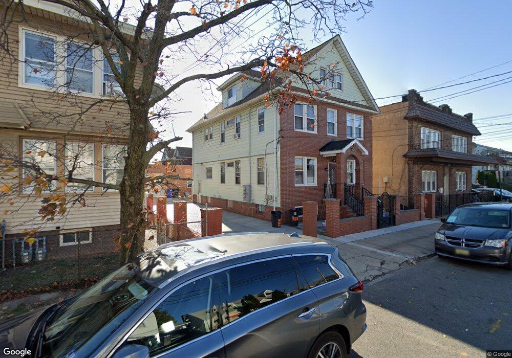
330 S 5th St Unit 332 Elizabeth, NJ 07206
Peters NeighborhoodEstimated Value: $689,143 - $787,000
--
Bed
--
Bath
2,857
Sq Ft
$261/Sq Ft
Est. Value
About This Home
This home is located at 330 S 5th St Unit 332, Elizabeth, NJ 07206 and is currently estimated at $746,286, approximately $261 per square foot. 330 S 5th St Unit 332 is a home located in Union County with nearby schools including Number 15, Christopher Columbus Elementary School and Elizabeth High School.
Ownership History
Date
Name
Owned For
Owner Type
Purchase Details
Closed on
Dec 4, 2017
Sold by
Acabou Jose H and Acabou Maria Dulce
Bought by
Suqui Angel Carchipulla
Current Estimated Value
Home Financials for this Owner
Home Financials are based on the most recent Mortgage that was taken out on this home.
Original Mortgage
$363,298
Outstanding Balance
$305,548
Interest Rate
3.9%
Mortgage Type
FHA
Estimated Equity
$440,738
Purchase Details
Closed on
Feb 26, 1990
Bought by
Acabou Jose and Acabou Maria
Create a Home Valuation Report for This Property
The Home Valuation Report is an in-depth analysis detailing your home's value as well as a comparison with similar homes in the area
Home Values in the Area
Average Home Value in this Area
Purchase History
| Date | Buyer | Sale Price | Title Company |
|---|---|---|---|
| Suqui Angel Carchipulla | $370,000 | None Available | |
| Acabou Jose | $190,000 | -- |
Source: Public Records
Mortgage History
| Date | Status | Borrower | Loan Amount |
|---|---|---|---|
| Open | Suqui Angel Carchipulla | $363,298 |
Source: Public Records
Tax History Compared to Growth
Tax History
| Year | Tax Paid | Tax Assessment Tax Assessment Total Assessment is a certain percentage of the fair market value that is determined by local assessors to be the total taxable value of land and additions on the property. | Land | Improvement |
|---|---|---|---|---|
| 2025 | $10,940 | $568,600 | $190,000 | $378,600 |
| 2024 | $11,378 | $568,600 | $190,000 | $378,600 |
| 2023 | $11,070 | $36,200 | $11,000 | $25,200 |
| 2022 | $11,070 | $36,200 | $11,000 | $25,200 |
| 2021 | $10,841 | $36,200 | $11,000 | $25,200 |
| 2020 | $10,596 | $36,200 | $11,000 | $25,200 |
| 2019 | $10,434 | $36,200 | $11,000 | $25,200 |
| 2018 | $10,333 | $36,200 | $11,000 | $25,200 |
| 2017 | $10,044 | $36,200 | $11,000 | $25,200 |
| 2016 | $10,045 | $36,200 | $11,000 | $25,200 |
| 2015 | $9,448 | $36,200 | $11,000 | $25,200 |
| 2014 | -- | $36,200 | $11,000 | $25,200 |
Source: Public Records
Map
Nearby Homes
- 315 S 5th St
- 313 Loomis St
- 325 Spencer St
- 234 Niles St
- 232 Niles St
- 433 3rd Ave
- 429 Niles St Unit 431
- 220 Palmer St
- 227 Palmer St
- 221 Palmer St
- 31 Spencer St
- 28 Niles St
- 316-318 John St
- 566 2nd Ave
- 336 John St Unit 340
- 230 Christine St Unit 32
- 234 Lt Glenn Zamorski Dr Unit G
- 225 Delaware St
- 555-557 1st Ave
- 619B Arnett St
- 330-332 S 5th St
- 326 S 5th St Unit 328
- 467 4th Ave
- 465 4th Ave
- 329-331 S 5th St
- 320 S 5th St
- 331 S 5th St
- 463 4th Ave
- 329 Loomis St Unit 331
- 333 S 5th St
- 327 Loomis St
- 329 S 5th St Unit 331
- 461 4th Ave
- 400 S 5th St
- 327 S 5th St
- 325 S 5th St
- 316 S Pt 5th St
- 323 Loomis St Unit 325
- 323 S 5th St
- 402 S 5th St