Estimated Value: $140,000 - $151,000
--
Bed
--
Bath
--
Sq Ft
0.39
Acres
About This Home
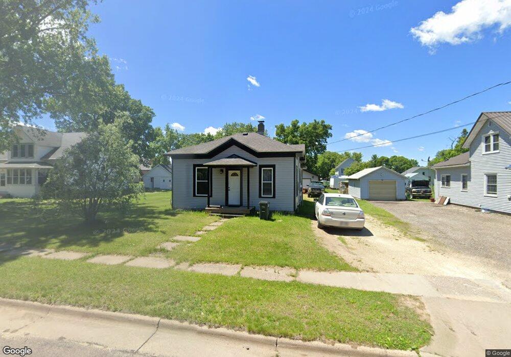
This home is located at 330 S Pearl St, Blair, WI 54616 and is currently estimated at $146,133. 330 S Pearl St is a home with nearby schools including Blair-Taylor Elementary School, Blair-Taylor Middle/High School, and Pinehill Amish School.
Ownership History
Date
Name
Owned For
Owner Type
Purchase Details
Closed on
Sep 4, 2015
Sold by
Harris Kenneth L
Bought by
Harris Revocable Living Trust
Current Estimated Value
Purchase Details
Closed on
Sep 20, 2013
Sold by
George David J
Bought by
Harris Kenneth L and Harris Roxanne
Home Financials for this Owner
Home Financials are based on the most recent Mortgage that was taken out on this home.
Original Mortgage
$44,000
Interest Rate
4.56%
Mortgage Type
Future Advance Clause Open End Mortgage
Purchase Details
Closed on
Dec 6, 2007
Sold by
Tranberg Gary L
Bought by
George David J
Home Financials for this Owner
Home Financials are based on the most recent Mortgage that was taken out on this home.
Original Mortgage
$48,000
Interest Rate
6.3%
Mortgage Type
New Conventional
Create a Home Valuation Report for This Property
The Home Valuation Report is an in-depth analysis detailing your home's value as well as a comparison with similar homes in the area
Home Values in the Area
Average Home Value in this Area
Purchase History
| Date | Buyer | Sale Price | Title Company |
|---|---|---|---|
| Harris Revocable Living Trust | $65,000 | -- | |
| Harris Kenneth L | $55,000 | None Available | |
| George David J | $60,000 | None Available |
Source: Public Records
Mortgage History
| Date | Status | Borrower | Loan Amount |
|---|---|---|---|
| Previous Owner | Harris Kenneth L | $44,000 | |
| Previous Owner | George David J | $48,000 |
Source: Public Records
Tax History Compared to Growth
Tax History
| Year | Tax Paid | Tax Assessment Tax Assessment Total Assessment is a certain percentage of the fair market value that is determined by local assessors to be the total taxable value of land and additions on the property. | Land | Improvement |
|---|---|---|---|---|
| 2024 | $1,598 | $110,300 | $10,900 | $99,400 |
| 2023 | $1,615 | $67,400 | $13,700 | $53,700 |
| 2022 | $1,558 | $67,400 | $13,700 | $53,700 |
| 2021 | $1,319 | $67,400 | $13,700 | $53,700 |
| 2020 | $1,440 | $18,870 | $13,700 | $5,170 |
| 2019 | $1,519 | $65,400 | $13,700 | $51,700 |
| 2018 | $1,317 | $65,400 | $13,700 | $51,700 |
| 2017 | $1,351 | $65,400 | $13,700 | $51,700 |
| 2016 | $1,247 | $65,400 | $13,700 | $51,700 |
| 2015 | $1,476 | $65,400 | $13,700 | $51,700 |
| 2014 | $1,373 | $65,400 | $13,700 | $51,700 |
| 2011 | $1,003 | $45,000 | $9,600 | $35,400 |
Source: Public Records
Map
Nearby Homes
- 328 S Urberg Ave
- 127 E Broadway St
- 102 S Peterson Ave
- 313 S Park Rd
- 517 W Broadway St
- 612 E Broadway St
- N34701 County Rd S
- N28881 County Rd S
- N34701 County Rd N
- N34855 County Rd S
- XX Vold Rd
- N27146 County Rd S
- N32838 Briten Rd
- N27046 County Rd S
- 00 Joe Coulee Rd
- W19292 Wisconsin 95
- N30732 Square Bluff Rd
- 341 2nd St
- N26144 Joe Coulee Rd
- W15971 Cedar Rd
- 327 S Pearl St
- 324 S Pearl St
- 406 S Pearl St
- 318 S Pearl St
- 317 S Pearl St
- 312 S Pearl St
- 313 S Pearl St
- 325 Urberg St
- 327 Urberg St
- 307 S Urberg Ave
- 419 S Pearl St
- 119 W 2nd St
- 103 E 2nd St
- 131 W 2nd St
- 427 S Pearl St
- 0 Lot 1&2 W 4th St Unit LOT 1 1694769
- 2 W 4th St Unit LOT 2
- 3 W 4th St Unit LOT 3
- 125 Oak St
- 102 W 2nd St