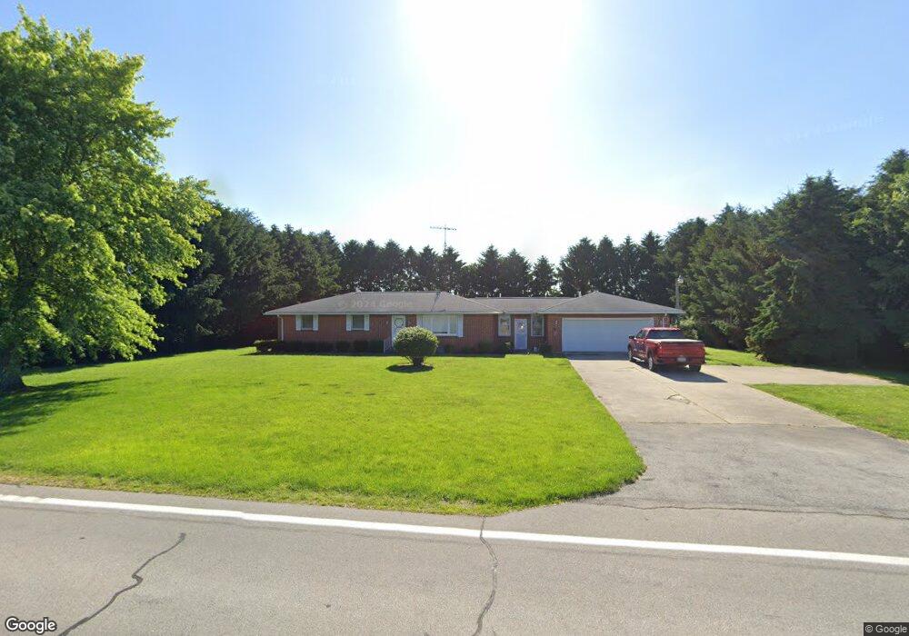
330 S State Route 590 Fremont, OH 43420
Estimated Value: $224,000 - $660,342
3
Beds
2
Baths
1,326
Sq Ft
$333/Sq Ft
Est. Value
About This Home
This home is located at 330 S State Route 590, Fremont, OH 43420 and is currently estimated at $442,171, approximately $333 per square foot. 330 S State Route 590 is a home located in Sandusky County with nearby schools including Lakota Elementary School, Lakota Middle School, and Lakota High School.
Ownership History
Date
Name
Owned For
Owner Type
Purchase Details
Closed on
Apr 2, 2021
Sold by
Kreilick Kenneth A and Kreilick Heather R
Bought by
Kreilick Steven W
Current Estimated Value
Purchase Details
Closed on
Feb 3, 2021
Sold by
Kreilick Bernard A
Bought by
Bernard A Kreilick and Steven W Kreilick
Purchase Details
Closed on
Mar 30, 2020
Sold by
Kreilick Bernard A
Bought by
Bernard A Kreilick and Steven W Kreilick
Purchase Details
Closed on
Jan 4, 2018
Sold by
Kreilick Lester W and Kreilick Sara W
Bought by
Kreilick Bernard A and Kreilick Steven W
Purchase Details
Closed on
Mar 4, 2008
Sold by
Krellick Lester W and Krellick Sara W
Bought by
Krellick Lester W and Krellick Sara W
Purchase Details
Closed on
May 1, 1993
Sold by
Kreilick Lester W and Kreilick Sar
Bought by
Kreilick Lester W & Sara W Trustees
Purchase Details
Closed on
Oct 1, 1987
Bought by
Kreilick Lester W & Sara W Trustees
Create a Home Valuation Report for This Property
The Home Valuation Report is an in-depth analysis detailing your home's value as well as a comparison with similar homes in the area
Home Values in the Area
Average Home Value in this Area
Purchase History
| Date | Buyer | Sale Price | Title Company |
|---|---|---|---|
| Kreilick Steven W | $54,800 | None Available | |
| Bernard A Kreilick | -- | -- | |
| Bernard A Kreilick | -- | -- | |
| Kreilick Bernard A | -- | None Available | |
| Krellick Lester W | -- | Attorney | |
| Kreilick Lester W & Sara W Trustees | $180,000 | -- | |
| Kreilick Lester W & Sara W Trustees | -- | -- |
Source: Public Records
Tax History Compared to Growth
Tax History
| Year | Tax Paid | Tax Assessment Tax Assessment Total Assessment is a certain percentage of the fair market value that is determined by local assessors to be the total taxable value of land and additions on the property. | Land | Improvement |
|---|---|---|---|---|
| 2024 | $5,466 | $238,810 | $175,180 | $63,630 |
| 2023 | $5,466 | $179,560 | $131,710 | $47,850 |
| 2022 | $4,166 | $179,560 | $131,710 | $47,850 |
| 2021 | $3,759 | $179,560 | $131,710 | $47,850 |
| 2020 | $4,164 | $161,420 | $117,810 | $43,610 |
| 2019 | $4,528 | $161,420 | $117,810 | $43,610 |
| 2018 | $2,466 | $112,600 | $112,600 | $0 |
| 2017 | $3,200 | $105,560 | $105,560 | $0 |
| 2016 | $2,983 | $105,560 | $105,560 | $0 |
| 2015 | $3,128 | $105,560 | $105,560 | $0 |
| 2014 | $1,635 | $66,120 | $66,120 | $0 |
| 2013 | $1,604 | $66,120 | $66,120 | $0 |
Source: Public Records
Map
Nearby Homes
- 0 Ohio 590
- 17 Adams Dr
- 0 County Road 59
- 0 County Road 90
- 227 Main St
- 2231 County Road 23
- 4470 W State St
- 2484 Buckland Ave
- 0 State Route 590 Unit 6136844
- 855 Rambo Ln
- 2020 Elm Dr
- 822 Upton Rd
- 520 Everett Rd
- 2242 Napoleon Rd
- 515 Everett Rd
- 614 3rd Ave
- 1719 Buckland Ave
- 2119 Lake St
- 2595 County Road 13
- 816 Lime St
- 283 S State Route 590
- 283 Ohio 590
- 234 S State Route 590
- 118 S State Route 590
- 2776 County Road 41
- 4680 Hayes Ave
- 4680 W Hayes
- 4680 Hayes (Sr 6) Ave
- 2540 County Road 41
- 2676 County Road 41
- 2827 Us Highway 6 E
- 2424 County Road 41
- 2503 County Road 41
- 618 S State Route 590
- 2842 Sr 6
- 2864 Sr 6
- 2870 W Us Highway 6
- 2400 County Road 41
- 4469 Hayes Ave
- 2743 County Road 41