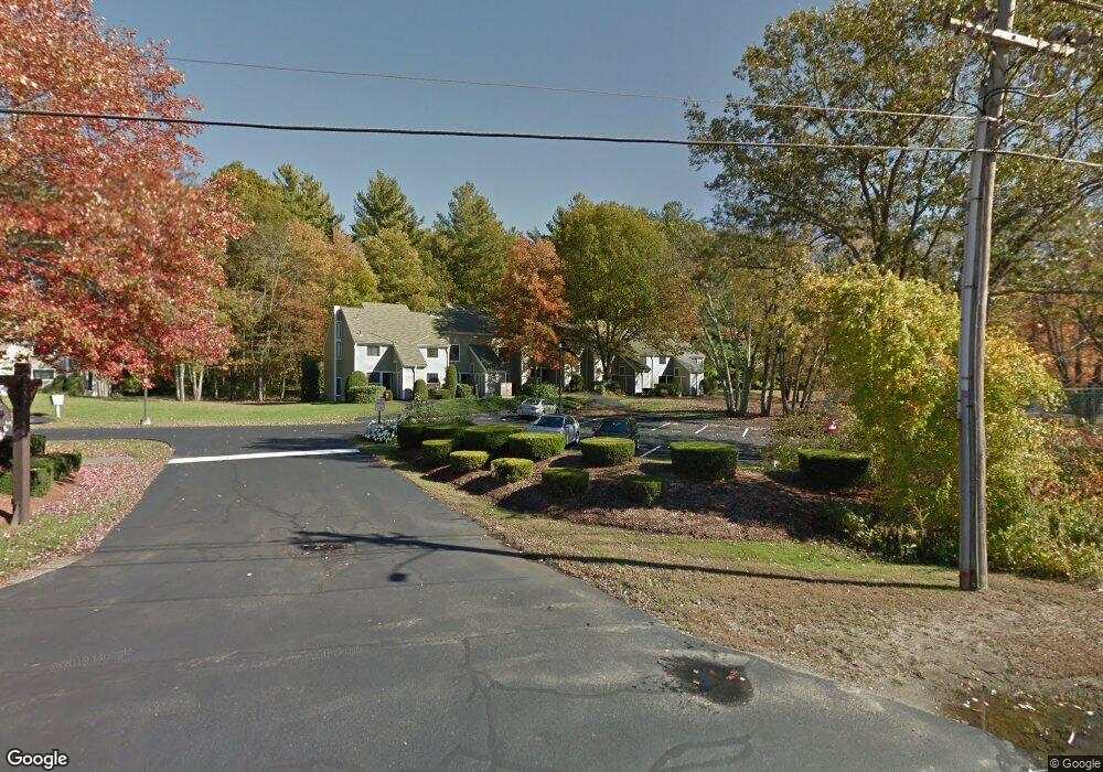
330 Sterling St Unit B4 West Boylston, MA 01583
Estimated Value: $265,000 - $291,000
2
Beds
2
Baths
1,002
Sq Ft
$273/Sq Ft
Est. Value
About This Home
This home is located at 330 Sterling St Unit B4, West Boylston, MA 01583 and is currently estimated at $273,947, approximately $273 per square foot. 330 Sterling St Unit B4 is a home located in Worcester County with nearby schools including Major Edwards Elementary School and West Boylston Junior/Senior High School.
Ownership History
Date
Name
Owned For
Owner Type
Purchase Details
Closed on
Nov 8, 2024
Sold by
Wilt Todd W
Bought by
Todd W Wilt Ft and Wilt
Current Estimated Value
Purchase Details
Closed on
Jul 21, 1994
Sold by
Doerr H Richard and Doerr Jeannette
Bought by
Wilt Todd W
Home Financials for this Owner
Home Financials are based on the most recent Mortgage that was taken out on this home.
Original Mortgage
$64,710
Interest Rate
8.19%
Mortgage Type
Purchase Money Mortgage
Create a Home Valuation Report for This Property
The Home Valuation Report is an in-depth analysis detailing your home's value as well as a comparison with similar homes in the area
Home Values in the Area
Average Home Value in this Area
Purchase History
| Date | Buyer | Sale Price | Title Company |
|---|---|---|---|
| Todd W Wilt Ft | -- | None Available | |
| Todd W Wilt Ft | -- | None Available | |
| Wilt Todd W | $71,900 | -- | |
| Wilt Todd W | $71,900 | -- |
Source: Public Records
Mortgage History
| Date | Status | Borrower | Loan Amount |
|---|---|---|---|
| Previous Owner | Wilt Todd W | $64,710 |
Source: Public Records
Tax History Compared to Growth
Tax History
| Year | Tax Paid | Tax Assessment Tax Assessment Total Assessment is a certain percentage of the fair market value that is determined by local assessors to be the total taxable value of land and additions on the property. | Land | Improvement |
|---|---|---|---|---|
| 2025 | $32 | $229,000 | $0 | $229,000 |
| 2024 | $3,364 | $227,600 | $0 | $227,600 |
| 2023 | $3,097 | $198,800 | $0 | $198,800 |
| 2022 | $2,995 | $169,400 | $0 | $169,400 |
| 2021 | $2,843 | $154,000 | $0 | $154,000 |
| 2020 | $2,558 | $137,700 | $0 | $137,700 |
| 2019 | $2,596 | $137,700 | $0 | $137,700 |
| 2018 | $2,501 | $133,600 | $0 | $133,600 |
| 2017 | $2,433 | $129,400 | $0 | $129,400 |
| 2016 | $2,268 | $122,900 | $0 | $122,900 |
| 2015 | $2,204 | $120,200 | $0 | $120,200 |
Source: Public Records
Map
Nearby Homes
- 18 Laurel Ave
- 23 Western Ave
- 2 Lakeview Ave
- 15 Myrtle Ave
- 136 Sterling St Unit A3
- 0 Boutelle Rd
- 20 Winthrop St
- 127 N Main St
- 16 N Main St
- 223 Worcester Rd
- 61 Boutelle Rd
- 43 Chace Hill Rd
- 15 N Cove Rd
- 4 Jewett Rd Unit B
- 4 Jewett Rd Unit A
- 287 Laurel St
- 19 Fitch Farm Rd
- 17 Maple St
- 54 Maple St
- 9 Michael Ln
- 330 Sterling St Unit B10
- 330 Sterling St Unit B9
- 330 Sterling St Unit B8
- 330 Sterling St Unit B7
- 330 Sterling St Unit B5
- 330 Sterling St Unit B2
- 330 Sterling St Unit B1
- 330 Sterling St
- 330 Sterling St Unit 8B
- 330 Sterling St Unit B
- 330 Sterling St Unit 3 B
- 326 Sterling St Unit C11
- 326 Sterling St Unit C10
- 326 Sterling St Unit C9
- 326 Sterling St Unit C8
- 326 Sterling St Unit C7
- 326 Sterling St Unit C6
- 326 Sterling St Unit C5
- 326 Sterling St Unit C4
- 326 Sterling St Unit C3