Estimated Value: $183,786 - $213,000
3
Beds
2
Baths
1,283
Sq Ft
$153/Sq Ft
Est. Value
About This Home
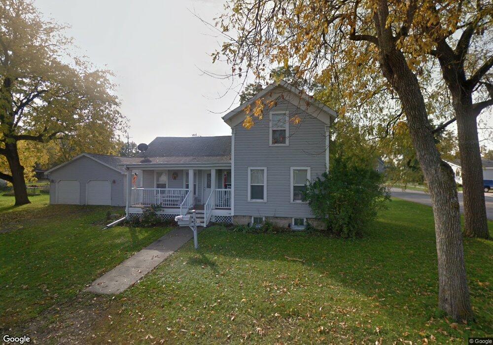
This home is located at 330 W Huron St, Omro, WI 54963 and is currently estimated at $196,697, approximately $153 per square foot. 330 W Huron St is a home located in Winnebago County with nearby schools including Patch Elementary School, Omro Elementary School, and Omro Middle School.
Ownership History
Date
Name
Owned For
Owner Type
Purchase Details
Closed on
Jul 31, 2008
Sold by
Jari Douglas B and Jari Karen N
Bought by
Thomson Robert S and Thomson Ann T
Current Estimated Value
Home Financials for this Owner
Home Financials are based on the most recent Mortgage that was taken out on this home.
Original Mortgage
$105,000
Outstanding Balance
$66,047
Interest Rate
5.5%
Mortgage Type
Adjustable Rate Mortgage/ARM
Estimated Equity
$130,650
Purchase Details
Closed on
Dec 14, 2006
Sold by
Alder Roberta A
Bought by
Barrette Karen N
Create a Home Valuation Report for This Property
The Home Valuation Report is an in-depth analysis detailing your home's value as well as a comparison with similar homes in the area
Home Values in the Area
Average Home Value in this Area
Purchase History
| Date | Buyer | Sale Price | Title Company |
|---|---|---|---|
| Thomson Robert S | $105,000 | None Available | |
| Barrette Karen N | $65,500 | None Available |
Source: Public Records
Mortgage History
| Date | Status | Borrower | Loan Amount |
|---|---|---|---|
| Open | Thomson Robert S | $105,000 |
Source: Public Records
Tax History Compared to Growth
Tax History
| Year | Tax Paid | Tax Assessment Tax Assessment Total Assessment is a certain percentage of the fair market value that is determined by local assessors to be the total taxable value of land and additions on the property. | Land | Improvement |
|---|---|---|---|---|
| 2024 | $2,572 | $103,600 | $13,000 | $90,600 |
| 2023 | $2,316 | $103,600 | $13,000 | $90,600 |
| 2022 | $2,295 | $103,600 | $13,000 | $90,600 |
| 2021 | $2,156 | $103,600 | $13,000 | $90,600 |
| 2020 | $2,196 | $103,600 | $13,000 | $90,600 |
| 2019 | $2,107 | $103,600 | $13,000 | $90,600 |
| 2018 | $2,113 | $103,600 | $13,000 | $90,600 |
| 2017 | $2,018 | $87,300 | $10,600 | $76,700 |
| 2016 | $1,968 | $87,300 | $10,600 | $76,700 |
| 2015 | $2,056 | $87,300 | $10,600 | $76,700 |
| 2014 | -- | $87,300 | $10,600 | $76,700 |
| 2013 | -- | $87,300 | $10,600 | $76,700 |
Source: Public Records
Map
Nearby Homes
- 330 Jefferson Ave
- 131 Madison Ave
- 610 Tyler Ave
- 343 Dakota Lee Way
- 220 Brooke Dr Unit 1
- 1860 Justin Dr
- 1110 E Main St
- 1741 Jaimee Dr
- 366 Brooke Dr
- 364 Brooke Dr
- 367 Brooke Dr
- 320 Brooke Dr
- 314 Brooke Dr
- 1343-CE Plan at Springview Acres
- 1328-CH Plan at Springview Acres
- 1365-BA Plan at Springview Acres
- 0 Broderick Rd
- 6059 E Scott St
- 4980 Broderick Rd
- 0 Springbrook Rd Unit 1990202
- 215 Adams Ave
- 325 W Huron St
- 333 W Huron St
- 205 Washington Ave
- 331 W Ontario St
- 233 Adams Ave
- 224 Washington Ave
- 223 Washington Ave
- 205 Adams Ave
- 233 Washington Ave
- 330 W Ontario St
- 230 W Huron St
- 232 Adams Ave
- 305 Adams Ave
- 0 W Ontario St
- 305 Washington Ave
- 225 W Huron St
- 425 W Ontario St
- 225 W Ontario St
- 215 W Huron St