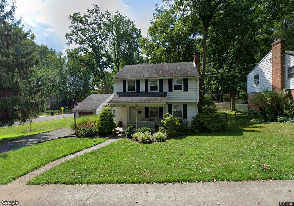
330 W Leamy Ave Springfield, PA 19064
Estimated Value: $463,524 - $553,000
2
Beds
1
Bath
1,623
Sq Ft
$316/Sq Ft
Est. Value
About This Home
This home is located at 330 W Leamy Ave, Springfield, PA 19064 and is currently estimated at $512,631, approximately $315 per square foot. 330 W Leamy Ave is a home located in Delaware County with nearby schools including Springfield High School, St Francis Of Assisi School, and Holy Cross School.
Ownership History
Date
Name
Owned For
Owner Type
Purchase Details
Closed on
Sep 9, 1999
Sold by
Kloss Kevin P and Kloss Mary Lou
Bought by
Bollinger David L and Bollinger Lisa A
Current Estimated Value
Home Financials for this Owner
Home Financials are based on the most recent Mortgage that was taken out on this home.
Original Mortgage
$139,800
Outstanding Balance
$40,905
Interest Rate
7.65%
Estimated Equity
$471,726
Create a Home Valuation Report for This Property
The Home Valuation Report is an in-depth analysis detailing your home's value as well as a comparison with similar homes in the area
Home Values in the Area
Average Home Value in this Area
Purchase History
| Date | Buyer | Sale Price | Title Company |
|---|---|---|---|
| Bollinger David L | $147,200 | T A Title Insurance Company |
Source: Public Records
Mortgage History
| Date | Status | Borrower | Loan Amount |
|---|---|---|---|
| Open | Bollinger David L | $139,800 |
Source: Public Records
Tax History Compared to Growth
Tax History
| Year | Tax Paid | Tax Assessment Tax Assessment Total Assessment is a certain percentage of the fair market value that is determined by local assessors to be the total taxable value of land and additions on the property. | Land | Improvement |
|---|---|---|---|---|
| 2025 | $7,211 | $256,550 | $94,850 | $161,700 |
| 2024 | $7,211 | $256,550 | $94,850 | $161,700 |
| 2023 | $6,943 | $256,550 | $94,850 | $161,700 |
| 2022 | $6,793 | $256,550 | $94,850 | $161,700 |
| 2021 | $10,520 | $256,550 | $94,850 | $161,700 |
| 2020 | $5,700 | $125,780 | $45,590 | $80,190 |
| 2019 | $5,566 | $125,780 | $45,590 | $80,190 |
| 2018 | $5,486 | $125,780 | $0 | $0 |
| 2017 | $5,359 | $125,780 | $0 | $0 |
| 2016 | $690 | $125,780 | $0 | $0 |
| 2015 | $704 | $125,780 | $0 | $0 |
| 2014 | $704 | $125,780 | $0 | $0 |
Source: Public Records
Map
Nearby Homes
- 232 S Highland Rd
- 201 S Highland Rd
- 247 Orchard Rd
- 517 W Woodland Ave
- 341 Kennerly Rd
- 364 S Rolling Rd
- 89 Saxer Ave
- 326 Powell Rd
- 251 Powell Rd
- 214 Lynbrooke Rd
- 225 Lynbrooke Rd
- 165 Summit Rd
- 332 Franklin Ave
- 200 N State Rd
- 15 Pearson Dr
- 30 Wayne Ave
- 230 Ridgewood Rd
- 506 Flora Cir
- 140 N Rolling Rd
- 499 Collins Dr
- 308 Spring Valley Rd
- 340 W Leamy Ave
- 400 W Leamy Ave
- 327 W Leamy Ave
- 333 W Leamy Ave
- 131 Forest Rd
- 301 Spring Valley Rd
- 311 Spring Valley Rd
- 318 Spring Valley Rd
- 406 W Leamy Ave
- 319 Spring Valley Rd
- 121 Forest Rd
- 294 S Highland Rd
- 324 Spring Valley Rd
- 411 Kerr Ln
- 301 W Leamy Ave
- 126 Forest Rd
- 93 Shelburne Rd
- 325 Spring Valley Rd
- 280 S Highland Rd