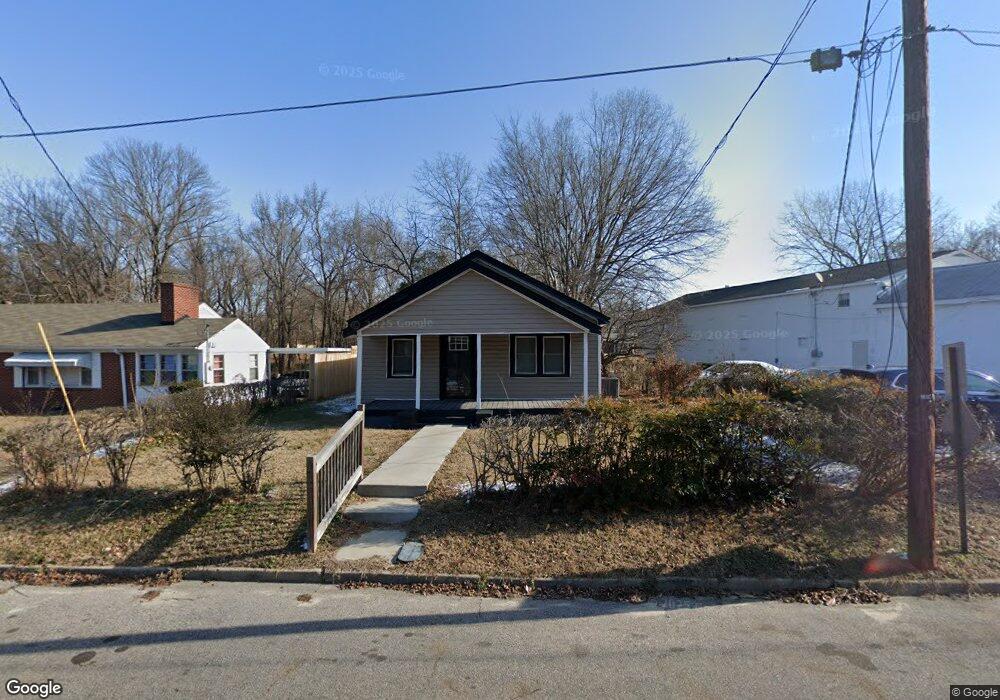
330 W Rock Spring St Henderson, NC 27536
Estimated Value: $79,000 - $159,702
2
Beds
1
Bath
832
Sq Ft
$136/Sq Ft
Est. Value
About This Home
This home is located at 330 W Rock Spring St, Henderson, NC 27536 and is currently estimated at $113,176, approximately $136 per square foot. 330 W Rock Spring St is a home located in Vance County with nearby schools including E.M. Rollins Elementary School, Vance County Middle School, and Vance County High School.
Ownership History
Date
Name
Owned For
Owner Type
Purchase Details
Closed on
Dec 30, 2022
Sold by
Harris Alana Lynette
Bought by
Bryson Properties Llc
Current Estimated Value
Purchase Details
Closed on
May 26, 2022
Sold by
Lynnette Harris Andrea
Bought by
Harris Alana Lynnette and Harris Omara S
Purchase Details
Closed on
Apr 20, 2022
Sold by
Lynnette Harris Alana
Bought by
Harris Alana Lynnette and Harris Omara S
Purchase Details
Closed on
Sep 29, 2009
Sold by
Harris Geneva S
Bought by
Harris Andrea L
Create a Home Valuation Report for This Property
The Home Valuation Report is an in-depth analysis detailing your home's value as well as a comparison with similar homes in the area
Home Values in the Area
Average Home Value in this Area
Purchase History
| Date | Buyer | Sale Price | Title Company |
|---|---|---|---|
| Bryson Properties Llc | $36,500 | -- | |
| Harris Alana Lynnette | -- | Sttterwhite & Zollicoffer Pllc | |
| Harris Alana Lynnette | -- | Stainback Satterwhite & Zollic | |
| Harris Andrea L | -- | -- |
Source: Public Records
Tax History Compared to Growth
Tax History
| Year | Tax Paid | Tax Assessment Tax Assessment Total Assessment is a certain percentage of the fair market value that is determined by local assessors to be the total taxable value of land and additions on the property. | Land | Improvement |
|---|---|---|---|---|
| 2025 | $1,310 | $85,391 | $23,000 | $62,391 |
| 2024 | $1,400 | $85,391 | $23,000 | $62,391 |
| 2023 | $382 | $15,995 | $3,520 | $12,475 |
| 2022 | $376 | $15,995 | $3,520 | $12,475 |
| 2021 | $256 | $15,995 | $3,520 | $12,475 |
| 2020 | $373 | $15,995 | $3,520 | $12,475 |
| 2019 | $368 | $15,995 | $3,520 | $12,475 |
| 2018 | $256 | $15,995 | $3,520 | $12,475 |
| 2017 | $361 | $15,995 | $3,520 | $12,475 |
| 2016 | $361 | $15,995 | $3,520 | $12,475 |
| 2015 | $245 | $17,750 | $4,400 | $13,350 |
| 2014 | $356 | $17,749 | $4,400 | $13,349 |
Source: Public Records
Map
Nearby Homes
- 332 Hamilton St
- 315 Hamilton St
- 436 John St
- 810 Vaughan St
- 239 Gary St
- 228 Crozier St Unit 230
- 638 Poplar Pine St
- 732 E Rockspring St
- 632 Breckenridge St
- 503 Adams St
- 246 Keene St
- 428 Merriman St
- 0 U S 158 Unit 1131934
- 936 Eaton St
- 605 E Montgomery St
- 911 Water St
- 500 Zene St
- 1230 Hight St
- 533 E Winder St
- 232 Burwell Ave
- 330 W Rockspring St
- 340 W Rock Spring St
- 340 W Rockspring St
- 327 W Rock Spring St
- 314 W Rock Spring St
- 317 W Rockspring St
- 317 W Rock Spring St
- 313 W Rockspring St
- 234 Pearl St Unit 236
- 228 Pearl St
- 242 Pearl St
- 318 Pearl St
- 313 W Rock Spring St
- 309 W Rock Spring St
- 244 Pearl St
- 368 W Rockspring St
- 368 W Rock Spring St
- 220 Pearl St
- 256 Pearl St
- 722 N Chestnut St