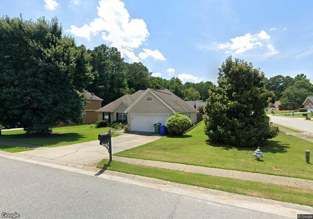
330 Weatherly Dr Fayetteville, GA 30214
Estimated Value: $308,854 - $349,000
--
Bed
2
Baths
1,636
Sq Ft
$200/Sq Ft
Est. Value
About This Home
This home is located at 330 Weatherly Dr, Fayetteville, GA 30214 and is currently estimated at $327,464, approximately $200 per square foot. 330 Weatherly Dr is a home located in Fayette County with nearby schools including Spring Hill Elementary School, Bennett's Mill Middle School, and Fayette County High School.
Ownership History
Date
Name
Owned For
Owner Type
Purchase Details
Closed on
Dec 15, 2005
Sold by
Smith Leroy F and Smith Shirley A
Bought by
Jones Derrick
Current Estimated Value
Purchase Details
Closed on
May 13, 1998
Sold by
Churchill Develop
Bought by
Smith Leroy F and Smith Shirley A
Home Financials for this Owner
Home Financials are based on the most recent Mortgage that was taken out on this home.
Original Mortgage
$117,900
Interest Rate
7.11%
Mortgage Type
VA
Purchase Details
Closed on
Oct 2, 1996
Sold by
Hutto Jan T
Bought by
Churchill Devel
Create a Home Valuation Report for This Property
The Home Valuation Report is an in-depth analysis detailing your home's value as well as a comparison with similar homes in the area
Home Values in the Area
Average Home Value in this Area
Purchase History
| Date | Buyer | Sale Price | Title Company |
|---|---|---|---|
| Jones Derrick | $160,000 | -- | |
| Smith Leroy F | $117,900 | -- | |
| Churchill Devel | $19,500 | -- |
Source: Public Records
Mortgage History
| Date | Status | Borrower | Loan Amount |
|---|---|---|---|
| Previous Owner | Smith Leroy F | $117,900 | |
| Closed | Churchill Devel | $0 |
Source: Public Records
Tax History Compared to Growth
Tax History
| Year | Tax Paid | Tax Assessment Tax Assessment Total Assessment is a certain percentage of the fair market value that is determined by local assessors to be the total taxable value of land and additions on the property. | Land | Improvement |
|---|---|---|---|---|
| 2024 | $2,752 | $128,024 | $18,000 | $110,024 |
| 2023 | $2,110 | $111,320 | $18,000 | $93,320 |
| 2022 | $2,484 | $102,080 | $18,000 | $84,080 |
| 2021 | $2,319 | $88,280 | $18,000 | $70,280 |
| 2020 | $2,345 | $77,880 | $12,000 | $65,880 |
| 2019 | $2,278 | $75,000 | $12,000 | $63,000 |
| 2018 | $2,201 | $71,800 | $9,600 | $62,200 |
| 2017 | $1,944 | $67,200 | $9,600 | $57,600 |
| 2016 | $1,634 | $55,680 | $9,600 | $46,080 |
| 2015 | $1,540 | $51,720 | $9,600 | $42,120 |
| 2014 | $1,434 | $47,520 | $9,600 | $37,920 |
| 2013 | -- | $47,520 | $0 | $0 |
Source: Public Records
Map
Nearby Homes
- 225 Buckeye Ln Unit 2
- 210 Rosewood Dr
- 120 Woodland Rd
- 250 Mimosa Dr
- 125 Woodland Rd Unit LOT 2
- 125 Woodland Rd Unit LOT 1
- 265 Allenwood Rd
- 145 Holly Hill Rd
- 855 E Lanier Ave
- 500 Circle Dr
- 1115 Highway 54 E
- 1119 Highway 54 E
- 1202 Highway 54 E
- 250 Jeff Davis Place
- 225 Banks Rd
- 595 E Lanier Ave
- 310 Autumn Glen Cir
- 135 Rabbits Run
- 125 Rabbits Run
- 105 Rabbits Run
- 210 Cannon Dr
- 340 Weatherly Dr
- 190 Cannon Dr
- 205 Cannon Dr
- 220 Cannon Dr
- 315 Weatherly Dr
- 215 Cannon Dr
- 335 Weatherly Dr
- 230 Cannon Dr
- 180 Cannon Dr
- 0 Cannon Dr Unit 8690747
- 0 Cannon Dr Unit 8073065
- 0 Cannon Dr Unit 7274059
- 0 Cannon Dr Unit 3248193
- 0 Cannon Dr Unit 7017825
- 0 Cannon Dr Unit 7208725
- 0 Cannon Dr Unit 7463812
- 0 Cannon Dr Unit 8063093
- 0 Cannon Dr Unit 8331655
- 0 Cannon Dr Unit 8641523