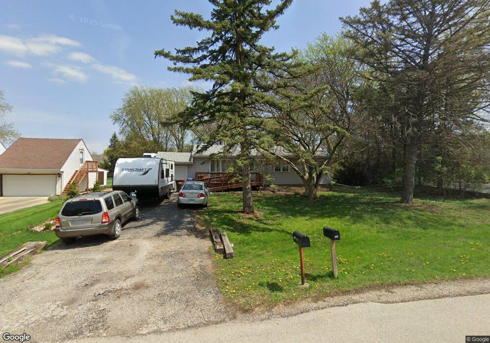
330 Williams St New Lenox, IL 60451
Estimated Value: $292,000 - $348,104
--
Bed
--
Bath
--
Sq Ft
0.41
Acres
About This Home
This home is located at 330 Williams St, New Lenox, IL 60451 and is currently estimated at $325,776. 330 Williams St is a home located in Will County with nearby schools including Bentley Elementary School, Arnold J Tyler School, and Alex M Martino Jr High School.
Ownership History
Date
Name
Owned For
Owner Type
Purchase Details
Closed on
Jun 20, 2014
Sold by
Ornelaz Valerie A and Estate Of Nina A Gelsomino
Bought by
Collins Daniel T and Collins Jessica F
Current Estimated Value
Home Financials for this Owner
Home Financials are based on the most recent Mortgage that was taken out on this home.
Original Mortgage
$103,000
Outstanding Balance
$78,078
Interest Rate
4.11%
Mortgage Type
New Conventional
Estimated Equity
$247,698
Create a Home Valuation Report for This Property
The Home Valuation Report is an in-depth analysis detailing your home's value as well as a comparison with similar homes in the area
Home Values in the Area
Average Home Value in this Area
Purchase History
| Date | Buyer | Sale Price | Title Company |
|---|---|---|---|
| Collins Daniel T | $155,000 | None Available |
Source: Public Records
Mortgage History
| Date | Status | Borrower | Loan Amount |
|---|---|---|---|
| Open | Collins Daniel T | $103,000 |
Source: Public Records
Tax History Compared to Growth
Tax History
| Year | Tax Paid | Tax Assessment Tax Assessment Total Assessment is a certain percentage of the fair market value that is determined by local assessors to be the total taxable value of land and additions on the property. | Land | Improvement |
|---|---|---|---|---|
| 2024 | $6,563 | $91,880 | $33,480 | $58,400 |
| 2023 | $6,563 | $83,756 | $30,520 | $53,236 |
| 2022 | $6,286 | $77,159 | $28,116 | $49,043 |
| 2021 | $5,625 | $72,565 | $26,442 | $46,123 |
| 2020 | $5,458 | $69,976 | $25,499 | $44,477 |
| 2019 | $5,215 | $67,806 | $24,708 | $43,098 |
| 2018 | $5,087 | $65,470 | $23,857 | $41,613 |
| 2017 | $4,823 | $63,588 | $23,171 | $40,417 |
| 2016 | $4,676 | $61,886 | $22,551 | $39,335 |
| 2015 | $2,008 | $59,938 | $21,841 | $38,097 |
| 2014 | $2,008 | $59,198 | $21,571 | $37,627 |
| 2013 | $2,008 | $59,996 | $21,862 | $38,134 |
Source: Public Records
Map
Nearby Homes
- 235 Roberts Rd
- 920 Barnside Rd
- 203 Tonell Ave
- 117 Walona Ave
- 718 S Prairie Rd
- 805 Regent St
- 513 Somerset Ln
- 328 E Lincoln Hwy
- 1017 E Lincoln Hwy
- 00 NE Corner Cherry Hill Road and Moss Lane Rd
- 315 S Pine St
- 1000 S Cedar Rd
- 125 N Anderson Rd
- 214 Somerset Ct
- 202 Hickory St
- 1535 Glenbrooke Ln
- 329 Hancock Dr
- 911 Canongate Ln
- 1139 Georgias Way
- 1125 Georgias Way
- 330 William St
- 328 Williams St
- 332 Williams St
- 713 Bon Terre Rd
- 711 Bon Terre Rd
- 326 Williams St
- 334 Williams St
- 715 Bon Terre Rd
- 329 William St
- 709 Bon Terre Rd Unit 1
- 717 Bon Terre Rd
- 318 Williams St
- 707 Bon Terre Rd
- 336 Williams St
- 719 Bon Terre Rd
- 325 Williams St
- 337 Williams St
- 720 Bon Terre Rd
- 700 Plank Rd
- 522 Alan Dr