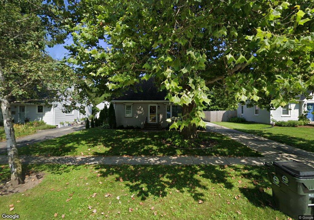
330 Woodland Rd Libertyville, IL 60048
North Mundelein NeighborhoodEstimated Value: $246,000 - $323,000
--
Bed
1
Bath
768
Sq Ft
$358/Sq Ft
Est. Value
About This Home
This home is located at 330 Woodland Rd, Libertyville, IL 60048 and is currently estimated at $275,264, approximately $358 per square foot. 330 Woodland Rd is a home located in Lake County with nearby schools including Butterfield School, Highland Middle School, and Libertyville High School.
Ownership History
Date
Name
Owned For
Owner Type
Purchase Details
Closed on
Nov 2, 2017
Sold by
Mack Alan B and Alan B Mack Trust
Bought by
Mack Donald D and Revocable Trust Agreement Of D
Current Estimated Value
Purchase Details
Closed on
Feb 21, 2017
Sold by
Mack Dean M and Mack Alan B
Bought by
Mack Alan B and Alan B Mack Trust
Purchase Details
Closed on
Jul 1, 2008
Sold by
Mack Mary J and Mack Mary N
Bought by
Mack Mary N and Mary N Mack Living Trust
Create a Home Valuation Report for This Property
The Home Valuation Report is an in-depth analysis detailing your home's value as well as a comparison with similar homes in the area
Home Values in the Area
Average Home Value in this Area
Purchase History
| Date | Buyer | Sale Price | Title Company |
|---|---|---|---|
| Mack Donald D | -- | Attorney | |
| Mack Alan B | -- | Attorney | |
| Mack Mary N | -- | None Available |
Source: Public Records
Tax History Compared to Growth
Tax History
| Year | Tax Paid | Tax Assessment Tax Assessment Total Assessment is a certain percentage of the fair market value that is determined by local assessors to be the total taxable value of land and additions on the property. | Land | Improvement |
|---|---|---|---|---|
| 2024 | $4,222 | $77,157 | $30,050 | $47,107 |
| 2023 | $4,456 | $68,428 | $26,650 | $41,778 |
| 2022 | $4,456 | $66,718 | $25,614 | $41,104 |
| 2021 | $4,275 | $65,282 | $25,063 | $40,219 |
| 2020 | $3,977 | $64,185 | $24,642 | $39,543 |
| 2019 | $3,863 | $63,575 | $24,408 | $39,167 |
| 2018 | $3,840 | $62,557 | $28,674 | $33,883 |
| 2017 | $3,713 | $60,582 | $27,769 | $32,813 |
| 2016 | $2,175 | $57,440 | $26,329 | $31,111 |
| 2015 | $2,313 | $53,687 | $24,609 | $29,078 |
| 2014 | $2,321 | $53,244 | $24,279 | $28,965 |
| 2012 | $2,216 | $53,706 | $24,490 | $29,216 |
Source: Public Records
Map
Nearby Homes
- 223 Kenloch Ave
- 1330 W Park Ave
- 20924 & 20902 W Park Ave
- 1137 Pine Tree Ln
- 533 Drake St
- 832 Interlaken Ln
- 551 W Park Ave Unit E
- 423 Ames St
- 0 Ames St
- 420 W Cook Ave
- 505 Lange Ct
- 308 Mckinley Ave
- 212 Elm Ct
- 694 Parkside Ct
- 847 Mckinley Ave
- 662 Parkside Ct
- 619 Parkside Ct
- 1338 Trinity Place
- 616 Parkside Ct
- 1754 Glenmore Rd
- 334 Woodland Rd
- 324 Woodland Rd
- 338 Woodland Rd
- 329 Kenloch Ave
- 323 Kenloch Ave
- 318 Woodland Rd
- 331 Kenloch Ave
- 317 Kenloch Ave
- 335 Kenloch Ave
- 311 Kenloch Ave
- 329 Woodland Rd
- 342 Woodland Rd
- 323 Woodland Rd
- 305 Kenloch Ave
- 314 Woodland Rd
- 319 Woodland Rd
- 315 Woodland Rd
- 301 Kenloch Ave
- 310 Woodland Rd
- 341 Kenloch Ave