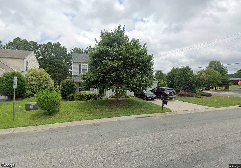
3300 Arbor Pointe Dr Unit 18 Indian Trail, NC 28079
Estimated Value: $375,000 - $445,000
4
Beds
3
Baths
2,482
Sq Ft
$169/Sq Ft
Est. Value
About This Home
This home is located at 3300 Arbor Pointe Dr Unit 18, Indian Trail, NC 28079 and is currently estimated at $420,328, approximately $169 per square foot. 3300 Arbor Pointe Dr Unit 18 is a home located in Union County with nearby schools including Sardis Elementary School, Porter Ridge Middle School, and Porter Ridge High School.
Ownership History
Date
Name
Owned For
Owner Type
Purchase Details
Closed on
Dec 30, 2015
Sold by
Lovings April and Lovings Tim
Bought by
Dao Kathy and Carlo Adrian
Current Estimated Value
Home Financials for this Owner
Home Financials are based on the most recent Mortgage that was taken out on this home.
Original Mortgage
$156,400
Outstanding Balance
$124,470
Interest Rate
3.98%
Mortgage Type
New Conventional
Estimated Equity
$295,858
Purchase Details
Closed on
Oct 31, 2003
Sold by
Colony Homes Llc
Bought by
Long April R
Home Financials for this Owner
Home Financials are based on the most recent Mortgage that was taken out on this home.
Original Mortgage
$157,035
Interest Rate
7.87%
Mortgage Type
Unknown
Purchase Details
Closed on
Nov 2, 2001
Sold by
Provident Development Group Inc
Bought by
Colony Homes Llc and Colony Homes Of North Carolina Llc
Create a Home Valuation Report for This Property
The Home Valuation Report is an in-depth analysis detailing your home's value as well as a comparison with similar homes in the area
Home Values in the Area
Average Home Value in this Area
Purchase History
| Date | Buyer | Sale Price | Title Company |
|---|---|---|---|
| Dao Kathy | $196,000 | Attorney | |
| Long April R | $157,500 | -- | |
| Colony Homes Llc | $168,000 | -- |
Source: Public Records
Mortgage History
| Date | Status | Borrower | Loan Amount |
|---|---|---|---|
| Open | Dao Kathy | $156,400 | |
| Previous Owner | Long April R | $157,035 |
Source: Public Records
Tax History Compared to Growth
Tax History
| Year | Tax Paid | Tax Assessment Tax Assessment Total Assessment is a certain percentage of the fair market value that is determined by local assessors to be the total taxable value of land and additions on the property. | Land | Improvement |
|---|---|---|---|---|
| 2024 | $2,399 | $284,600 | $48,000 | $236,600 |
| 2023 | $2,379 | $284,600 | $48,000 | $236,600 |
| 2022 | $2,379 | $284,600 | $48,000 | $236,600 |
| 2021 | $2,379 | $284,600 | $48,000 | $236,600 |
| 2020 | $1,353 | $173,500 | $27,500 | $146,000 |
| 2019 | $1,727 | $173,500 | $27,500 | $146,000 |
| 2018 | $1,353 | $173,500 | $27,500 | $146,000 |
| 2017 | $1,816 | $173,500 | $27,500 | $146,000 |
| 2016 | $1,777 | $173,500 | $27,500 | $146,000 |
| 2015 | $1,436 | $173,500 | $27,500 | $146,000 |
| 2014 | $1,304 | $182,580 | $34,000 | $148,580 |
Source: Public Records
Map
Nearby Homes
- 4311 Ethel Sustar Dr
- 5706 Sustar Dr
- 3900 Crimson Wing Dr
- 1010 Glen Hollow Dr
- 5205 Sustar Dr
- 3013 Doughton Ln
- 2006 Paddington Dr
- 5508 Burning Ridge Dr
- 2026 Union Grove Ln
- 1009 Kemp Rd
- 3702 Arthur St
- 3613 Arthur St
- 3612 Esther St
- 5901 Creft Cir
- 3319 Creek Trail Rd
- 272 Briana Marie Way
- 269 Briana Marie Way
- 6017 Creft Cir
- 3722 Society Ct
- 7607 Taft Place
- 3300 Arbor Pointe Dr
- 3302 Arbor Pointe Dr
- 3926 Laurel View Cir
- 3304 Arbor Pointe Dr
- 3301 Arbor Pointe Dr
- 3924 Laurel View Cir
- 3306 Arbor Pointe Dr
- 3303 Arbor Pointe Dr
- 3930 Laurel View Cir
- 3305 Arbor Pointe Dr
- 3922 Laurel View Cir
- 3308 Arbor Pointe Dr
- 3927 Laurel View Cir
- 3722 Univl Indn Tl Rd W
- 3920 Laurel View Cir
- 3925 Laurel View Cir
- 3310 Arbor Pointe Dr
- 3309 Arbor Pointe Dr
- 3923 Laurel View Cir
- 3721 Univl Indn Tl Rd W