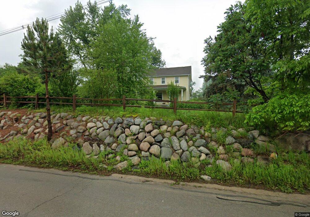
3300 Dutton Rd Rochester Hills, MI 48306
Estimated Value: $475,173 - $582,000
4
Beds
2
Baths
2,391
Sq Ft
$228/Sq Ft
Est. Value
About This Home
This home is located at 3300 Dutton Rd, Rochester Hills, MI 48306 and is currently estimated at $546,043, approximately $228 per square foot. 3300 Dutton Rd is a home located in Oakland County with nearby schools including Musson Elementary School, Van Hoosen Middle School, and Rochester Adams High School.
Ownership History
Date
Name
Owned For
Owner Type
Purchase Details
Closed on
Mar 7, 2014
Sold by
May Sheryl and May Sheryl Marie
Bought by
May Sheryl and Sheryl Marie May Trust
Current Estimated Value
Purchase Details
Closed on
Sep 26, 2005
Sold by
The Dahlem Family Living Trust
Bought by
May Sheryl
Purchase Details
Closed on
Mar 19, 1998
Sold by
Dahlem Thomas P
Bought by
Dahlem Trust
Purchase Details
Closed on
Jun 30, 1997
Sold by
Carlin Gerard L
Bought by
Dahlem Thomas P
Home Financials for this Owner
Home Financials are based on the most recent Mortgage that was taken out on this home.
Original Mortgage
$200,000
Interest Rate
8.01%
Create a Home Valuation Report for This Property
The Home Valuation Report is an in-depth analysis detailing your home's value as well as a comparison with similar homes in the area
Home Values in the Area
Average Home Value in this Area
Purchase History
| Date | Buyer | Sale Price | Title Company |
|---|---|---|---|
| May Sheryl | -- | None Available | |
| May Sheryl | $413,000 | Title Source Inc | |
| Dahlem Trust | -- | -- | |
| Dahlem Thomas P | $385,000 | -- |
Source: Public Records
Mortgage History
| Date | Status | Borrower | Loan Amount |
|---|---|---|---|
| Previous Owner | Dahlem Thomas P | $200,000 |
Source: Public Records
Tax History Compared to Growth
Tax History
| Year | Tax Paid | Tax Assessment Tax Assessment Total Assessment is a certain percentage of the fair market value that is determined by local assessors to be the total taxable value of land and additions on the property. | Land | Improvement |
|---|---|---|---|---|
| 2024 | $2,105 | $170,600 | $0 | $0 |
| 2023 | $2,024 | $169,320 | $0 | $0 |
| 2022 | $3,013 | $153,580 | $0 | $0 |
| 2021 | $2,826 | $145,930 | $0 | $0 |
| 2020 | $1,955 | $142,580 | $0 | $0 |
| 2019 | $2,981 | $140,880 | $0 | $0 |
| 2018 | $2,993 | $143,260 | $0 | $0 |
| 2017 | $2,932 | $140,690 | $0 | $0 |
| 2016 | $2,924 | $135,140 | $0 | $0 |
| 2015 | -- | $121,770 | $0 | $0 |
| 2014 | -- | $113,300 | $0 | $0 |
| 2011 | -- | $103,930 | $0 | $0 |
Source: Public Records
Map
Nearby Homes
- 1906 Independence Ct
- 5826 Murfield Dr
- 3273 Salem Dr
- 3185 Saint James Ct
- 3674 Merriweather Ln
- 5724 Murfield Dr
- 5700 Rolling Hills Dr
- 1609 Kilburn Rd N
- 2935 Woodford Cir
- 2821 Addison Cir S
- 3582 Tremonte Cir S Unit 276
- 3577 Oakmonte Blvd
- 3574 Oakmonte Blvd
- 3633 Thornwood Dr
- 2750 Castlemartin Ct Unit 22
- 2879 Hastings Ct Unit 73
- 2794 Castlemartin Ct
- 5350 Brewster Rd
- 5043 Belmonte Dr Unit 65
- 1513 Lomas Verdes
- 3347 Saint George Ct
- 1994 Heritage Hill Ct
- 1995 Heritage Hill Ct
- 1982 Heritage Hill Ct
- 1981 Heritage Hill Ct
- 3346 Saint George Ct
- 1970 Heritage Hill Ct
- 3381 St George
- 3298 Summit Ridge Dr
- 3316 Summit Ridge Dr Unit Bldg-Unit
- 3316 Summit Ridge Dr
- 3381 Saint George Ct
- 3334 Summit Ridge Dr
- 3280 Summit Ridge Dr
- 3436 Summit Ridge Dr
- 3424 Summit Ridge Dr
- 3448 Summit Ridge Dr
- 3352 Summit Ridge Dr
- 3406 Summit Ridge Dr
- 3370 Summit Ridge Dr