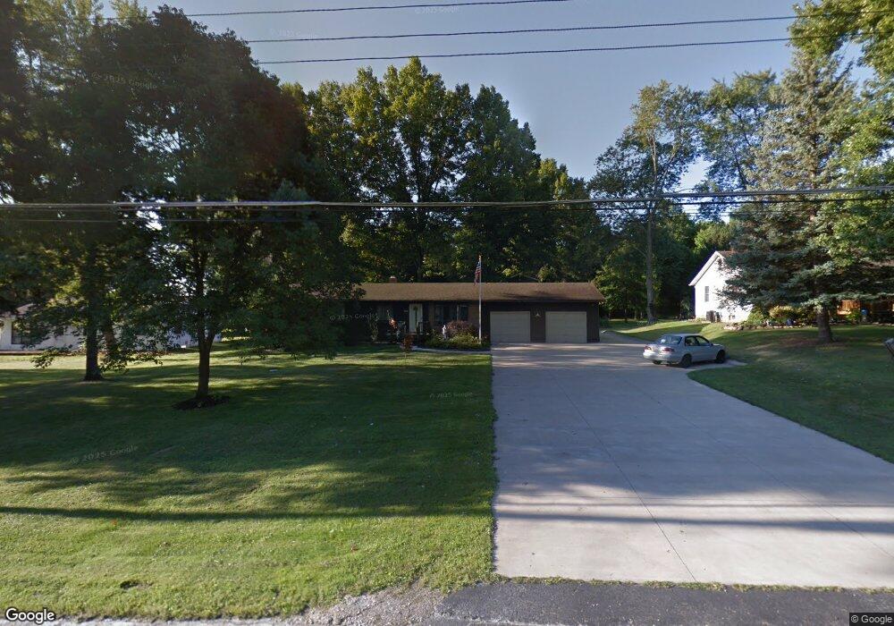
3300 Shellhart Rd Norton, OH 44203
Estimated Value: $265,405 - $293,000
3
Beds
2
Baths
1,656
Sq Ft
$168/Sq Ft
Est. Value
About This Home
This home is located at 3300 Shellhart Rd, Norton, OH 44203 and is currently estimated at $277,851, approximately $167 per square foot. 3300 Shellhart Rd is a home located in Summit County with nearby schools including Norton Primary Elementary School, Norton Middle School, and Norton High School.
Ownership History
Date
Name
Owned For
Owner Type
Purchase Details
Closed on
Jun 4, 2003
Sold by
Berube Sharon Trustee
Bought by
Mcdonald Dennis M
Current Estimated Value
Home Financials for this Owner
Home Financials are based on the most recent Mortgage that was taken out on this home.
Original Mortgage
$94,400
Outstanding Balance
$38,272
Interest Rate
5.71%
Mortgage Type
Purchase Money Mortgage
Estimated Equity
$239,579
Purchase Details
Closed on
Jun 24, 1998
Sold by
Morrison John M
Bought by
Berube Sharon A
Home Financials for this Owner
Home Financials are based on the most recent Mortgage that was taken out on this home.
Original Mortgage
$105,170
Interest Rate
7.27%
Mortgage Type
New Conventional
Create a Home Valuation Report for This Property
The Home Valuation Report is an in-depth analysis detailing your home's value as well as a comparison with similar homes in the area
Home Values in the Area
Average Home Value in this Area
Purchase History
We collect this data history from publicly available records. To have your information removed, we recommend requesting removal directly through your county’s website.
| Date | Buyer | Sale Price | Title Company |
|---|---|---|---|
| Mcdonald Dennis M | $118,000 | Landsel Title Agency Inc | |
| Berube Sharon A | $128,500 | -- |
Source: Public Records
Mortgage History
We collect this data history from publicly available records. To have your information removed, we recommend requesting removal directly through your county’s website.
| Date | Status | Borrower | Loan Amount |
|---|---|---|---|
| Open | Mcdonald Dennis M | $94,400 | |
| Previous Owner | Berube Sharon A | $105,170 | |
| Closed | Mcdonald Dennis M | $17,700 |
Source: Public Records
Tax History
| Year | Tax Paid | Tax Assessment Tax Assessment Total Assessment is a certain percentage of the fair market value that is determined by local assessors to be the total taxable value of land and additions on the property. | Land | Improvement |
|---|---|---|---|---|
| 2025 | $3,198 | $76,416 | $12,240 | $64,176 |
| 2024 | $3,198 | $76,416 | $12,240 | $64,176 |
| 2023 | $3,198 | $76,416 | $12,240 | $64,176 |
| 2022 | $3,182 | $62,451 | $9,716 | $52,735 |
| 2021 | $3,198 | $62,451 | $9,716 | $52,735 |
| 2020 | $2,996 | $62,460 | $9,720 | $52,740 |
| 2019 | $2,972 | $54,410 | $8,840 | $45,570 |
| 2018 | $2,516 | $46,830 | $8,840 | $37,990 |
| 2017 | $2,581 | $46,830 | $8,840 | $37,990 |
| 2016 | $2,581 | $44,010 | $8,840 | $35,170 |
| 2015 | $2,581 | $44,010 | $8,840 | $35,170 |
| 2014 | $2,557 | $44,010 | $8,840 | $35,170 |
| 2013 | $2,759 | $47,990 | $8,840 | $39,150 |
Source: Public Records
Map
Nearby Homes
- 3264 Grenfall Rd
- 3720 Brookside Dr
- 3187 Grenfall Rd
- 4001 S Cleveland Massillon Rd
- 3277 Longwood Dr
- 3699 Creedmoor Rd
- 3700 Strawboard Ave
- 2989 Fair Oaks Dr
- 3713 Alumina Dr
- 3715 Alumina Dr
- 3717 Alumina Dr
- 1275 Norton Ave Unit H4
- 3892 Higgins Dr
- 4035 Brookside Ct
- 3368 Wadsworth Rd
- 3862 Mount Vernon Blvd
- 3109 Fair Oaks Dr
- 3510 Wadsworth Rd
- 3682 Lebbens Rd
- 3885 Mount Vernon Blvd
- 3290 Shellhart Rd
- 3310 Shellhart Rd
- 3320 Shellhart Rd
- 3280 Shellhart Rd
- 3311 Shellhart Rd
- 3301 Shellhart Rd
- 3291 Shellhart Rd
- 3336 Shellhart Rd
- 3270 Shellhart Rd
- 3321 Shellhart Rd
- 3281 Shellhart Rd
- 3331 Shellhart Rd
- 3271 Shellhart Rd
- 3260 Shellhart Rd
- 3627 Easton Rd
- 3577 Easton Rd
- 3587 Easton Rd
- 3261 Shellhart Rd
- 3597 Easton Rd
- 3250 Shellhart Rd
Your Personal Tour Guide
Ask me questions while you tour the home.