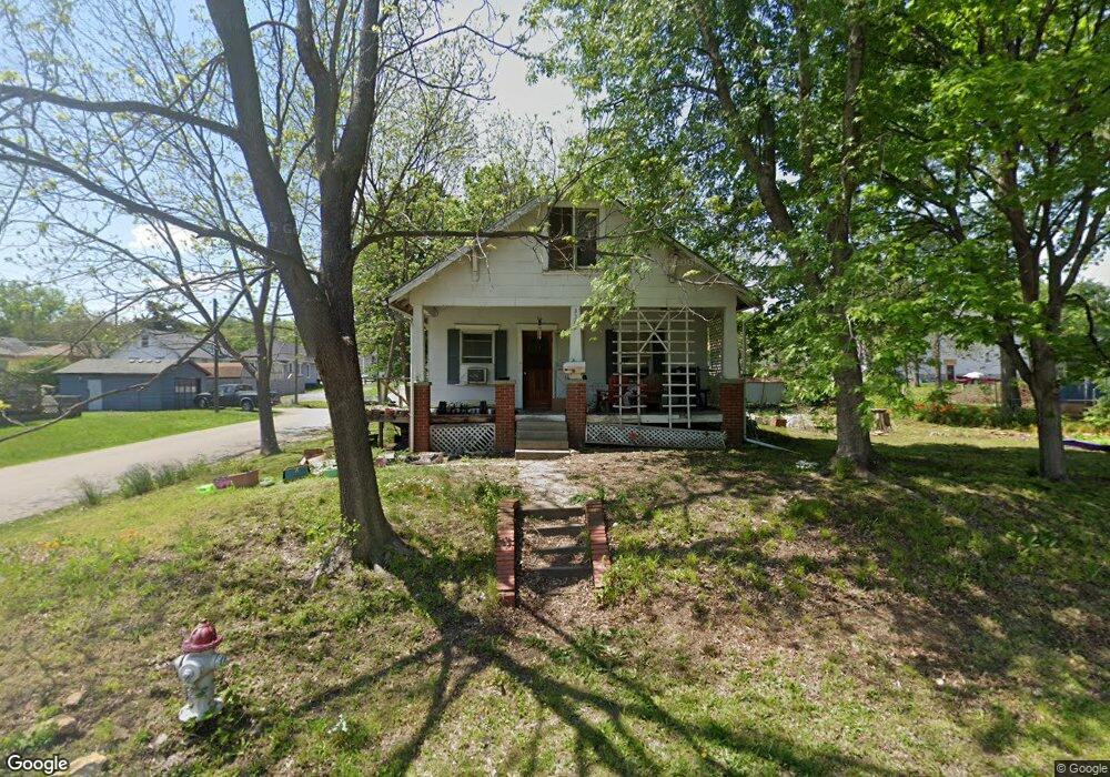
3302 Burnside Ave Saint Joseph, MO 64505
Northside NeighborhoodEstimated Value: $67,993 - $168,000
Studio
--
Bath
976
Sq Ft
$112/Sq Ft
Est. Value
About This Home
This home is located at 3302 Burnside Ave, Saint Joseph, MO 64505 and is currently estimated at $109,248, approximately $111 per square foot. 3302 Burnside Ave is a home located in Buchanan County with nearby schools including Lindbergh Elementary School, Robidoux Middle School, and Lafayette High School.
Ownership History
Date
Name
Owned For
Owner Type
Purchase Details
Closed on
Dec 22, 2010
Sold by
Patterson William J and Patterson Karen L
Bought by
Co Lamore Llc
Current Estimated Value
Purchase Details
Closed on
Jul 24, 2009
Sold by
Frank Charles L
Bought by
Patterson William J and Patterson Karen L
Home Financials for this Owner
Home Financials are based on the most recent Mortgage that was taken out on this home.
Original Mortgage
$30,800
Interest Rate
5.71%
Create a Home Valuation Report for This Property
The Home Valuation Report is an in-depth analysis detailing your home's value as well as a comparison with similar homes in the area
Home Values in the Area
Average Home Value in this Area
Purchase History
| Date | Buyer | Sale Price | Title Company |
|---|---|---|---|
| Co Lamore Llc | -- | None Available | |
| Patterson William J | -- | St Joseph Title & Abstract C |
Source: Public Records
Mortgage History
| Date | Status | Borrower | Loan Amount |
|---|---|---|---|
| Previous Owner | Patterson William J | $30,800 |
Source: Public Records
Tax History
| Year | Tax Paid | Tax Assessment Tax Assessment Total Assessment is a certain percentage of the fair market value that is determined by local assessors to be the total taxable value of land and additions on the property. | Land | Improvement |
|---|---|---|---|---|
| 2025 | $395 | $5,470 | $1,400 | $4,070 |
| 2024 | $374 | $5,190 | $1,400 | $3,790 |
| 2023 | $374 | $5,190 | $1,400 | $3,790 |
| 2022 | $346 | $5,190 | $1,400 | $3,790 |
| 2021 | $347 | $5,190 | $1,400 | $3,790 |
| 2020 | $345 | $5,190 | $1,400 | $3,790 |
| 2019 | $334 | $5,190 | $1,400 | $3,790 |
| 2018 | $301 | $5,190 | $1,400 | $3,790 |
| 2017 | $299 | $5,190 | $0 | $0 |
| 2015 | $0 | $5,190 | $0 | $0 |
| 2014 | $323 | $5,120 | $0 | $0 |
Source: Public Records
Map
Nearby Homes
- 3133 Saint Joseph Ave
- 3131 Saint Joseph Ave
- 1302 Randolph St
- 1012 Logan St
- 3118 N 11th St
- 1108 Roosevelt Ave
- 3123 N 10th St
- 3502 Saint Joseph Ave
- 1024 Roosevelt Ave
- 1020 7th Ave
- 1511 6th Ave
- 1101 Myrtle Ave
- 2911 N 6th St
- 3504 N 5th Street Terrace
- 1717 6th Ave
- 2624 Saint Joseph Ave
- 0 Helena St
- 3309 Westwood Dr
- 1525 4th Ave
- 1805 6th Ave
- 3306 Burnside Ave
- 3308 Burnside Ave
- 3132 Burnside Ave
- 3303 Saint Joseph Ave
- 3305 Saint Joseph Ave
- 3310 Burnside Ave
- 3128 Burnside Ave
- 3301 Burnside Ave
- 3307 St Joseph Ave
- 3207 Saint Joseph Ave
- 3312 Burnside Ave
- 3127 Burnside Ave
- 3124 Burnside Ave
- 3303 Burnside Ave
- 3135 Saint Joseph Ave
- 3314 Burnside Ave
- 3125 Burnside Ave
- 3220 Saint Joseph Ave
- 3313 Burnside Ave
- 3120 Burnside Ave
Your Personal Tour Guide
Ask me questions while you tour the home.