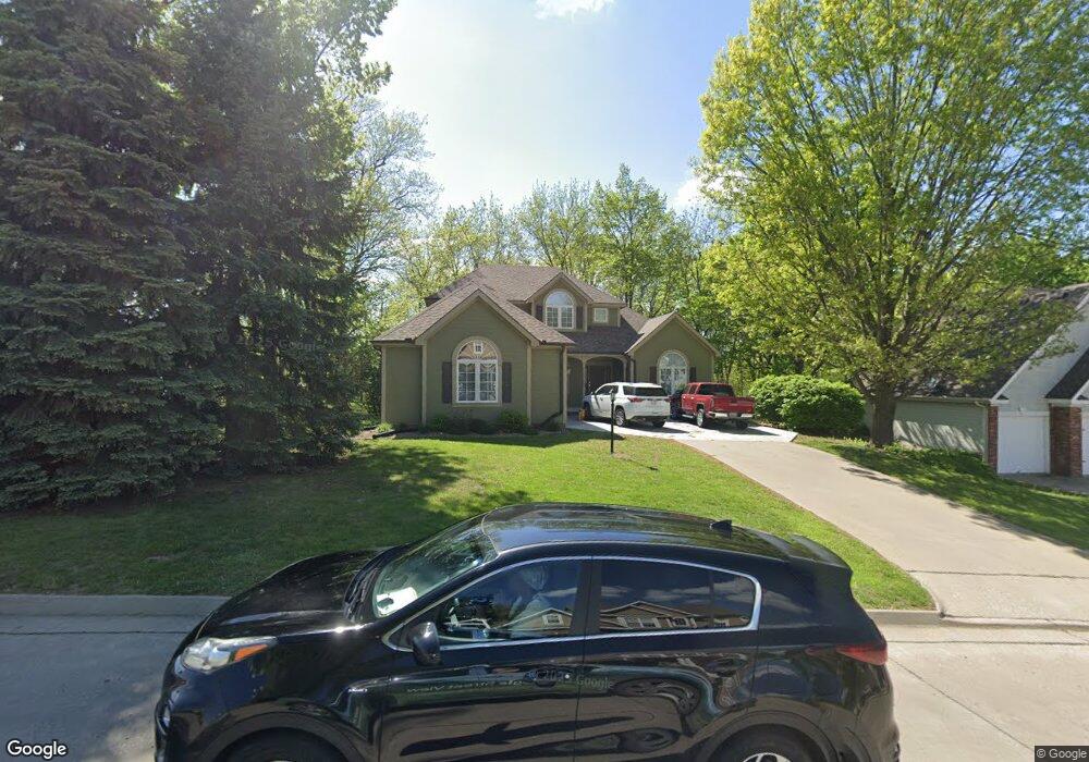
3302 W Devonshire Dr Saint Joseph, MO 64506
East Saint Joseph NeighborhoodEstimated Value: $348,270 - $430,000
Studio
--
Bath
1,241
Sq Ft
$312/Sq Ft
Est. Value
About This Home
This home is located at 3302 W Devonshire Dr, Saint Joseph, MO 64506 and is currently estimated at $387,068, approximately $311 per square foot. 3302 W Devonshire Dr is a home located in Buchanan County with nearby schools including Oak Grove Elementary School, Bode Middle School, and Central High School.
Ownership History
Date
Name
Owned For
Owner Type
Purchase Details
Closed on
Aug 27, 2020
Sold by
Shipley Jason and Shipley Hattie
Bought by
Fattig Kermit W and Fattig Valerie L
Current Estimated Value
Home Financials for this Owner
Home Financials are based on the most recent Mortgage that was taken out on this home.
Original Mortgage
$72,150
Outstanding Balance
$63,737
Interest Rate
2.9%
Mortgage Type
New Conventional
Estimated Equity
$323,331
Purchase Details
Closed on
Sep 30, 2016
Sold by
Pierce Kenneth V and Pierce Cartol A
Bought by
Shipley Jason and Shipley Hattie
Home Financials for this Owner
Home Financials are based on the most recent Mortgage that was taken out on this home.
Original Mortgage
$242,500
Interest Rate
3.46%
Mortgage Type
New Conventional
Create a Home Valuation Report for This Property
The Home Valuation Report is an in-depth analysis detailing your home's value as well as a comparison with similar homes in the area
Home Values in the Area
Average Home Value in this Area
Purchase History
| Date | Buyer | Sale Price | Title Company |
|---|---|---|---|
| Fattig Kermit W | -- | First American Title Ins Co | |
| Shipley Jason | -- | First American Title |
Source: Public Records
Mortgage History
| Date | Status | Borrower | Loan Amount |
|---|---|---|---|
| Open | Fattig Kermit W | $72,150 | |
| Previous Owner | Shipley Jason | $242,500 |
Source: Public Records
Tax History
| Year | Tax Paid | Tax Assessment Tax Assessment Total Assessment is a certain percentage of the fair market value that is determined by local assessors to be the total taxable value of land and additions on the property. | Land | Improvement |
|---|---|---|---|---|
| 2025 | $3,137 | $46,420 | $9,500 | $36,920 |
| 2024 | $3,090 | $43,840 | $9,500 | $34,340 |
| 2023 | $3,090 | $43,840 | $9,500 | $34,340 |
| 2022 | $2,862 | $43,840 | $9,500 | $34,340 |
| 2021 | $2,874 | $43,840 | $9,500 | $34,340 |
| 2020 | $2,859 | $43,840 | $9,500 | $34,340 |
| 2019 | $2,759 | $43,840 | $9,500 | $34,340 |
| 2018 | $2,488 | $43,840 | $9,500 | $34,340 |
| 2017 | $2,464 | $43,840 | $0 | $0 |
| 2015 | $1 | $43,840 | $0 | $0 |
| 2014 | $2,707 | $43,840 | $0 | $0 |
Source: Public Records
Map
Nearby Homes
- 4007 Bennington Dr
- 4303 Leighton Ct
- 3904 Remington Ct
- 3212 Morton Ln
- 2805 Quail Dr
- 0 N Pointe Dr
- 5411 N Pointe Dr
- 5408 N Pointe Dr
- 2 N Pointe Dr
- 5415 N Pointe Dr
- 5418 N Pointe Dr
- 4216 Gene Field Rd
- 4113 Hidden Valley Dr
- 2712 N 39th Terrace
- 4109 Hidden Valley Dr
- 2607 Ashmat Ln
- 4704 Donnelly Dr
- 4311 Hidden Valley Dr
- 4802 Corinth Dr
- 4207 Hidden Valley Dr
- 3306 W Devonshire Dr
- 3301 W Devonshire Dr
- 3308 W Devonshire Dr
- 3303 W Devonshire Dr
- 3305 W Devonshire Dr
- 3307 W Devonshire Dr
- 4104 Karnes Rd
- 3309 W Devonshire Dr
- 4214 Karnes Rd
- 3402 W Devonshire Dr
- 3401 W Devonshire Dr
- 3404 W Devonshire Dr
- 4022 Karnes Rd
- 4230 Karnes Rd
- 3404 Stanford Ct
- 3406 W Devonshire Dr
- 3402 Stanford Ct
- 3403 W Devonshire Dr
- 3119 Fieldcrest Ave
- 3406 Stanford Ct
Your Personal Tour Guide
Ask me questions while you tour the home.