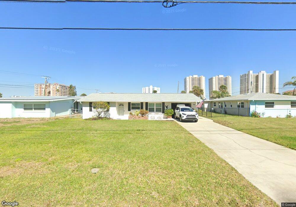
3303 S Peninsula Dr Daytona Beach, FL 32118
Estimated Value: $286,000 - $410,000
2
Beds
2
Baths
1,680
Sq Ft
$204/Sq Ft
Est. Value
About This Home
This home is located at 3303 S Peninsula Dr, Daytona Beach, FL 32118 and is currently estimated at $342,466, approximately $203 per square foot. 3303 S Peninsula Dr is a home located in Volusia County with nearby schools including R.J. Longstreet Elementary School, Atlantic High School, and Silver Sands Middle School.
Ownership History
Date
Name
Owned For
Owner Type
Purchase Details
Closed on
Jun 11, 2007
Sold by
Mccolly Martha Jane
Bought by
Puckett Roger
Current Estimated Value
Purchase Details
Closed on
Dec 29, 1998
Sold by
Lotsey Irene C
Bought by
Mccolly Martha Jane
Purchase Details
Closed on
Oct 15, 1992
Bought by
Puckett Roger
Purchase Details
Closed on
Sep 15, 1982
Bought by
Puckett Roger
Purchase Details
Closed on
Jun 15, 1974
Bought by
Puckett Roger
Create a Home Valuation Report for This Property
The Home Valuation Report is an in-depth analysis detailing your home's value as well as a comparison with similar homes in the area
Home Values in the Area
Average Home Value in this Area
Purchase History
| Date | Buyer | Sale Price | Title Company |
|---|---|---|---|
| Puckett Roger | $179,000 | Southern Title Hldg Co Llc | |
| Mccolly Martha Jane | $71,300 | -- | |
| Lotsey Irene C | -- | -- | |
| Puckett Roger | $100 | -- | |
| Puckett Roger | $50,000 | -- | |
| Puckett Roger | $17,000 | -- |
Source: Public Records
Tax History Compared to Growth
Tax History
| Year | Tax Paid | Tax Assessment Tax Assessment Total Assessment is a certain percentage of the fair market value that is determined by local assessors to be the total taxable value of land and additions on the property. | Land | Improvement |
|---|---|---|---|---|
| 2025 | $2,707 | $184,453 | -- | -- |
| 2024 | $2,707 | $179,255 | -- | -- |
| 2023 | $2,707 | $174,034 | $0 | $0 |
| 2022 | $2,643 | $168,965 | $0 | $0 |
| 2021 | $2,705 | $164,044 | $0 | $0 |
| 2020 | $2,657 | $161,779 | $0 | $0 |
| 2019 | $2,626 | $158,142 | $0 | $0 |
| 2018 | $2,589 | $155,193 | $0 | $0 |
| 2017 | $2,572 | $152,001 | $0 | $0 |
| 2016 | $2,567 | $148,875 | $0 | $0 |
| 2015 | $3,018 | $139,086 | $0 | $0 |
| 2014 | $2,735 | $125,211 | $0 | $0 |
Source: Public Records
Map
Nearby Homes
- 2 Talo Cir
- 100 Talo Cir
- 0 S Peninsula Dr Unit MFRV4942972
- 0 S Peninsula Dr Unit 1219405
- 0 S Peninsula Dr
- 0 S Peninsula Dr Unit 1213918
- 3244 S Peninsula Dr
- 5 Talo Cir
- 3315 S Atlantic Ave Unit 1605
- 3315 S Atlantic Ave Unit 1406
- 3315 S Atlantic Ave Unit 1005
- 3315 S Atlantic Ave Unit 806
- 3315 S Atlantic Ave Unit 1707
- 3315 S Atlantic Ave Unit 408
- 3315 S Atlantic Ave Unit 1108
- 3315 S Atlantic Ave Unit 1106
- 3255 S Atlantic Ave Unit 207
- 3255 S Atlantic Ave Unit 106
- 3245 S Atlantic Ave Unit 208
- 3311 S Atlantic Ave Unit 1504
- 100 Simpson Ave
- 3305 S Peninsula Dr
- 107 Dottie Ave
- 106 Simpson Ave
- 111 Dottie Ave
- 108 Simpson Ave
- 3311 S Peninsula Dr
- 3310 S Peninsula Dr
- 115 Dottie Ave
- 110 Simpson Ave
- 3264 La Paloma Ave
- 108 Dottie Ave
- 3263 S Peninsula Dr
- 3315 S Peninsula Dr
- 3254 S Peninsula Dr
- 117 Dottie Ave
- 105 Ogden Blvd
- 112 Dottie Ave
- 112 Simpson Ave
- 107 Ogden Blvd