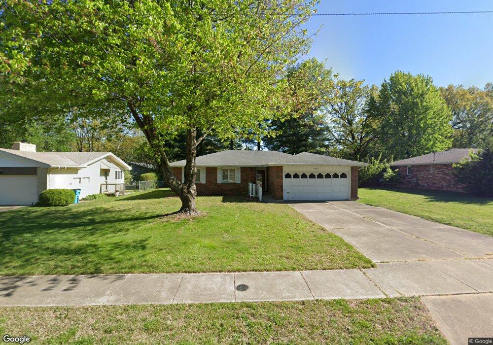
3304 E Linwood St Springfield, MO 65804
Oak Grove NeighborhoodEstimated Value: $213,555 - $231,000
3
Beds
2
Baths
1,334
Sq Ft
$166/Sq Ft
Est. Value
About This Home
This home is located at 3304 E Linwood St, Springfield, MO 65804 and is currently estimated at $220,889, approximately $165 per square foot. 3304 E Linwood St is a home located in Greene County with nearby schools including Pittman Elementary School, Hickory Hills K-8 School, and Glendale High School.
Ownership History
Date
Name
Owned For
Owner Type
Purchase Details
Closed on
Feb 6, 2009
Sold by
Rankin Dorothy B
Bought by
Thomas William B and Thomas Kathy S
Current Estimated Value
Home Financials for this Owner
Home Financials are based on the most recent Mortgage that was taken out on this home.
Original Mortgage
$99,684
Outstanding Balance
$63,248
Interest Rate
5.17%
Mortgage Type
VA
Estimated Equity
$157,641
Purchase Details
Closed on
Apr 22, 2008
Sold by
Rankin Dorothy B
Bought by
Rankin Dorothy B
Create a Home Valuation Report for This Property
The Home Valuation Report is an in-depth analysis detailing your home's value as well as a comparison with similar homes in the area
Home Values in the Area
Average Home Value in this Area
Purchase History
| Date | Buyer | Sale Price | Title Company |
|---|---|---|---|
| Thomas William B | -- | None Available | |
| Rankin Dorothy B | -- | None Available |
Source: Public Records
Mortgage History
| Date | Status | Borrower | Loan Amount |
|---|---|---|---|
| Open | Thomas William B | $99,684 |
Source: Public Records
Tax History
| Year | Tax Paid | Tax Assessment Tax Assessment Total Assessment is a certain percentage of the fair market value that is determined by local assessors to be the total taxable value of land and additions on the property. | Land | Improvement |
|---|---|---|---|---|
| 2025 | $1,114 | $24,470 | $5,700 | $18,770 |
| 2024 | $1,114 | $20,770 | $4,750 | $16,020 |
| 2023 | $1,108 | $20,770 | $4,750 | $16,020 |
| 2022 | $1,039 | $19,020 | $4,750 | $14,270 |
| 2021 | $1,039 | $19,020 | $4,750 | $14,270 |
| 2020 | $1,019 | $17,840 | $4,750 | $13,090 |
| 2019 | $990 | $17,840 | $4,750 | $13,090 |
| 2018 | $1,024 | $18,450 | $3,800 | $14,650 |
| 2017 | $1,013 | $17,880 | $3,800 | $14,080 |
| 2016 | $980 | $17,880 | $3,800 | $14,080 |
| 2015 | $971 | $17,880 | $3,800 | $14,080 |
| 2014 | $944 | $17,250 | $3,800 | $13,450 |
Source: Public Records
Map
Nearby Homes
- 1634 S Saint Charles Ave
- 1650 S Saint Charles Ave
- 3438 E Carol Dr
- 3534 E Whitehall Dr
- 1315 S Oak Run Place
- 3526 E Cinnamon Place
- 1967 S Saint Charles Ave
- 1901 S Sieger Dr
- 2917 E Portland St
- 3546 E Cinnamon Place
- 3460 E Catalpa St
- 1146 S John Ave
- 3005 E Eastmoor Ct
- 3165 E Topping Cir
- 1253 S Belcrest Ave
- 1249 S Belcrest Ave
- 1121 S John Ave
- 1124 S Bruce Ave
- 1305 S Prince Ln
- 1516 S Essex Rd
- 3310 E Linwood St
- 3254 E Linwood St
- 3242 E Linwood St
- 3320 E Linwood St
- 3305 E Linwood St
- 3305 E Portland St
- 1543 S Saint Marys Ave
- 3309 E Portland St
- 1543 S Lovers Ln
- 3234 E Linwood St
- 1538 S Saint Marys Ave
- 3317 E Portland St
- 1537 S Saint Marys Ave
- 1544 S John Ave
- 1537 S Lovers Ln
- 3304 E Portland St
- 1528 S Saint Marys Ave
- 3232 E Linwood St
- 3325 E Portland St
- 1529 S Saint Marys Ave
Your Personal Tour Guide
Ask me questions while you tour the home.