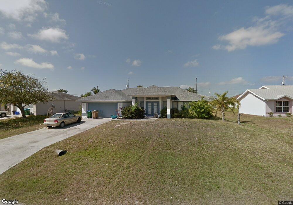
3306 Oasis Blvd Cape Coral, FL 33914
Pelican NeighborhoodEstimated Value: $379,145 - $424,000
3
Beds
2
Baths
2,243
Sq Ft
$178/Sq Ft
Est. Value
About This Home
This home is located at 3306 Oasis Blvd, Cape Coral, FL 33914 and is currently estimated at $399,286, approximately $178 per square foot. 3306 Oasis Blvd is a home located in Lee County with nearby schools including Cape Elementary School, Caloosa Elementary School, and Tropic Isles Elementary School.
Ownership History
Date
Name
Owned For
Owner Type
Purchase Details
Closed on
Aug 11, 2014
Sold by
Garmager Karl M
Bought by
Ney Robert and Ney Mary Ellen
Current Estimated Value
Purchase Details
Closed on
Dec 11, 1996
Sold by
Cameron Kerry
Bought by
Garmager Karl M
Home Financials for this Owner
Home Financials are based on the most recent Mortgage that was taken out on this home.
Original Mortgage
$7,200
Interest Rate
7.65%
Create a Home Valuation Report for This Property
The Home Valuation Report is an in-depth analysis detailing your home's value as well as a comparison with similar homes in the area
Home Values in the Area
Average Home Value in this Area
Purchase History
| Date | Buyer | Sale Price | Title Company |
|---|---|---|---|
| Ney Robert | $128,000 | Stewart Title Company | |
| Garmager Karl M | $7,000 | -- |
Source: Public Records
Mortgage History
| Date | Status | Borrower | Loan Amount |
|---|---|---|---|
| Previous Owner | Garmager Karl M | $7,200 |
Source: Public Records
Tax History Compared to Growth
Tax History
| Year | Tax Paid | Tax Assessment Tax Assessment Total Assessment is a certain percentage of the fair market value that is determined by local assessors to be the total taxable value of land and additions on the property. | Land | Improvement |
|---|---|---|---|---|
| 2025 | $2,795 | $197,992 | -- | -- |
| 2024 | $2,642 | $192,412 | -- | -- |
| 2023 | $2,642 | $186,808 | $0 | $0 |
| 2022 | $2,545 | $181,367 | $0 | $0 |
| 2021 | $2,574 | $241,176 | $32,500 | $208,676 |
| 2020 | $3,424 | $173,653 | $0 | $0 |
| 2019 | $2,941 | $169,749 | $0 | $0 |
| 2018 | $2,954 | $166,584 | $0 | $0 |
| 2017 | $3,526 | $163,158 | $0 | $0 |
| 2016 | $2,919 | $189,041 | $18,500 | $170,541 |
| 2015 | $2,398 | $128,294 | $17,600 | $110,694 |
| 2014 | -- | $114,904 | $24,000 | $90,904 |
| 2013 | -- | $107,899 | $11,200 | $96,699 |
Source: Public Records
Map
Nearby Homes
- 3308 SW 25th Place
- 2528 Gleason Pkwy
- 2527 Gleason Pkwy
- 3330 SW 25th Ct
- 3412 SW 25th Place
- 3413 SW 25th Ct Unit 19
- 2610 SW 32nd St
- 3321 SW 26th Place
- 2516 SW 35th Terrace
- 2321 SW 32nd St
- 2527 SW 35th Ln
- 3111 SW 25th Ave
- 2406 SW 32nd St
- 1828 SW 32nd St
- 2225 SW 32nd St
- 1828 SW 32nd St Unit 15
- 3043 SW 24th Ave
- 2705 SW 32nd Ln
- 2663 SW 32nd St
- 2301 SW 32nd St
- 3302 Oasis Blvd
- 3310 Oasis Blvd
- 3303 SW 25th Place
- 3307 SW 25th Place
- 2522 Gleason Pkwy
- 3314 Oasis Blvd
- 2519 SW 32nd Ln
- 3311 SW 25th Place
- 2520 Gleason Pkwy
- 3309 Oasis Blvd
- 2524 Gleason Pkwy
- 3318 Oasis Blvd
- 3308 SW 25th Place Unit 29
- 3302 SW 25th Place
- 3322 Oasis Blvd
- 2518 Gleason Pkwy
- 2525 SW 32nd Ln
- 3319 SW 25th Place
- 3312 SW 25th Place
- 2522 SW 32nd Ln