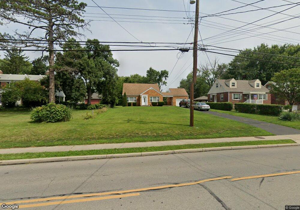
3308 W Galbraith Rd Cincinnati, OH 45239
Estimated Value: $176,000 - $225,513
3
Beds
1
Bath
1,278
Sq Ft
$152/Sq Ft
Est. Value
About This Home
This home is located at 3308 W Galbraith Rd, Cincinnati, OH 45239 and is currently estimated at $194,128, approximately $151 per square foot. 3308 W Galbraith Rd is a home located in Hamilton County with nearby schools including White Oak Middle School, Colerain High School, and Cincinnati Achievement Academy.
Ownership History
Date
Name
Owned For
Owner Type
Purchase Details
Closed on
Nov 21, 2006
Sold by
Fannie Mae
Bought by
Miller Myron J
Current Estimated Value
Home Financials for this Owner
Home Financials are based on the most recent Mortgage that was taken out on this home.
Original Mortgage
$95,000
Outstanding Balance
$56,792
Interest Rate
6.4%
Mortgage Type
Purchase Money Mortgage
Estimated Equity
$137,336
Purchase Details
Closed on
Sep 21, 2006
Sold by
Neal Larry and Neal Debra
Bought by
Fannie Mae and Federal National Mortgage Association
Purchase Details
Closed on
May 17, 2002
Sold by
Biddle Harold D
Bought by
Neal Larry and Neal Debra
Home Financials for this Owner
Home Financials are based on the most recent Mortgage that was taken out on this home.
Original Mortgage
$120,021
Interest Rate
6.95%
Mortgage Type
FHA
Purchase Details
Closed on
Mar 15, 2002
Sold by
Estate Of Luella E Biddle
Bought by
Biddle Harold D
Create a Home Valuation Report for This Property
The Home Valuation Report is an in-depth analysis detailing your home's value as well as a comparison with similar homes in the area
Home Values in the Area
Average Home Value in this Area
Purchase History
| Date | Buyer | Sale Price | Title Company |
|---|---|---|---|
| Miller Myron J | $95,000 | None Available | |
| Fannie Mae | $95,000 | None Available | |
| Neal Larry | $121,000 | Park Place Title Agency | |
| Biddle Harold D | -- | -- |
Source: Public Records
Mortgage History
| Date | Status | Borrower | Loan Amount |
|---|---|---|---|
| Open | Miller Myron J | $95,000 | |
| Previous Owner | Neal Larry | $120,021 |
Source: Public Records
Tax History Compared to Growth
Tax History
| Year | Tax Paid | Tax Assessment Tax Assessment Total Assessment is a certain percentage of the fair market value that is determined by local assessors to be the total taxable value of land and additions on the property. | Land | Improvement |
|---|---|---|---|---|
| 2024 | $2,675 | $49,844 | $11,165 | $38,679 |
| 2023 | $2,691 | $49,844 | $11,165 | $38,679 |
| 2022 | $2,509 | $37,898 | $11,067 | $26,831 |
| 2021 | $2,488 | $37,898 | $11,067 | $26,831 |
| 2020 | $2,514 | $37,898 | $11,067 | $26,831 |
| 2019 | $2,175 | $30,562 | $8,925 | $21,637 |
| 2018 | $1,952 | $30,562 | $8,925 | $21,637 |
| 2017 | $1,850 | $30,562 | $8,925 | $21,637 |
| 2016 | $1,999 | $32,634 | $9,450 | $23,184 |
| 2015 | $2,018 | $32,634 | $9,450 | $23,184 |
| 2014 | $2,022 | $32,634 | $9,450 | $23,184 |
| 2013 | $1,925 | $32,634 | $9,450 | $23,184 |
Source: Public Records
Map
Nearby Homes
- 3277 Warfield Ave
- 3369 W Galbraith Rd
- 8269 Sandy Ln
- 7776 Cella Dr
- 8344 Firshade Terrace
- 8474 Chesswood Dr
- 3397 Nandale Dr
- 7476 Boleyn Dr
- 3329 Alexis Rd
- 7640 Cheviot Rd
- 7448 Locust View Ln
- 8335 Jackies Dr
- 7227 Locust View Ln
- 8278 Lyness Dr
- 3388 Bauerwoods Dr
- 3055 Sovereign Dr
- 8281 Royal Heights Dr
- 3693 W Galbraith Rd
- 3701 W Galbraith Rd
- 8659 Sarahs Bend Dr
- 3284 W Galbraith Rd
- 3310 W Galbraith Rd
- 3285 Warfield Ave
- 3280 W Galbraith Rd
- 3281 Warfield Ave
- 3276 W Galbraith Rd
- 3272 W Galbraith Rd
- 3273 Warfield Ave
- 3268 W Galbraith Rd
- 3284 Warfield Ave
- 3269 Warfield Ave
- 3280 Warfield Ave
- 3332 W Galbraith Rd
- 3303 W Galbraith Rd
- 3297 W Galbraith Rd
- 3309 W Galbraith Rd
- 3276 Warfield Ave
- 3264 W Galbraith Rd
- 3265 Warfield Ave
- 3291 W Galbraith Rd