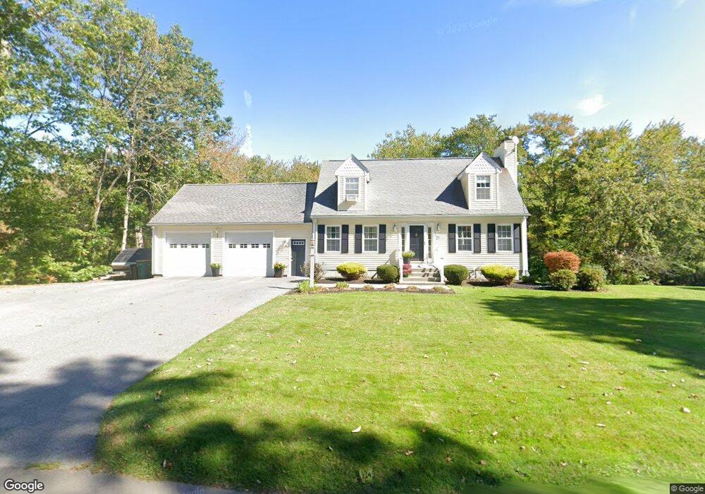
331 Cumberland Ave North Attleboro, MA 02760
North Attleboro NeighborhoodEstimated Value: $616,518 - $643,000
3
Beds
2
Baths
1,700
Sq Ft
$368/Sq Ft
Est. Value
About This Home
This home is located at 331 Cumberland Ave, North Attleboro, MA 02760 and is currently estimated at $625,130, approximately $367 per square foot. 331 Cumberland Ave is a home located in Bristol County with nearby schools including North Attleboro High School, Dayspring Christian Academy, and St Cecilia School.
Ownership History
Date
Name
Owned For
Owner Type
Purchase Details
Closed on
Apr 4, 1997
Sold by
Orion Rlty Co Inc
Bought by
Morse Keith D and Morse Kerri J
Current Estimated Value
Home Financials for this Owner
Home Financials are based on the most recent Mortgage that was taken out on this home.
Original Mortgage
$140,600
Interest Rate
7.5%
Mortgage Type
Purchase Money Mortgage
Create a Home Valuation Report for This Property
The Home Valuation Report is an in-depth analysis detailing your home's value as well as a comparison with similar homes in the area
Home Values in the Area
Average Home Value in this Area
Purchase History
| Date | Buyer | Sale Price | Title Company |
|---|---|---|---|
| Morse Keith D | $148,000 | -- |
Source: Public Records
Mortgage History
| Date | Status | Borrower | Loan Amount |
|---|---|---|---|
| Open | Morse Keith D | $137,000 | |
| Closed | Morse Keith D | $140,600 |
Source: Public Records
Tax History Compared to Growth
Tax History
| Year | Tax Paid | Tax Assessment Tax Assessment Total Assessment is a certain percentage of the fair market value that is determined by local assessors to be the total taxable value of land and additions on the property. | Land | Improvement |
|---|---|---|---|---|
| 2025 | $5,870 | $497,900 | $127,100 | $370,800 |
| 2024 | $5,621 | $487,100 | $127,100 | $360,000 |
| 2023 | $5,684 | $444,400 | $127,100 | $317,300 |
| 2022 | $5,245 | $376,500 | $127,100 | $249,400 |
| 2021 | $5,330 | $373,500 | $127,100 | $246,400 |
| 2020 | $5,182 | $361,100 | $127,100 | $234,000 |
| 2019 | $5,018 | $352,400 | $115,600 | $236,800 |
| 2018 | $4,450 | $333,600 | $115,600 | $218,000 |
| 2017 | $4,106 | $310,600 | $115,600 | $195,000 |
| 2016 | $4,222 | $319,400 | $128,400 | $191,000 |
| 2015 | $3,917 | $298,100 | $134,800 | $163,300 |
| 2014 | $3,755 | $283,600 | $124,600 | $159,000 |
Source: Public Records
Map
Nearby Homes
- 181 Paine Rd
- 31 Paine Rd
- 1 Frederick a Nittel Dr
- 155 May St
- 135 Cumberland Ave
- 740 Allen Ave
- 0 Mendon Rd
- 44 Powder Horn Way
- 27 Killarney Way
- 23 Cumberland Ave
- 543 Newport Ave
- 517 Newport Ave
- 338 Newport Ave
- 143 Millard Rd
- 154 Bear Hill Rd Unit 306
- 154 Bear Hill Rd Unit 405
- 154 Bear Hill Rd Unit 1402
- 64 Highland Ave Unit A
- 64 Highland Ave Unit B
- 11 Howarth Ave
- 341 Cumberland Ave
- 321 Cumberland Ave
- 351 Cumberland Ave
- 326 Cumberland Ave
- 338 Cumberland Ave
- 334 Cumberland Ave
- 312 Cumberland Ave
- 361 Cumberland Ave
- 301 Cumberland Ave
- 342 Cumberland Ave
- 304 Cumberland Ave
- 348 Cumberland Ave
- 293 Cumberland Ave
- 296 Cumberland Ave
- 352 Cumberland Ave
- 287 Cumberland Ave
- 505 Cushman Rd
- 290 Cumberland Ave
- 519 Cushman Rd
- 282 Cumberland Ave