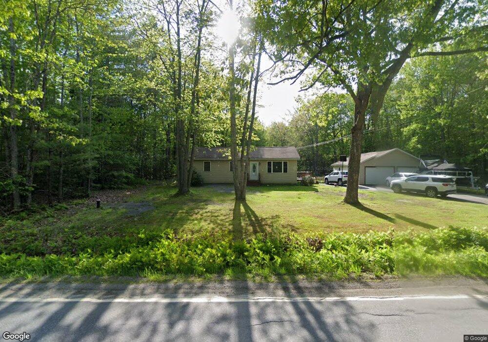
331 Dow Rd Orrington, ME 04474
Estimated Value: $256,549 - $359,000
--
Bed
--
Bath
--
Sq Ft
1.15
Acres
About This Home
This home is located at 331 Dow Rd, Orrington, ME 04474 and is currently estimated at $310,887. 331 Dow Rd is a home located in Penobscot County with nearby schools including Center Drive School and Calvary Chapel Christian School.
Ownership History
Date
Name
Owned For
Owner Type
Purchase Details
Closed on
Jun 25, 2007
Sold by
Andrews Charles S and Andrews Frances J
Bought by
Look Joshua F
Current Estimated Value
Home Financials for this Owner
Home Financials are based on the most recent Mortgage that was taken out on this home.
Original Mortgage
$145,000
Outstanding Balance
$88,484
Interest Rate
6.14%
Mortgage Type
Unknown
Estimated Equity
$222,403
Create a Home Valuation Report for This Property
The Home Valuation Report is an in-depth analysis detailing your home's value as well as a comparison with similar homes in the area
Home Values in the Area
Average Home Value in this Area
Purchase History
| Date | Buyer | Sale Price | Title Company |
|---|---|---|---|
| Look Joshua F | -- | -- |
Source: Public Records
Mortgage History
| Date | Status | Borrower | Loan Amount |
|---|---|---|---|
| Open | Look Joshua F | $145,000 |
Source: Public Records
Tax History Compared to Growth
Tax History
| Year | Tax Paid | Tax Assessment Tax Assessment Total Assessment is a certain percentage of the fair market value that is determined by local assessors to be the total taxable value of land and additions on the property. | Land | Improvement |
|---|---|---|---|---|
| 2024 | $2,280 | $209,200 | $48,600 | $160,600 |
| 2023 | $2,170 | $197,300 | $45,200 | $152,100 |
| 2022 | $2,301 | $180,500 | $47,700 | $132,800 |
| 2021 | $2,435 | $162,300 | $47,700 | $114,600 |
| 2020 | $2,445 | $153,800 | $47,700 | $106,100 |
| 2019 | $2,445 | $153,800 | $47,700 | $106,100 |
| 2018 | $2,138 | $153,800 | $47,700 | $106,100 |
| 2017 | $2,138 | $153,800 | $47,700 | $106,100 |
| 2016 | $1,957 | $136,400 | $33,400 | $103,000 |
| 2015 | $1,957 | $136,400 | $33,400 | $103,000 |
| 2014 | $1,967 | $137,100 | $33,400 | $103,700 |
| 2013 | $1,844 | $137,100 | $33,400 | $103,700 |
Source: Public Records
Map
Nearby Homes
- 290 Center Dr
- 473 Center Dr
- 245 Center Dr
- 12 Harvest Dr
- 38 Harvest Dr
- 173 Center Dr
- 101 Oak Hill Rd
- Lot 3 00 Stonewall Dr
- Lot 4 00 Stonewall Dr
- 21 Betts Rd
- 197 Arctic Station Rd
- 1002 River Rd
- 900 Brewer Lake Rd
- Map4Lot3 E Bucksport Rd
- 23 Carver Rd
- 12 Rowell Rd
- 59 Summer St
- 8 Bartlett Cove
- 314 Main Rd N
- 304 Main Rd N