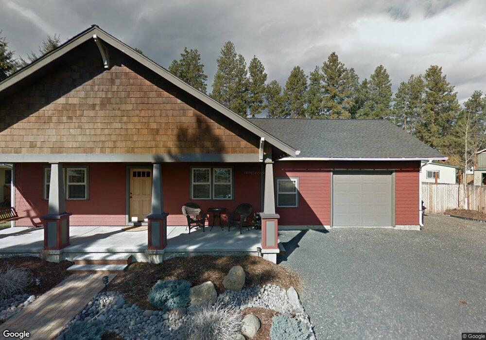
331 N Maple Ln Sisters, OR 97759
Estimated Value: $499,000 - $560,302
3
Beds
2
Baths
1,216
Sq Ft
$429/Sq Ft
Est. Value
About This Home
This home is located at 331 N Maple Ln, Sisters, OR 97759 and is currently estimated at $521,326, approximately $428 per square foot. 331 N Maple Ln is a home located in Deschutes County with nearby schools including Sisters Elementary School, Sisters Middle School, and Sisters High School.
Ownership History
Date
Name
Owned For
Owner Type
Purchase Details
Closed on
Sep 9, 2010
Sold by
Federal National Mortgage Association
Bought by
Ruddiman Stanley E and Ruddiman Denise L
Current Estimated Value
Purchase Details
Closed on
Feb 1, 2010
Sold by
Everhome Mortgage Company
Bought by
Federal National Mortgage Association
Purchase Details
Closed on
Jan 14, 2010
Sold by
Schar Andrew and Schar Lori
Bought by
Everhome Mortgage Company
Purchase Details
Closed on
Apr 6, 2005
Sold by
Sister Investments Llc
Bought by
Schar Andrew and Schar Lori
Home Financials for this Owner
Home Financials are based on the most recent Mortgage that was taken out on this home.
Original Mortgage
$169,600
Interest Rate
5.25%
Mortgage Type
Construction
Create a Home Valuation Report for This Property
The Home Valuation Report is an in-depth analysis detailing your home's value as well as a comparison with similar homes in the area
Home Values in the Area
Average Home Value in this Area
Purchase History
| Date | Buyer | Sale Price | Title Company |
|---|---|---|---|
| Ruddiman Stanley E | $139,400 | Amerititle | |
| Federal National Mortgage Association | -- | Amerititle | |
| Everhome Mortgage Company | $182,997 | Amerititle | |
| Schar Andrew | $80,000 | First Amer Title Ins Co Or |
Source: Public Records
Mortgage History
| Date | Status | Borrower | Loan Amount |
|---|---|---|---|
| Previous Owner | Schar Andrew | $169,600 | |
| Closed | Schar Andrew | $21,200 |
Source: Public Records
Tax History
| Year | Tax Paid | Tax Assessment Tax Assessment Total Assessment is a certain percentage of the fair market value that is determined by local assessors to be the total taxable value of land and additions on the property. | Land | Improvement |
|---|---|---|---|---|
| 2025 | $3,726 | $224,500 | -- | -- |
| 2024 | $3,609 | $217,970 | -- | -- |
| 2023 | $3,506 | $211,630 | $0 | $0 |
| 2022 | $3,259 | $199,490 | $0 | $0 |
| 2021 | $3,294 | $193,680 | $0 | $0 |
| 2020 | $3,131 | $193,680 | $0 | $0 |
| 2019 | $3,054 | $188,040 | $0 | $0 |
| 2018 | $2,955 | $182,570 | $0 | $0 |
| 2017 | $2,853 | $177,260 | $0 | $0 |
| 2016 | $2,813 | $172,100 | $0 | $0 |
| 2015 | $2,641 | $167,090 | $0 | $0 |
| 2014 | $2,555 | $162,230 | $0 | $0 |
Source: Public Records
Map
Nearby Homes
- 936 E Black Butte Ave
- 1005 E Horse Back Trail
- 988 E Black Butte Ave Unit 30
- 973 E Cascade Ave
- 1025 E Horse Back Trail
- 405 S Timber Creek Dr
- 952 E Timber Pine Dr
- 1094 E Horse Back Trail
- 0 N Spruce St
- 410 S Timber Creek Dr
- 358 S Cedar St
- 1078 E Black Butte Ave
- 1041 E Timber Pine Dr
- 180 S Spruce St
- 347 E Jefferson Ave
- 243 W Adams Ave
- 504 Sisters Park Dr Unit Lot 102
- 693 E Tyler Ave
- 714 S Wrangler Ct
- 1052 N Jantzen Ln Unit Lot 7
- 331 N Maple Ln
- 321 N Maple Ln
- 311 N Maple Ln
- 740 E Green Ridge Ave
- 330 N Maple St
- 340 N Maple St
- 342 N Maple Ln
- 351 N Maple Ln
- 714 E Green Ridge Ave
- 764 E Green Ridge Ave
- 362 N Maple Ln
- 360 N Maple St
- 320 N Maple St
- 371 N Maple Ln
- 368 N Maple St
- 281 N Maple Ln
- 325 N Tamarack St
- 721 E Green Ridge Ave
- 784 E Green Ridge Ave
- 382 N Maple Ln
Your Personal Tour Guide
Ask me questions while you tour the home.