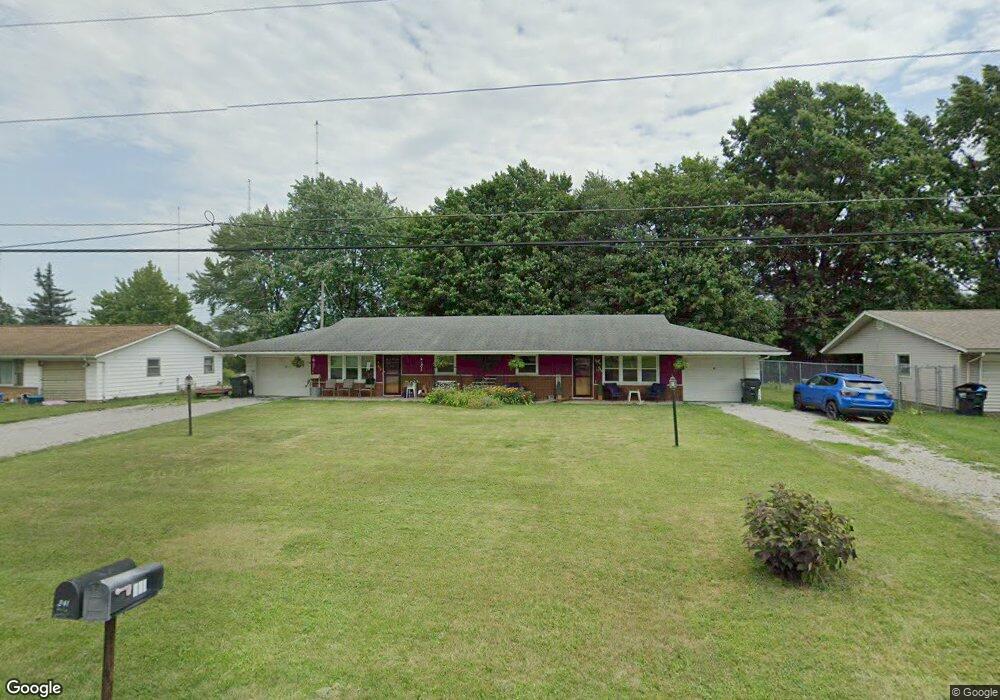
331 Smyth Ave Alliance, OH 44601
Estimated Value: $91,000 - $200,489
4
Beds
2
Baths
2,040
Sq Ft
$77/Sq Ft
Est. Value
About This Home
This home is located at 331 Smyth Ave, Alliance, OH 44601 and is currently estimated at $157,622, approximately $77 per square foot. 331 Smyth Ave is a home located in Stark County with nearby schools including Marlington High School and Regina Coeli/St Joseph School.
Ownership History
Date
Name
Owned For
Owner Type
Purchase Details
Closed on
May 2, 2011
Sold by
Brown Charles A and Brown Timothy Bion
Bought by
Ferrall Rhonda Irene
Current Estimated Value
Home Financials for this Owner
Home Financials are based on the most recent Mortgage that was taken out on this home.
Original Mortgage
$75,534
Interest Rate
4.58%
Mortgage Type
FHA
Purchase Details
Closed on
Sep 16, 2010
Sold by
Brown Charles A
Bought by
Brown Charles A and Brown Timothy Bion
Purchase Details
Closed on
Apr 8, 1994
Create a Home Valuation Report for This Property
The Home Valuation Report is an in-depth analysis detailing your home's value as well as a comparison with similar homes in the area
Purchase History
| Date | Buyer | Sale Price | Title Company |
|---|---|---|---|
| Ferrall Rhonda Irene | $77,500 | Attorney | |
| Brown Charles A | -- | Attorney | |
| -- | -- | -- |
Source: Public Records
Mortgage History
| Date | Status | Borrower | Loan Amount |
|---|---|---|---|
| Previous Owner | Ferrall Rhonda Irene | $75,534 |
Source: Public Records
Tax History
| Year | Tax Paid | Tax Assessment Tax Assessment Total Assessment is a certain percentage of the fair market value that is determined by local assessors to be the total taxable value of land and additions on the property. | Land | Improvement |
|---|---|---|---|---|
| 2025 | -- | $51,390 | $21,180 | $30,210 |
| 2024 | -- | $51,600 | $21,180 | $30,420 |
| 2023 | $1,451 | $40,880 | $14,910 | $25,970 |
| 2022 | $1,456 | $40,880 | $14,910 | $25,970 |
| 2021 | $1,252 | $40,880 | $14,910 | $25,970 |
| 2020 | $1,381 | $34,450 | $12,850 | $21,600 |
| 2019 | $1,372 | $34,450 | $12,850 | $21,600 |
Source: Public Records
Map
Nearby Homes
- 347 Buckeye Ave
- 432 Johnson Ave
- 550 Johnson Ave
- 0 W Main St Unit 5090123
- 160 Bonnieview Ave
- 10580 Heltman Ave NE
- 000 Meadowbrook Ave
- 664 Fairview Place
- 0 Meadowbrook Ave
- 0 Meadow St NE
- 11335 Meadowbrook Ave NE
- 479 W High St
- 0 Homestead Ave NE
- 118 S Mckinley Ave
- 264 W Market St
- 1044 Glamorgan St
- 535 S Mckinley Ave
- 1114 Briarcliff Ave
- 717 Garfield Ave
- 870 Parkway Blvd
- 351 Smyth Ave
- 309 Smyth Ave
- 373 Smyth Ave
- 249 Smyth Ave
- 370 Smyth Ave
- 370 Smyth Ave
- 225 Smyth Ave
- 386 Smyth Ave
- 1491 Beeson St NE
- 408 Smyth Ave
- 1497 Beeson St NE
- 432 Smyth Ave
- 205 Smyth Ave
- 442 Smyth Ave
- 459 Smyth Ave
- 452 Smyth Ave
- 1451 Beeson St NE
- 1415 Beeson St NE
- 470 Smyth Ave
- 1488 Mishler St NE
Your Personal Tour Guide
Ask me questions while you tour the home.