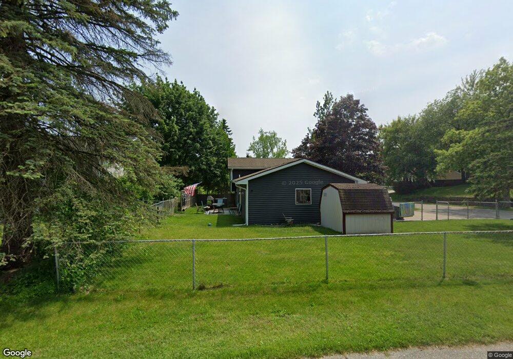
331 Summit Blvd Lake Orion, MI 48362
Estimated Value: $295,761 - $326,000
3
Beds
2
Baths
1,474
Sq Ft
$210/Sq Ft
Est. Value
About This Home
This home is located at 331 Summit Blvd, Lake Orion, MI 48362 and is currently estimated at $309,690, approximately $210 per square foot. 331 Summit Blvd is a home located in Oakland County with nearby schools including Orion Oaks Elementary School, Oakview Middle School, and Lake Orion Community High School.
Ownership History
Date
Name
Owned For
Owner Type
Purchase Details
Closed on
Aug 13, 2021
Sold by
Coleman Catherine J
Bought by
Smith Erin R
Current Estimated Value
Home Financials for this Owner
Home Financials are based on the most recent Mortgage that was taken out on this home.
Original Mortgage
$210,600
Outstanding Balance
$190,921
Interest Rate
2.7%
Mortgage Type
New Conventional
Estimated Equity
$118,769
Purchase Details
Closed on
Jan 25, 2011
Sold by
Clawson Steven and Clawson Kerri M
Bought by
Federal Home Loan Mortgage Corp
Purchase Details
Closed on
Oct 7, 1999
Sold by
Rose Lawrence J
Bought by
Clawson Steven P
Create a Home Valuation Report for This Property
The Home Valuation Report is an in-depth analysis detailing your home's value as well as a comparison with similar homes in the area
Home Values in the Area
Average Home Value in this Area
Purchase History
| Date | Buyer | Sale Price | Title Company |
|---|---|---|---|
| Smith Erin R | $234,000 | 1S Choice Title Agency Llc | |
| Smith Erin R | $234,000 | 1S Choice Title Agency Llc | |
| Federal Home Loan Mortgage Corp | $152,160 | None Available | |
| Clawson Steven P | $157,000 | -- |
Source: Public Records
Mortgage History
| Date | Status | Borrower | Loan Amount |
|---|---|---|---|
| Open | Smith Erin R | $210,600 | |
| Closed | Smith Erin R | $210,600 |
Source: Public Records
Tax History Compared to Growth
Tax History
| Year | Tax Paid | Tax Assessment Tax Assessment Total Assessment is a certain percentage of the fair market value that is determined by local assessors to be the total taxable value of land and additions on the property. | Land | Improvement |
|---|---|---|---|---|
| 2024 | $2,420 | $109,060 | $0 | $0 |
| 2023 | $2,309 | $100,270 | $0 | $0 |
| 2022 | $3,256 | $91,610 | $0 | $0 |
| 2021 | $2,558 | $86,630 | $0 | $0 |
| 2020 | $2,007 | $77,290 | $0 | $0 |
| 2019 | $2,406 | $73,300 | $0 | $0 |
| 2018 | $2,382 | $71,350 | $0 | $0 |
| 2017 | $2,295 | $71,350 | $0 | $0 |
| 2016 | $2,283 | $64,270 | $0 | $0 |
| 2015 | -- | $55,410 | $0 | $0 |
| 2014 | -- | $47,840 | $0 | $0 |
| 2011 | -- | $47,250 | $0 | $0 |
Source: Public Records
Map
Nearby Homes
- 0 Susan Marie St
- 0000 Garden Dr
- 411 Heights Rd
- 471 Algene St
- 481 Heights Rd
- 800 Kimberly
- 694 Ferndale Ave
- 00 Heights Rd
- 0000 S Lapeer Rd
- 980 Sherry Dr
- 593 Heights Rd
- 769 Markdale St
- 418 Converse Ct
- 328 S Broadway St
- 599 Westpointe Ct
- 305 Goldengate St
- 000 King Cir
- 498 Green Hill Ln
- 752 Preston Island
- 625 W Clarkston Rd
- 337 Summit Blvd
- 651 Harry Paul Dr
- 321 Summit Blvd
- 311 Summit Blvd
- 661 Harry Paul Dr
- 640 Rochester St
- 330 Summit Blvd
- 340 Summit Blvd
- 320 Summit Blvd
- 650 Harry Paul Dr
- 650 Rochester St
- 342 Summit Blvd
- 671 Harry Paul Dr
- 310 Summit Blvd
- 641 Alan Dr
- 660 Rochester St
- 344 Summit Blvd
- 691 Harry Paul Dr
- 670 Harry Paul Dr
- 651 Alan Dr