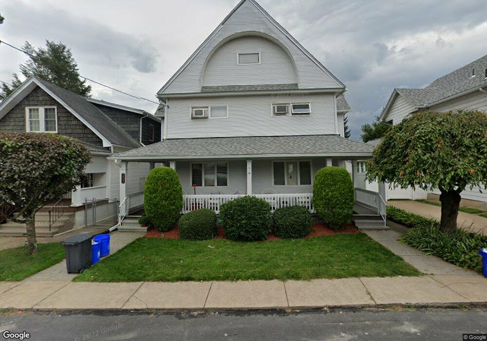
331 Warren St Unit 333 Scranton, PA 18508
Tripp's Park NeighborhoodEstimated Value: $22,995 - $206,000
Studio
--
Bath
3,538
Sq Ft
$41/Sq Ft
Est. Value
About This Home
This home is located at 331 Warren St Unit 333, Scranton, PA 18508 and is currently estimated at $146,499, approximately $41 per square foot. 331 Warren St Unit 333 is a home located in Lackawanna County with nearby schools including Neil Armstrong Elementary School, Northeast Scranton Intermediate School, and Scranton High School.
Ownership History
Date
Name
Owned For
Owner Type
Purchase Details
Closed on
Jul 1, 2020
Sold by
Skelston Robert and Skelston Mari
Bought by
Morahan Meghan L
Current Estimated Value
Purchase Details
Closed on
Feb 7, 2013
Sold by
Minora Patricia H and Hopkins Dorothy N
Bought by
Minora Patricia Hopkins and Minora Barry A
Purchase Details
Closed on
Dec 22, 2004
Sold by
Hopkins James Peter and Saltry Kathleen Hopkins
Bought by
Hopkins James Peter and Saltry Kathleen Hopkins
Purchase Details
Closed on
Jun 3, 1991
Bought by
Minora Barry and Minora Patricia
Create a Home Valuation Report for This Property
The Home Valuation Report is an in-depth analysis detailing your home's value as well as a comparison with similar homes in the area
Home Values in the Area
Average Home Value in this Area
Purchase History
We collect this data history from publicly available records. To have your information removed, we recommend requesting removal directly through your county’s website.
| Date | Buyer | Sale Price | Title Company |
|---|---|---|---|
| Morahan Meghan L | -- | Reliable Abstract Co | |
| Minora Patricia Hopkins | $12,000 | None Available | |
| Hopkins James Peter | $50,000 | None Available | |
| Minora Barry | $69,500 | -- |
Source: Public Records
Tax History
| Year | Tax Paid | Tax Assessment Tax Assessment Total Assessment is a certain percentage of the fair market value that is determined by local assessors to be the total taxable value of land and additions on the property. | Land | Improvement |
|---|---|---|---|---|
| 2026 | $47,853 | $299,100 | $28,100 | $271,000 |
| 2025 | $3,229 | $10,000 | $1,650 | $8,350 |
| 2024 | $2,951 | $10,000 | $1,650 | $8,350 |
| 2023 | $2,951 | $10,000 | $1,650 | $8,350 |
| 2022 | $2,886 | $10,000 | $1,650 | $8,350 |
| 2021 | $2,886 | $10,000 | $1,650 | $8,350 |
| 2020 | $2,833 | $10,000 | $1,650 | $8,350 |
| 2019 | $2,665 | $10,000 | $1,650 | $8,350 |
| 2018 | $2,665 | $10,000 | $1,650 | $8,350 |
| 2017 | $2,618 | $10,000 | $1,650 | $8,350 |
| 2016 | $0 | $10,000 | $1,650 | $8,350 |
| 2015 | $1,665 | $10,000 | $1,650 | $8,350 |
| 2014 | -- | $10,000 | $1,650 | $8,350 |
Source: Public Records
Map
Nearby Homes
- 401 Putnam St
- 339 Ferdinand St
- 240 Theodore St
- 220 Ferdinand St
- 1928 Brick Ave
- 1425 N Rebecca Ave
- 1402 N Rebecca Ave
- 514 Albion St
- 215- 215 & 1 2 William St
- 1438 Church Ave Unit 1440
- 429 Leggett St
- 214 William St
- 1436 Church Ave
- 805 Ferdinand St
- 546 Leggett St
- 1430 N Main Ave
- 2115-2117 Wayne Ave
- 1406 N Main Ave
- 2045 Edna Ave
- 1817 Ross Ave
- 1708 Brick Ave
- 1708 Brick Ave
- 335 Cayuga St
- 338 Cayuga St
- 338 Putnam St
- 338 Putnam St
- 1710 Brick Ave
- 1706 Brick Ave
- 1652 Brick Ave Unit 1656
- 1658 Brick Ave
- 1714 Brick Ave
- 335 Warren St
- 1648 Brick Ave Unit 1650
- 1716 Brick Ave
- 329 Warren St
- 332 Putnam St Unit 334
- 325 Warren St
- 1718 Brick Ave
- 344 Putnam St
- 337 Warren St
Your Personal Tour Guide
Ask me questions while you tour the home.