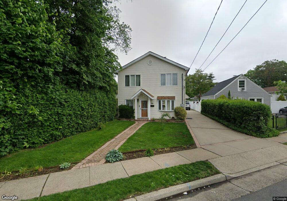
331 Westbury Blvd Hempstead, NY 11550
Estimated Value: $496,000 - $616,538
4
Beds
2
Baths
1,584
Sq Ft
$351/Sq Ft
Est. Value
About This Home
This home is located at 331 Westbury Blvd, Hempstead, NY 11550 and is currently estimated at $556,269, approximately $351 per square foot. 331 Westbury Blvd is a home located in Nassau County with nearby schools including The Academy Charter School, Uniondale Elementary School, and Hebrew Academy of Nassau County Middle School and Brookdale High School.
Ownership History
Date
Name
Owned For
Owner Type
Purchase Details
Closed on
Jun 1, 2021
Sold by
Rawlins Alphonso and Rawlins Blessing
Bought by
Belle Royston and Adams Lincoln
Current Estimated Value
Home Financials for this Owner
Home Financials are based on the most recent Mortgage that was taken out on this home.
Original Mortgage
$333,841
Outstanding Balance
$300,932
Interest Rate
2.9%
Mortgage Type
FHA
Estimated Equity
$255,337
Purchase Details
Closed on
Jul 21, 2017
Sold by
Chimera Management Llc
Bought by
Rawlins Alphonso and Rawlins Blessing
Home Financials for this Owner
Home Financials are based on the most recent Mortgage that was taken out on this home.
Original Mortgage
$294,566
Interest Rate
4.62%
Mortgage Type
FHA
Purchase Details
Closed on
Aug 4, 2015
Sold by
Morla Rafael and Cuello Natividad
Bought by
Chimera Management Llc
Purchase Details
Closed on
Oct 17, 2006
Sold by
Morla Rafael
Purchase Details
Closed on
Apr 9, 2002
Sold by
Paredes Eladio
Purchase Details
Closed on
Dec 29, 1999
Sold by
Fuller James
Bought by
Morla Rafael and Cuello Natividad
Home Financials for this Owner
Home Financials are based on the most recent Mortgage that was taken out on this home.
Original Mortgage
$149,050
Interest Rate
7.79%
Mortgage Type
FHA
Purchase Details
Closed on
Sep 17, 1999
Sold by
Jericho Properties Corp
Bought by
Fuller James
Purchase Details
Closed on
Feb 24, 1998
Sold by
Bankers Trust Co
Bought by
Jericho Properites Corp
Purchase Details
Closed on
Aug 7, 1997
Sold by
Green Lula M
Bought by
Bankers Trust Co
Create a Home Valuation Report for This Property
The Home Valuation Report is an in-depth analysis detailing your home's value as well as a comparison with similar homes in the area
Home Values in the Area
Average Home Value in this Area
Purchase History
| Date | Buyer | Sale Price | Title Company |
|---|---|---|---|
| Belle Royston | $340,000 | Fidelity Title | |
| Belle Royston | $340,000 | Fidelity Title | |
| Belle Royston | $340,000 | Fidelity Title | |
| Rawlins Alphonso | $300,000 | Atlantis National Services I | |
| Rawlins Alphonso | $300,000 | Atlantis National Services I | |
| Rawlins Alphonso | $300,000 | Atlantis National Services I | |
| Chimera Management Llc | $148,050 | Stewart Title | |
| Chimera Management Llc | $148,050 | Stewart Title | |
| Chimera Management Llc | $148,050 | Stewart Title | |
| -- | -- | -- | |
| -- | -- | -- | |
| -- | -- | -- | |
| -- | -- | -- | |
| -- | -- | -- | |
| Morla Rafael | $149,900 | -- | |
| Morla Rafael | $149,900 | -- | |
| Morla Rafael | $149,900 | -- | |
| Morla Rafael | $149,900 | -- | |
| Morla Rafael | $149,900 | -- | |
| Fuller James | $140,000 | -- | |
| Fuller James | $140,000 | -- | |
| Jericho Properites Corp | $60,000 | -- | |
| Jericho Properites Corp | $60,000 | -- | |
| Bankers Trust Co | $65,737 | -- | |
| Bankers Trust Co | $65,737 | -- |
Source: Public Records
Mortgage History
| Date | Status | Borrower | Loan Amount |
|---|---|---|---|
| Open | Belle Royston | $333,841 | |
| Closed | Belle Royston | $333,841 | |
| Previous Owner | Rawlins Alphonso | $294,566 | |
| Previous Owner | Morla Rafael | $149,050 |
Source: Public Records
Tax History
| Year | Tax Paid | Tax Assessment Tax Assessment Total Assessment is a certain percentage of the fair market value that is determined by local assessors to be the total taxable value of land and additions on the property. | Land | Improvement |
|---|---|---|---|---|
| 2025 | $8,705 | $343 | $106 | $237 |
| 2024 | $817 | $324 | $106 | $218 |
Source: Public Records
Map
Nearby Homes
- 175 Meadow St
- 7 Pilot St
- 59 Boylston St
- 6 Boylston St
- 58 Remsen Ave
- 55 Harriet Ave
- 155 Rhodes Ave
- 296 Harvard St
- 210 Dartmouth St
- 136 Fairview Blvd
- 186 Westbury Blvd
- 126 Fairview Blvd
- 95 Rhodes Ave
- 139 Garden St
- 140 Amherst St
- 64 Fairview Blvd
- 133 Wellington St
- 260 Yale St
- 159 Stewart Ave
- 103 Garden St
- 335 Westbury Blvd
- 14 Commander Ave
- 20 Commander Ave
- 7 Lindbergh St
- 10 Commander Ave
- 28 Commander Ave
- 11 Lindbergh St
- 326 Westbury Blvd
- 32 Commander Ave
- 15 Lindbergh St
- 273 Rhodes Ave
- 265 Rhodes Ave
- 21 Commander Ave
- 23 Commander Ave
- 36 Commander Ave
- 258 Fairview Blvd
- 351 Westbury Blvd
- 48 Byrd St
- 19 Lindbergh St
- 3 Commander Ave
Your Personal Tour Guide
Ask me questions while you tour the home.