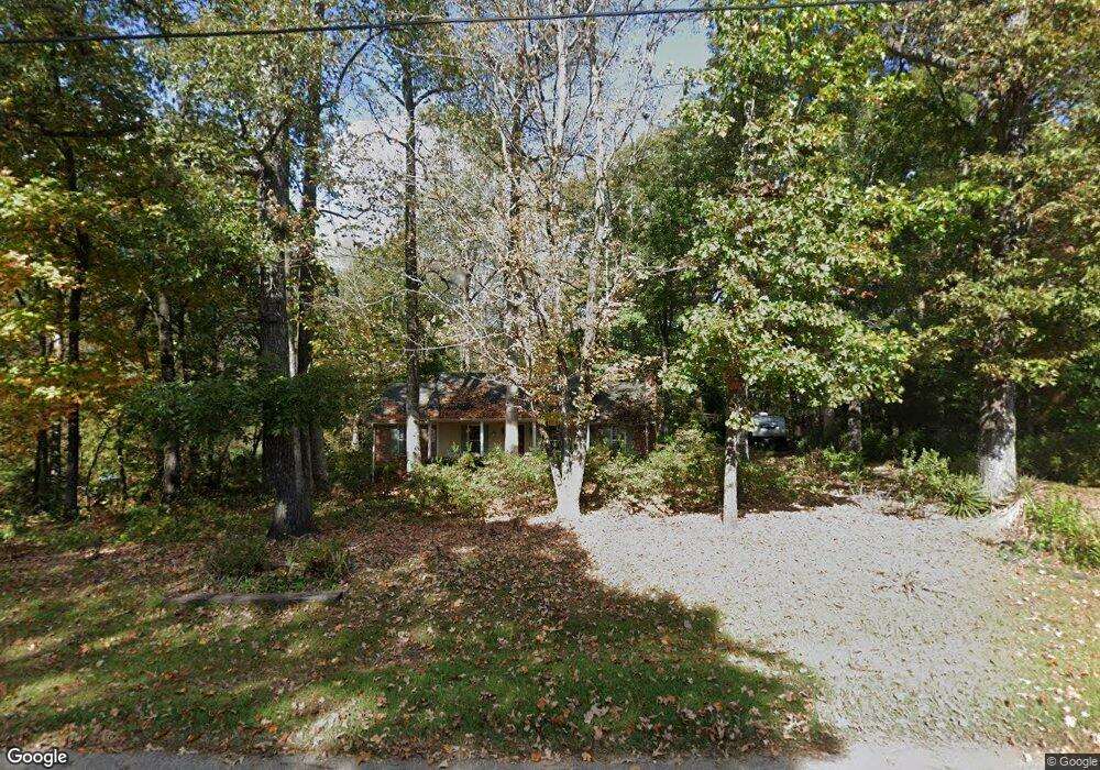
331 Woodfield Cir Lagrange, GA 30240
Estimated Value: $241,182 - $311,000
3
Beds
3
Baths
1,828
Sq Ft
$155/Sq Ft
Est. Value
About This Home
This home is located at 331 Woodfield Cir, Lagrange, GA 30240 and is currently estimated at $283,296, approximately $154 per square foot. 331 Woodfield Cir is a home located in Troup County with nearby schools including Long Cane Elementary School, Berta Weathersbee Elementary School, and Whitesville Road Elementary School.
Ownership History
Date
Name
Owned For
Owner Type
Purchase Details
Closed on
May 3, 2000
Sold by
Nelson Francis I and Nelson Virginia J
Bought by
Matlock Billy Wayne
Current Estimated Value
Purchase Details
Closed on
Jan 10, 1995
Sold by
Nelson Virginia
Bought by
Nelson Francis I and Nelson Virginia J
Purchase Details
Closed on
Aug 18, 1994
Sold by
Nelson Francis I
Bought by
Nelson Virginia
Purchase Details
Closed on
May 6, 1994
Sold by
Dye Dye A and Dye Cheryl L
Bought by
Nelson Francis I
Purchase Details
Closed on
Jan 15, 1988
Sold by
Prudente William Joseph and Prudente Kay
Bought by
Dye Dye A and Dye Cheryl L
Purchase Details
Closed on
Jun 1, 1980
Sold by
Knight & Knight Of Laginc
Bought by
Prudente William Joseph and Prudente Kay
Purchase Details
Closed on
Nov 24, 1975
Sold by
Knight W Hooper Etal
Bought by
Knight & Knight Of Laginc
Create a Home Valuation Report for This Property
The Home Valuation Report is an in-depth analysis detailing your home's value as well as a comparison with similar homes in the area
Purchase History
| Date | Buyer | Sale Price | Title Company |
|---|---|---|---|
| Matlock Billy Wayne | $129,000 | -- | |
| Nelson Francis I | -- | -- | |
| Nelson Virginia | -- | -- | |
| Nelson Francis I | $93,500 | -- | |
| Dye Dye A | $90,600 | -- | |
| Prudente William Joseph | $72,000 | -- | |
| Knight & Knight Of Laginc | -- | -- |
Source: Public Records
Tax History
| Year | Tax Paid | Tax Assessment Tax Assessment Total Assessment is a certain percentage of the fair market value that is determined by local assessors to be the total taxable value of land and additions on the property. | Land | Improvement |
|---|---|---|---|---|
| 2025 | $2,397 | $99,680 | $14,000 | $85,680 |
| 2024 | $1,914 | $72,160 | $14,000 | $58,160 |
| 2023 | $1,319 | $68,240 | $8,000 | $60,240 |
| 2022 | $1,764 | $65,200 | $8,000 | $57,200 |
| 2021 | $1,618 | $55,640 | $8,000 | $47,640 |
| 2020 | $1,618 | $55,640 | $8,000 | $47,640 |
| 2019 | $1,456 | $50,280 | $8,000 | $42,280 |
| 2018 | $1,390 | $48,080 | $8,000 | $40,080 |
| 2017 | $1,390 | $48,080 | $8,000 | $40,080 |
| 2016 | $1,263 | $43,860 | $7,200 | $36,660 |
| 2015 | $1,265 | $43,860 | $7,200 | $36,660 |
| 2014 | $1,209 | $41,930 | $7,200 | $34,730 |
| 2013 | -- | $44,005 | $7,200 | $36,805 |
Source: Public Records
Map
Nearby Homes
- 266 Glass Bridge Rd
- 640 Hudson Rd
- 119 Plymouth Dr
- 112 Foxdale Dr
- 113 Colonial Ct Unit 100
- 0 Glass Bridge Rd Unit 10679358
- 311 Cumberland Dr
- 101 Ivy Springs Dr
- 124 Lincoln Ln
- 135 Planters Ridge Dr
- 474 Newton Rd
- 40 River Point Dr
- 509 Connie Dr
- 808 S Fling Rd
- 98 Hearn Rd
- 105 Redwood Dr
- 4.5 ACRES Whatley Rd N
- 0 Deming St Unit 10550189
- 0 Salem Rd Tract 2 Unit 10675187
- 427 Fling Rd
- 329 Woodfield Cir
- 328 Woodfield Cir
- 335 Woodfield Cir
- 327 Woodfield Cir
- 334 Woodfield Cir
- 325 Woodfield Cir
- 337 Woodfield Cir
- 324 Woodfield Cir
- 324 Woodfield Cir Unit 27
- 108 Oakdale Dr
- 109 Oakdale Dr
- 213 Woodfield Cir
- 323 Woodfield Cir
- 211 Woodfield Cir
- 106 Oakdale Dr
- 321 Woodfield Cir
- 107 Oakdale Dr
- 103 Woodfield Cir
- 320 Woodfield Cir
- 209 Woodfield Cir
Your Personal Tour Guide
Ask me questions while you tour the home.