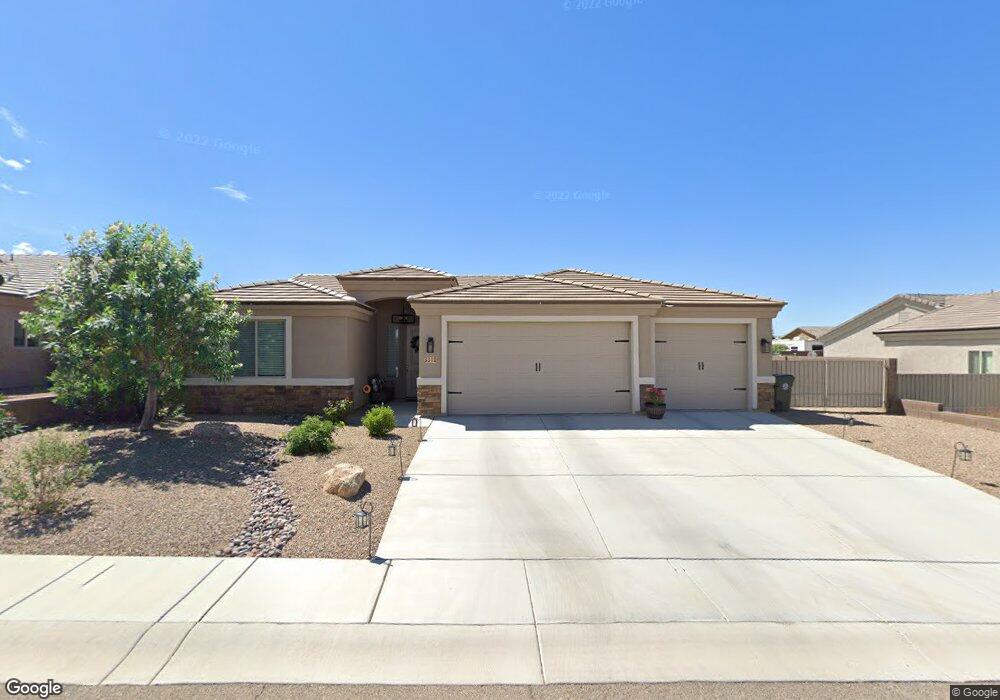
3310 Motherlode Rd Kingman, AR 86401
Estimated Value: $376,000 - $400,000
--
Bed
2
Baths
1,737
Sq Ft
$223/Sq Ft
Est. Value
About This Home
This home is located at 3310 Motherlode Rd, Kingman, AR 86401 and is currently estimated at $386,543, approximately $222 per square foot. 3310 Motherlode Rd is a home located in Mohave County with nearby schools including Hualapai Elementary School, White Cliffs Middle School, and Lee Williams High School.
Ownership History
Date
Name
Owned For
Owner Type
Purchase Details
Closed on
Jul 22, 2016
Sold by
Angle Homes Inc
Bought by
Haws Jeffrey Blane and Haws Lena Maria
Current Estimated Value
Home Financials for this Owner
Home Financials are based on the most recent Mortgage that was taken out on this home.
Original Mortgage
$150,000
Outstanding Balance
$68,079
Interest Rate
3.6%
Mortgage Type
New Conventional
Estimated Equity
$318,464
Purchase Details
Closed on
Dec 17, 2014
Sold by
Hualapai Shadows Llc
Bought by
Angle Homes Inc
Create a Home Valuation Report for This Property
The Home Valuation Report is an in-depth analysis detailing your home's value as well as a comparison with similar homes in the area
Home Values in the Area
Average Home Value in this Area
Purchase History
| Date | Buyer | Sale Price | Title Company |
|---|---|---|---|
| Haws Jeffrey Blane | $194,532 | Pioneer Title Agency Inc | |
| Angle Homes Inc | $234,000 | Pioneer Title Agency Inc | |
| Hualapai Shadows Llc | -- | Pioneer Title Agency Inc |
Source: Public Records
Mortgage History
| Date | Status | Borrower | Loan Amount |
|---|---|---|---|
| Open | Haws Jeffrey Blane | $150,000 |
Source: Public Records
Tax History Compared to Growth
Tax History
| Year | Tax Paid | Tax Assessment Tax Assessment Total Assessment is a certain percentage of the fair market value that is determined by local assessors to be the total taxable value of land and additions on the property. | Land | Improvement |
|---|---|---|---|---|
| 2026 | $825 | -- | -- | -- |
| 2025 | $1,688 | $28,707 | $0 | $0 |
| 2024 | $1,688 | $28,733 | $0 | $0 |
| 2023 | $1,688 | $26,574 | $0 | $0 |
| 2022 | $1,567 | $22,296 | $0 | $0 |
| 2021 | $1,622 | $21,151 | $0 | $0 |
| 2019 | $1,482 | $17,710 | $0 | $0 |
| 2018 | $1,531 | $17,606 | $0 | $0 |
| 2017 | $1,408 | $17,089 | $0 | $0 |
| 2016 | $151 | $3,115 | $0 | $0 |
| 2015 | $164 | $2,981 | $0 | $0 |
Source: Public Records
Map
Nearby Homes
- 3280 Whitehead Ave
- 3376 Motherlode Rd
- 3300 Cherri Ave
- 2144 Old Miners Rd
- 3316 Producers Mine Rd
- LOT 068 Hualapai Mountain Rd
- 2303 Indigo St
- 321-04-018E Hualapai Mountain Rd
- 3323 Karen Ave
- 2303 Wildflower St
- 00 Cheyenne Ave
- 3354 Isador Ave
- Lot 164 Hualapai Mountain Rd
- 3098 Amanda Cir
- 3059 Mallory Loop
- 2070 Buena Vista Dr
- 000 Ranch Rd
- 3201 Rio Grande Ave
- 3064 Brenda Cir
- 2199 Seneca St
- 3310 Motherlode Rd
- 3322 Motherlode Rd
- 3322 Motherlode Rd
- 3298 Motherlode Rd
- 3298 Motherload Rd
- 3339 Motherload Rd
- 3331 Motherload Rd
- 3319 Motherload Rd
- 3321 Silver Hill Rd
- 3301 Silver Hill Rd
- 3330 Motherlode Rd
- 3290 Motherlode Rd
- 3290 Motherlode Rd
- 3311 Motherlode Rd
- 3311 Motherlode Rd
- 3311 Motherload Rd
- 3319 Motherlode Rd
- 3299 Motherlode Rd
- 3299 Motherlode Rd