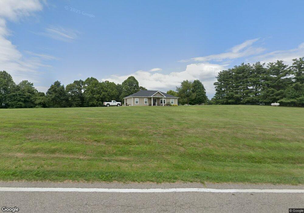
3310 State Route 676 Stockport, OH 43787
Estimated Value: $161,000 - $206,000
2
Beds
2
Baths
1,024
Sq Ft
$176/Sq Ft
Est. Value
About This Home
This home is located at 3310 State Route 676, Stockport, OH 43787 and is currently estimated at $180,093, approximately $175 per square foot. 3310 State Route 676 is a home with nearby schools including Morgan High School.
Ownership History
Date
Name
Owned For
Owner Type
Purchase Details
Closed on
Jan 10, 2020
Sold by
Sampson Merrill Eugene and Sampson Sheri D
Bought by
Sampson Merrill Eugene and Sampson Sheri D
Current Estimated Value
Home Financials for this Owner
Home Financials are based on the most recent Mortgage that was taken out on this home.
Original Mortgage
$85,000
Outstanding Balance
$71,941
Interest Rate
3.73%
Mortgage Type
Construction
Estimated Equity
$108,152
Purchase Details
Closed on
Apr 29, 2013
Sold by
Nichols Robert S and Nichols Pamela D
Bought by
Sampson Merrill Eugene and Sampson Sheri D
Purchase Details
Closed on
Sep 1, 2011
Sold by
Harra Travis E
Bought by
Sampson Merrill Eugene and Sampson Sheri D
Purchase Details
Closed on
Apr 18, 2011
Sold by
Sampson Merrill Eugene and Sampson Sheri D
Bought by
Harra Travis E
Create a Home Valuation Report for This Property
The Home Valuation Report is an in-depth analysis detailing your home's value as well as a comparison with similar homes in the area
Home Values in the Area
Average Home Value in this Area
Purchase History
| Date | Buyer | Sale Price | Title Company |
|---|---|---|---|
| Sampson Merrill Eugene | -- | None Available | |
| Sampson Merrill Eugene | -- | None Available | |
| Sampson Merrill Eugene | -- | None Available | |
| Harra Travis E | -- | None Available |
Source: Public Records
Mortgage History
| Date | Status | Borrower | Loan Amount |
|---|---|---|---|
| Open | Sampson Merrill Eugene | $85,000 |
Source: Public Records
Tax History Compared to Growth
Tax History
| Year | Tax Paid | Tax Assessment Tax Assessment Total Assessment is a certain percentage of the fair market value that is determined by local assessors to be the total taxable value of land and additions on the property. | Land | Improvement |
|---|---|---|---|---|
| 2024 | $1,240 | $37,710 | $8,120 | $29,590 |
| 2023 | $1,114 | $34,200 | $6,620 | $27,580 |
| 2022 | $1,118 | $34,200 | $6,620 | $27,580 |
| 2021 | $1,129 | $34,200 | $6,620 | $27,580 |
| 2019 | $1,074 | $31,100 | $6,010 | $25,090 |
| 2018 | $1,035 | $31,100 | $6,010 | $25,090 |
| 2017 | $931 | $27,244 | $5,187 | $22,057 |
| 2016 | $934 | $27,244 | $5,187 | $22,057 |
| 2015 | $933 | $27,244 | $5,187 | $22,057 |
| 2014 | $769 | $21,732 | $5,187 | $16,545 |
| 2013 | $179 | $5,187 | $5,187 | $0 |
Source: Public Records
Map
Nearby Homes
- 4000 C206
- 4660 E J Ross Ln
- Lot 1 Shinn Rd
- Lot 2 Shinn Rd
- Lot 2 Shinn Rd
- 0 Kosky Dr
- 3291 Kosky Dr
- 3111 Big Bottom Ln
- 5174 Lightner Ridge Rd
- 0 Meadow St Unit Lot 9 5158299
- 0 Meadow St Unit Lot 9 225008020
- 1960 Broadway St
- 1715 South St
- 1770 Broadway St
- 1920 North St
- 3020 State Route 376
- 3265 Tieber Rd
- 2712 Sycamore Ln
- 3130 Ohio 266
- 75 S River Rd SE
- 3271 State Route 676
- 3397 State Route 676
- 5765 Patten Mills Rd
- 7109 Dale Rd
- 3160 State Route 676
- 7188 Dale Rd
- 5715 Patten Mills Rd
- 3140 State Route 676
- 5750 Patten Mills Rd
- 4430 State Route 676
- 4433 Ohio 676
- 4433 Ohio 676
- 4433 State Route 676
- 4433 State Route 676
- 5645 Patten Mills Rd
- 5605 Patten Mills Rd
- 4900 State Route 676
- 7040 Dale Rd
- 4436 State Route 676
- 0 Ohio 676