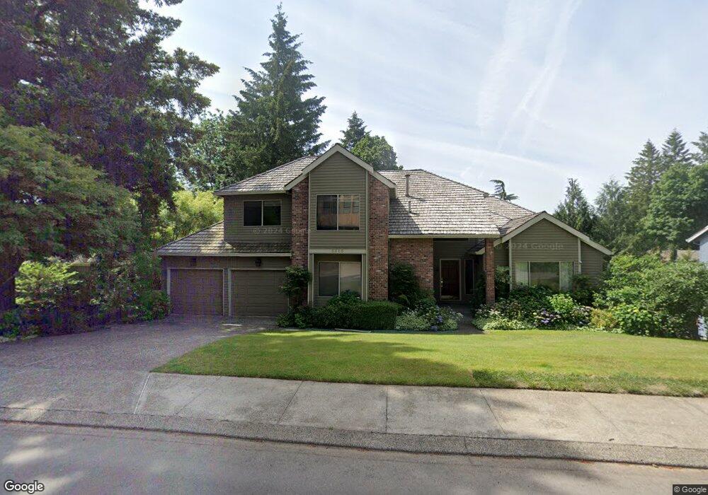
3310 Tempest Dr Lake Oswego, OR 97035
Mountain Park NeighborhoodEstimated Value: $922,742 - $1,120,000
4
Beds
4
Baths
3,762
Sq Ft
$272/Sq Ft
Est. Value
About This Home
This home is located at 3310 Tempest Dr, Lake Oswego, OR 97035 and is currently estimated at $1,024,936, approximately $272 per square foot. 3310 Tempest Dr is a home located in Clackamas County with nearby schools including Oak Creek Elementary School, Lake Oswego Junior High School, and Lake Oswego Senior High School.
Ownership History
Date
Name
Owned For
Owner Type
Purchase Details
Closed on
Mar 22, 2000
Sold by
Lawson Robert W and Mavricakis Haritomeni Eleni
Bought by
Saidi Said and Saidi Mahnaz
Current Estimated Value
Home Financials for this Owner
Home Financials are based on the most recent Mortgage that was taken out on this home.
Original Mortgage
$304,000
Outstanding Balance
$98,365
Interest Rate
7.87%
Estimated Equity
$926,571
Purchase Details
Closed on
Sep 18, 1996
Sold by
Pierce Roberta Wade
Bought by
Thomason Angelo F and Lawson Robert W
Purchase Details
Closed on
Feb 9, 1995
Sold by
Arkebauer Martin C and Arkebauer Susan J
Bought by
Lawson Robert W and Lawson Haritomeni M
Home Financials for this Owner
Home Financials are based on the most recent Mortgage that was taken out on this home.
Original Mortgage
$237,600
Interest Rate
8.25%
Create a Home Valuation Report for This Property
The Home Valuation Report is an in-depth analysis detailing your home's value as well as a comparison with similar homes in the area
Home Values in the Area
Average Home Value in this Area
Purchase History
| Date | Buyer | Sale Price | Title Company |
|---|---|---|---|
| Saidi Said | $380,000 | Pacific Nw Title | |
| Thomason Angelo F | $53,000 | Ticor Title Insurance | |
| Lawson Robert W | $297,000 | Fidelity National Title Co |
Source: Public Records
Mortgage History
| Date | Status | Borrower | Loan Amount |
|---|---|---|---|
| Open | Saidi Said | $304,000 | |
| Previous Owner | Lawson Robert W | $237,600 |
Source: Public Records
Tax History Compared to Growth
Tax History
| Year | Tax Paid | Tax Assessment Tax Assessment Total Assessment is a certain percentage of the fair market value that is determined by local assessors to be the total taxable value of land and additions on the property. | Land | Improvement |
|---|---|---|---|---|
| 2025 | $10,020 | $521,761 | -- | -- |
| 2024 | $9,753 | $506,565 | -- | -- |
| 2023 | $9,753 | $491,811 | $0 | $0 |
| 2022 | $9,185 | $477,487 | $0 | $0 |
| 2021 | $8,484 | $463,580 | $0 | $0 |
| 2020 | $8,271 | $450,078 | $0 | $0 |
| 2019 | $8,067 | $436,969 | $0 | $0 |
| 2018 | $7,672 | $424,242 | $0 | $0 |
| 2017 | $7,402 | $411,885 | $0 | $0 |
| 2016 | $6,739 | $399,888 | $0 | $0 |
| 2015 | $6,511 | $388,241 | $0 | $0 |
| 2014 | $6,427 | $376,933 | $0 | $0 |
Source: Public Records
Map
Nearby Homes
- 50 Touchstone
- 2 Falstaff St
- 16 Othello St
- 10 Mountain Cir
- 90 Wheatherstone Place
- 3 Mountain Cir
- 14417 Orchard Springs Rd
- 4 Touchstone Unit 136
- 4 Touchstone Unit 138
- 4 Touchstone Unit 141
- 100 Kerr Pkwy Unit 34
- 100 Kerr Pkwy Unit 30
- 100 Kerr Pkwy Unit 19
- 3816 Botticelli
- 3814 Botticelli St
- 3853 Carman Dr
- 13932 Sundeleaf Dr
- 3990 Carman Dr
- 15003 Twin Fir Rd
- 9 Bloch Terrace
- 3282 Tempest Dr
- 3352 Tempest Dr
- 15 Falstaff St
- 11 Falstaff St
- 17 Falstaff St
- 3301 Tempest Dr
- 3339 Tempest Dr
- 3378 Tempest Dr
- 9 Falstaff St
- 3244 Tempest Dr
- 3263 Tempest Drbest Buy
- 3393 Tempest Dr
- 19 Falstaff St
- 8 Polonius St
- 7 Falstaff St
- 3408 Tempest Dr
- 3286 Duncan Dr
- 3212 Tempest Dr
- 3312 Duncan Dr
- 3225 Tempest Dr